File:Plan-Nice-1624-Sincaire.jpg
跳转到导航
跳转到搜索

本预览的尺寸:774 × 600像素。 其他分辨率:310 × 240像素 | 619 × 480像素 | 991 × 768像素 | 1,280 × 992像素 | 1,974 × 1,530像素。
原始文件 (1,974 × 1,530像素,文件大小:707 KB,MIME类型:image/jpeg)
说明
说明
添加一行文字以描述该文件所表现的内容
摘要
[编辑]| 描述 |
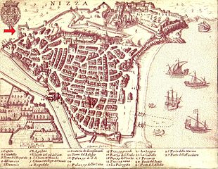
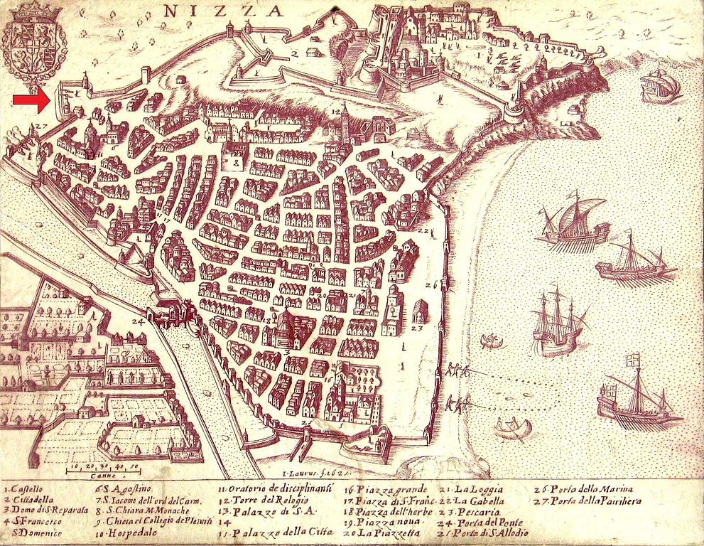
English: City map of Nice in 1624. The red arrow indicates the location of the bastion Sincaïre.
Français : Plan de la ville de Nice en 1624. La flèche rouge indique l'emplacement du bastion Sincaïre. |
| 日期 | |
| 来源 | Photograph of a map placed outdoor in the old city of Nice. Enhanced by Nataraja. Red arrow added by Assalit |
| 作者 | 未知 |
| 其他版本 |
|


许可协议
[编辑]
|
本作品在其来源国以及其他著作权期限是作者逝世后100年或以下的国家和地区属于公有领域。 | |
| 本文件已被确认为免除已知的著作权法限制(包括所有相关权利)。 | |
文件历史
点击某个日期/时间查看对应时刻的文件。
| 日期/时间 | 缩略图 | 大小 | 用户 | 备注 | |
|---|---|---|---|---|---|
| 当前 | 2010年9月27日 (一) 16:23 | | 1,974 × 1,530(707 KB) | Assalit~commonswiki(留言 | 贡献) | {{Information |Description= |Source= |Author= |Date= }} Photograph enhanced by Nataraja. Red arrow added by Assalit. 1624 Category:Quartier du Vieux-Nice [[Category:Historical images of Nice |
您不可以覆盖此文件。
文件用途
以下页面使用本文件:
全域文件用途
以下其他wiki使用此文件:
- fr.wikipedia.org上的用途
- incubator.wikimedia.org上的用途
- zh.wikipedia.org上的用途