File:Plate tectonics map.gif
Salta a la navegació
Salta a la cerca
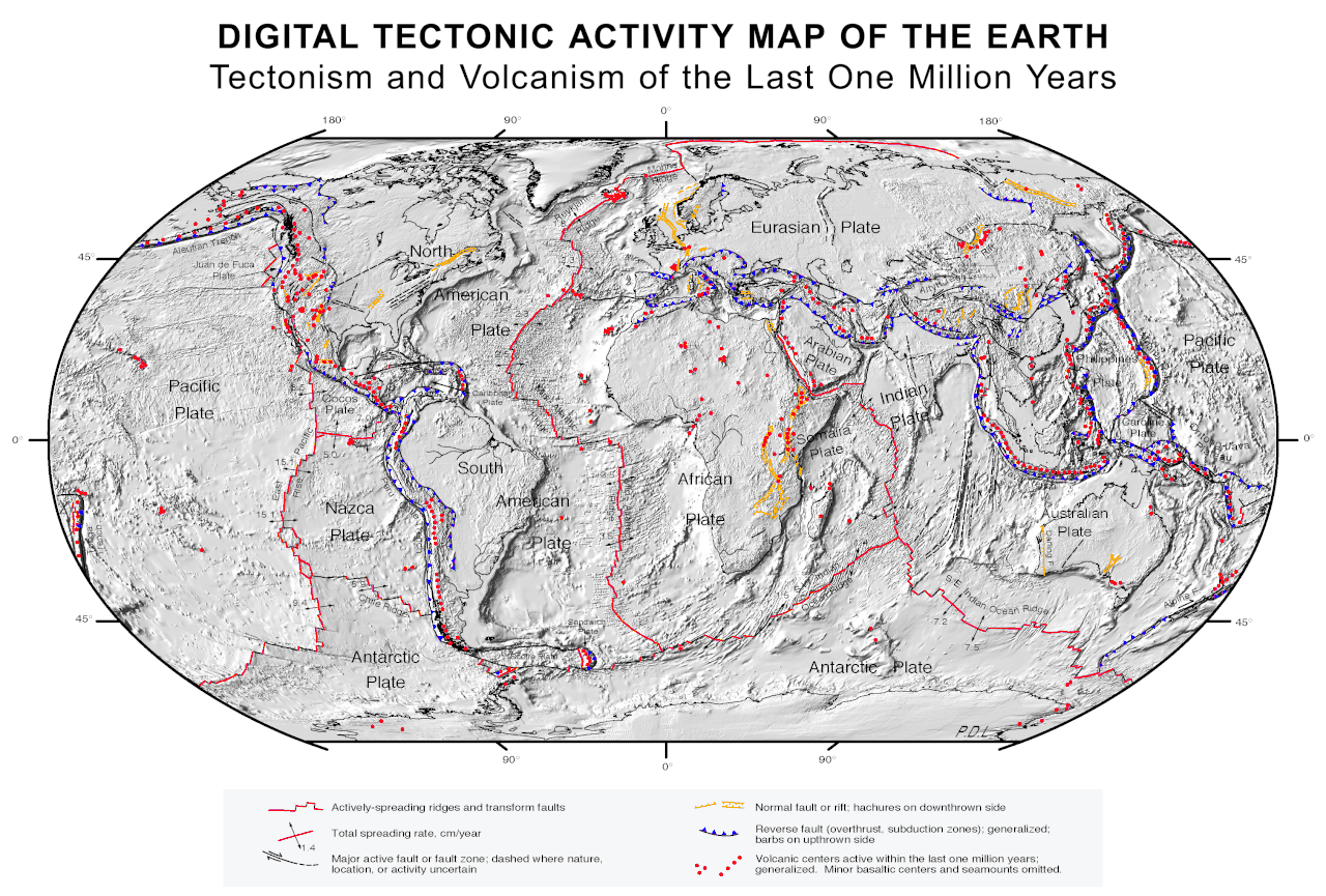
Mida d'aquesta previsualització: 800 × 541 píxels. Altres resolucions: 320 × 216 píxels | 640 × 433 píxels | 1.024 × 692 píxels | 1.280 × 865 píxels | 2.560 × 1.731 píxels | 3.380 × 2.285 píxels.
Fitxer original (3.380 × 2.285 píxels, mida del fitxer: 2,63 Mo, tipus MIME: image/gif)
Llegendes
Llegendes
Afegeix una explicació d'una línia del que representa aquest fitxer
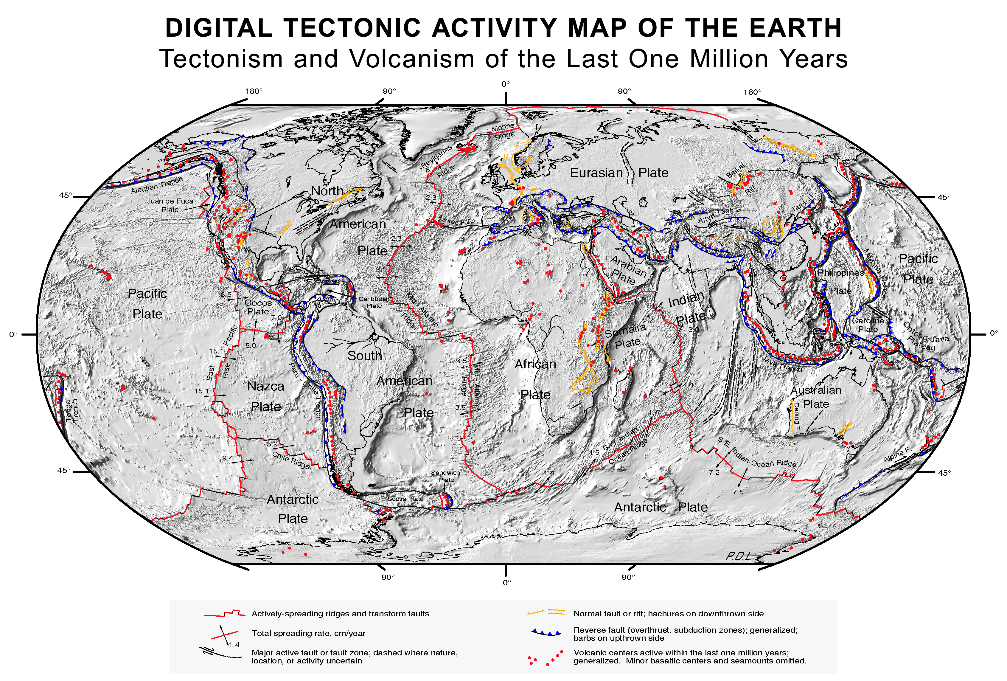
Tectonic activity map
Resum
[modifica]
| Descripció |
English: Quake epicenters Digital Tectonic Activity Map of the Earth (DTAM): |
| Data | October 2002 |
| Font |
|
| Creador |
NASA/Goddard Space Flight Center |
| Geotemporal data | |
| Sistema de referència espacial | Robinson Projection |
| Georeferencing | If inappropriate please set warp_status = skip to hide. |
Llicència
[modifica]
| Aquest fitxer és en el domini públic perquè ha estat creat per la NASA. L'avís legal de la NASA diu que «el material de la NASA no està protegit per copyright si no es diu el contrari». (NASA copyright policy page o JPL Image Use Policy). | ||
 |
Atenció:
|
Historial del fitxer
Cliqueu una data/hora per veure el fitxer tal com era aleshores.
| Data/hora | Miniatura | Dimensions | Usuari/a | Comentari | |
|---|---|---|---|---|---|
| actual | 09:41, 26 ago 2017 | | 3.380 × 2.285 (2,63 Mo) | Nagualdesign (discussió | contribucions) | White background. |
| 09:20, 26 ago 2017 |  | 3.380 × 2.285 (2,63 Mo) | Nagualdesign (discussió | contribucions) | Minor correction. | |
| 09:16, 26 ago 2017 |  | 3.380 × 2.285 (2,63 Mo) | Nagualdesign (discussió | contribucions) | Rearranged elements, removed clutter. | |
| 10:52, 16 abr 2011 |  | 3.577 × 2.313 (2,68 Mo) | Michael Metzger (discussió | contribucions) | uploaded a new version of this file with much higher resolution | |
| 12:08, 8 oct 2007 |  | 1.280 × 838 (359 Ko) | Geni (discussió | contribucions) | rmed nasa logo | |
| 03:19, 17 feb 2005 |  | 1.280 × 838 (360 Ko) | Quadell (discussió | contribucions) | Plate Tectonics map ([http://epod.usra.edu/archive/epodviewer.php3?oid=39392 source]){{PD-USGov-NASA}}Category:World mapsCategory:Plate tectonicsCategory:Continental drift |
No podeu sobreescriure aquest fitxer.
Ús del fitxer
La pàgina següent utilitza aquest fitxer:
Ús global del fitxer
Utilització d'aquest fitxer en altres wikis:
- Utilització a af.wikipedia.org
- Utilització a an.wikipedia.org
- Utilització a ar.wikipedia.org
- Utilització a az.wikipedia.org
- Utilització a bcl.wikipedia.org
- Utilització a be.wikipedia.org
- Utilització a bn.wikipedia.org
- Utilització a ca.wikipedia.org
- Utilització a cs.wikipedia.org
- Utilització a cv.wikipedia.org
- Utilització a da.wikipedia.org
- Utilització a de.wikipedia.org
- Utilització a el.wikipedia.org
- Utilització a en.wikipedia.org
- Plate tectonics
- List of tectonic plate interactions
- Lists of volcanoes
- Tectonics
- List of tectonic plates
- Wikipedia:WikiProject Seamounts/Images
- User talk:Newyorkadam
- User talk:Muffin Wizard/Archive 5
- Timeline of the development of tectonophysics (after 1952)
- User talk:PWNGWN
- User talk:Sahara4u/Archive 4
- User talk:Ryan115
- User talk:A.Minkowiski
- User talk:Simon Adler/Archive 1
- User talk:Geirfuglasker
- User talk:EMachine03/Archive
- User talk:BluJay
- User talk:TheEditor867
- User talk:CrawfordLou
- User talk:CryOCed
Vegeu més usos globals d'aquest fitxer.