File:Poland 1956-1990.svg
跳转到导航
跳转到搜索

此SVG文件的PNG预览的大小:450 × 456像素。 其他分辨率:237 × 240像素 | 474 × 480像素 | 758 × 768像素 | 1,011 × 1,024像素 | 2,021 × 2,048像素。
原始文件 (SVG文件,尺寸为450 × 456像素,文件大小:474 KB)
说明
说明
添加一行文字以描述该文件所表现的内容
摘要
[编辑]

.svg)
.svg)
.svg)
.svg)
.svg)


.svg)
.svg)
.svg)


.png)
.png)


.svg)


.svg)

.svg)


.svg)
.svg)
.svg)
.svg)


.svg)
.png)


.svg)


.svg)
.svg)


.svg)


.svg)


.svg)
.svg)
.svg)
.svg)
.svg)
.svg)
.svg)
_cropped.svg)
.svg)
.svg)
.svg)
.svg)
.svg)
.svg)
.svg)
.svg)
.svg)
.svg)
.svg)
.svg)
.svg)
.svg)
.svg)
.svg)
.svg)
.svg)
.svg)
.svg)
.svg)
.svg)
.svg)
.svg)
.svg)
.svg)
.svg)
.svg)
.svg)
.svg)
.svg)
.svg)
.svg)
.svg)
.svg)
.svg)
.svg)
.svg)
.svg)
.svg)
.svg)
.svg)
.svg)
.svg)
.svg)
| 这是一张修改过的图片,这意味着它已在原版本的基础上通过软件进行了编辑。其原始版本为:Blank map of Europe 1956-1990.svg。
|
许可协议
[编辑]
我,本作品著作权人,特此采用以下许可协议发表本作品:
本文件采用知识共享署名-相同方式共享 3.0 未本地化版本许可协议授权。
- 您可以自由地:
- 共享 – 复制、发行并传播本作品
- 修改 – 改编作品
- 惟须遵守下列条件:
- 署名 – 您必须对作品进行署名,提供授权条款的链接,并说明是否对原始内容进行了更改。您可以用任何合理的方式来署名,但不得以任何方式表明许可人认可您或您的使用。
- 相同方式共享 – 如果您再混合、转换或者基于本作品进行创作,您必须以与原先许可协议相同或相兼容的许可协议分发您贡献的作品。
原始上传日志
[编辑]
This image is a derivative work of the following images:
- File:Blank_map_of_Europe_1956-1990.svg licensed with Cc-by-sa-3.0
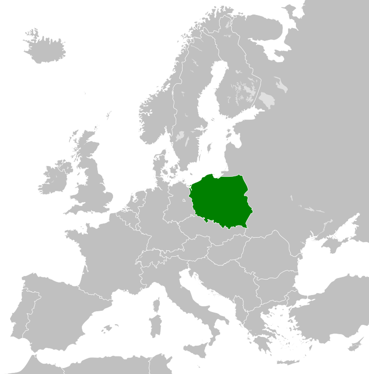
- 2011-10-30T04:43:42Z Alphathon 450x456 (485146 Bytes) == {{int:filedesc}} == {{Information |Description={{en|Blank map of Europe showing national borders as they stood from 1956-1990.}} |Source=*[[:File:Blank_map_of_Europe.svg|]] |Date=2011-10-30 04:42 (UTC) |Author=*[[:File:Bla
Uploaded with derivativeFX
文件历史
点击某个日期/时间查看对应时刻的文件。
| 日期/时间 | 缩略图 | 大小 | 用户 | 备注 | |
|---|---|---|---|---|---|
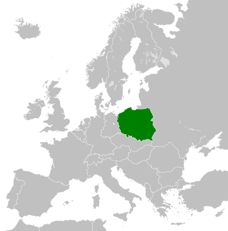
| 当前 | 2011年11月26日 (六) 00:23 | | 450 × 456(474 KB) | StalwartUK(留言 | 贡献) | == {{int:filedesc}} == {{Information |Description={{en|Map of the People's Republic of Poland as it was from 1945-1990. Surrounding countries accurate from 1956-1990.}} |Source=*[[:File:Blank_map_of_Europe_1956-1990.svg |
您不可以覆盖此文件。
文件用途
超过100个页面使用本文件。 下面的列表只显示使用本文件的前100个页面。完整列表可用。
- User:Alphathon/Historical Europe
- File:Albania 1956-1990.svg
- File:Albanian Kingdom (1935).svg
- File:Albanian Kingdom (1939).svg
- File:Austrian Lombardy 1789.svg
- File:Austrian Netherlands 1789.svg
- File:Austro-Hungarian Monarchy (1914).svg
- File:Blank map of Europe 1812.svg
- File:Blank map of Europe 1890.svg
- File:Blank map of Europe 1914.svg
- File:Blank map of Europe 1929-1938.svg
- File:Blank map of Europe 1956-1990.svg
- File:Blank map of Europe October 1938 - March 1939.svg
- File:Bulgaria 1956-1990.svg
- File:Confederation of the Rhine (1812).svg
- File:Cortina di ferro.png
- File:Czechoslovak Republic (1938).svg
- File:Czechoslovak Republic (1939).svg
- File:Czechoslovakia 1956–1990.svg
- File:Duchy of Holstein 1789.svg
- File:Duchy of Mecklenburg-Schwerin 1789.svg
- File:Duchy of Warsaw (1812).svg
- File:Duchy of Württemberg 1789.svg
- File:East Germany 1956-1990.svg
- File:Ecclesiastical lands of the Holy Roman Empire 1789.svg
- File:Electorate of Bavaria 1789.svg
- File:Electorate of Brunswick-Lüneburg 1789.svg
- File:Electorate of Saxony 1789.svg
- File:Europe 1789.svg
- File:Europe 1942.svg
- File:First French Empire 1812.svg
- File:Free City Danzig 1930.svg
- File:Free City of Danzig (1812).svg
- File:French Empire (1812).svg
- File:French State (1942).svg
- File:General Government (1942).svg
- File:German Empire 1914.svg
- File:German Reich (1939).svg
- File:Grand Duchy of Tuscany 1789.svg
- File:Grand Principality of Finland (1914).svg
- File:Greater German Reich (1942).svg
- File:Habsburg Monarchy 1789.svg
- File:Hellenic Republic (1935).svg
- File:Hellenic State (1942).svg
- File:Hungary 1956-1990.svg
- File:Imperial Italy.png
- File:InterwarCentralEurope.png
- File:Kingdom of Bulgaria (1914).svg
- File:Kingdom of Bulgaria (1942).svg
- File:Kingdom of France (1789).svg
- File:Kingdom of Greece (1890).svg
- File:Kingdom of Greece (1914).svg
- File:Kingdom of Greece (1973).svg
- File:Kingdom of Hungary (1942).svg
- File:Kingdom of Italy (1936).svg
- File:Kingdom of Italy (Napoleonic).svg
- File:Kingdom of Montenegro (1914).svg
- File:Kingdom of Portugal (1890).svg
- File:Kingdom of Prussia 1789.svg
- File:Kingdom of Romania (1890).svg
- File:Kingdom of Romania (1914).svg
- File:Kingdom of Romania (1939).svg
- File:Kingdom of Sardinia 1789.svg
- File:Kingdom of Serbia (1890).svg
- File:Kingdom of Serbia (1914).svg
- File:Kingdom of Spain (1789).svg
- File:Landgraviate of Hesse-Kassel 1789.svg
- File:Location Moldavian Democratic Republic.png
- File:Map Holy Roman Empire 1789.svg
- File:Map of the Republic of Serbia (2006–2008).svg
- File:Maps of Yugoslavia and FR Yugoslavia.svg
- File:Military Administration in Belgium and Northern France (1942).svg
- File:Military Administration in France (1942).svg
- File:Papal States 1789.svg
- File:Poland 1930.svg
- File:Poland 1956-1990.svg
- File:Polish-Lithuanian Commonwealth 1789.svg
- File:Prince-Bishopric of Montenegro (1812).svg
- File:Principality of Albania (1914).svg
- File:Principality of Bulgaria (1890).svg
- File:Principality of Montenegro (1890).svg
- File:Protectorate of Bohemia and Moravia (1942).svg
- File:Reichskommissariat Niederlande (1942).svg
- File:Reichskommissariat Norwegen (1942).svg
- File:Reichskommissariat Ostland (1942).svg
- File:Reichskommissariat Ukraine (1942).svg
- File:Republic of Genoa 1789.svg
- File:Republic of Montenegro (2006).svg
- File:Republic of Venice 1789.svg
- File:Republic of the Seven United Netherlands (1789).svg
- File:Romania 1956-1990.svg
- File:Serbia 1942.svg
- File:Slovak Republic (1942).svg
- File:Spanish Republic (1936).svg
- File:Spanish State (1975).svg
- File:Sweden 1789.svg
- File:Territory of the Serbian Uprising (1812).svg
- File:Voivodeship of Moldavia (1812).svg
- File:Voivodeship of Wallachia (1812).svg
- File:Weimar Republic 1930.svg
.svg)
.svg)
.svg)
.svg)
查看连接到这个文件的更多链接。
全域文件用途
以下其他wiki使用此文件:
- an.wikipedia.org上的用途
- ar.wikipedia.org上的用途
- az.wikipedia.org上的用途
- ca.wikipedia.org上的用途
- cs.wikipedia.org上的用途
- de.wikipedia.org上的用途
- el.wikipedia.org上的用途
- en.wikipedia.org上的用途
- en.wiktionary.org上的用途
- eo.wikipedia.org上的用途
- es.wikipedia.org上的用途
- et.wikipedia.org上的用途
- eu.wikipedia.org上的用途
- fa.wikipedia.org上的用途
- fi.wikipedia.org上的用途
- fr.wikipedia.org上的用途
- gl.wikipedia.org上的用途
- he.wikipedia.org上的用途
- hi.wikipedia.org上的用途
- hu.wikipedia.org上的用途
- hy.wikipedia.org上的用途
- id.wikipedia.org上的用途
- it.wikipedia.org上的用途
- ja.wikipedia.org上的用途
- kk.wikipedia.org上的用途
- ko.wikipedia.org上的用途
- lt.wikipedia.org上的用途
- lv.wikipedia.org上的用途
- mk.wikipedia.org上的用途
- ms.wikipedia.org上的用途
- mt.wikipedia.org上的用途
- nl.wikipedia.org上的用途
- pl.wikipedia.org上的用途
- pnb.wikipedia.org上的用途
- pt.wikipedia.org上的用途
- ro.wikipedia.org上的用途
- rue.wikipedia.org上的用途
- ru.wikipedia.org上的用途
- ru.wiktionary.org上的用途
- sc.wikipedia.org上的用途
查看此文件的更多全域用途。