File:Quercus coccinea range map 1.png
ნავიგაციაზე გადასვლა
ძიებაზე გადასვლა
ზომა წინასწარი გადახედვისას: 600 × 600 პიქსელი. სხვა გაფართოება: 240 × 240 პიქსელი | 480 × 480 პიქსელი | 768 × 768 პიქსელი | 1 024 × 1 024 პიქსელი | 1 792 × 1 792 პიქსელი.
თავდაპირველი ფაილი (1 792 × 1 792 პიქსელი, ფაილის ზომა: 102 კბ, MIME ტიპი: image/png)
Captions
Captions
Add a one-line explanation of what this file represents
რეზიუმე[რედაქტირება]
| აღწერა |
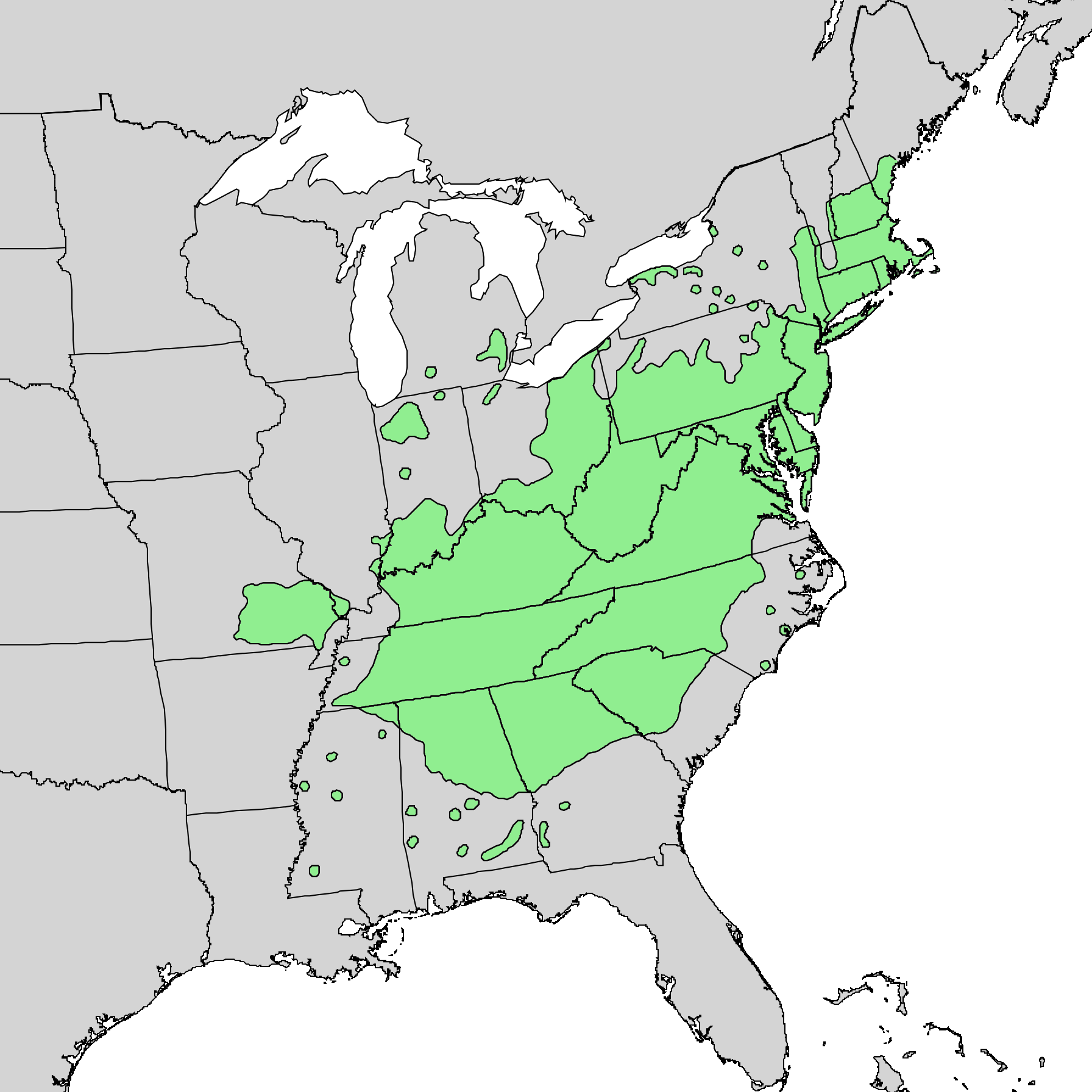
English: Natural distribution map for Quercus coccinea |
| თარიღი | |
| წყარო | USGS Geosciences and Environmental Change Science Center: Digital Representations of Tree Species Range Maps from "Atlas of United States Trees" by Elbert L. Little, Jr. (and other publications) |
| ავტორი | Elbert L. Little, Jr., USGS |
ლიცენზია[რედაქტირება]
This work is in the public domain in the United States because it is a work prepared by an officer or employee of the United States Government as part of that person’s official duties under the terms of Title 17, Chapter 1, Section 105 of the US Code.
Note: This only applies to original works of the Federal Government and not to the work of any individual U.S. state, territory, commonwealth, county, municipality, or any other subdivision. This template also does not apply to postage stamp designs published by the United States Postal Service since 1978. (See § 313.6(C)(1) of Compendium of U.S. Copyright Office Practices). It also does not apply to certain US coins; see The US Mint Terms of Use.
|
 | |
| This file has been identified as being free of known restrictions under copyright law, including all related and neighboring rights. | ||
ფაილის ისტორია
დააწკაპუნეთ თარიღზე/დროზე, რათა იხილოთ ფაილი, როგორც ის მაშინ გამოიყურებოდა.
| თარიღი/დრო | მინიატიურა | განზომილებები | მომხმარებელი | კომენტარი | |
|---|---|---|---|---|---|
| მიმდინარე | 15:37, 25 ოქტომბერი 2013 | | 1 792 × 1 792 (102 კბ) | Nonenmac (განხილვა | წვლილი) | User created page with UploadWizard |
თქვენ არ შეგიძლიათ ამ ფაილზე გადაწერა.
ფაილის გამოყენება
მომდევნო გვერდები იყენებენ ამ ფაილს:
ფაილის გლობალური გამოყენება
ეს ფაილი გამოიყენება შემდეგ ვიკებში:
- გამოყენება ceb.wikipedia.org-ში
- გამოყენება de.wikipedia.org-ში
- გამოყენება en.wikipedia.org-ში
- გამოყენება hu.wikipedia.org-ში
- გამოყენება is.wikipedia.org-ში
- გამოყენება ka.wikipedia.org-ში
- გამოყენება lt.wikipedia.org-ში
- გამოყენება nl.wikipedia.org-ში
- გამოყენება no.wikipedia.org-ში
- გამოყენება pl.wikipedia.org-ში
- გამოყენება uk.wikipedia.org-ში
- გამოყენება vi.wikipedia.org-ში