File:Raigad in Maharashtra (India).svg
跳至導覽
跳至搜尋

此 SVG 檔案的 PNG 預覽的大小:800 × 585 像素。 其他解析度:320 × 234 像素 | 640 × 468 像素 | 1,024 × 748 像素 | 1,280 × 935 像素 | 2,560 × 1,871 像素 | 1,233 × 901 像素。
原始檔案 (SVG 檔案,表面大小:1,233 × 901 像素,檔案大小:1.16 MB)
說明
說明
添加單行說明來描述出檔案所代表的內容
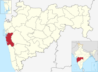
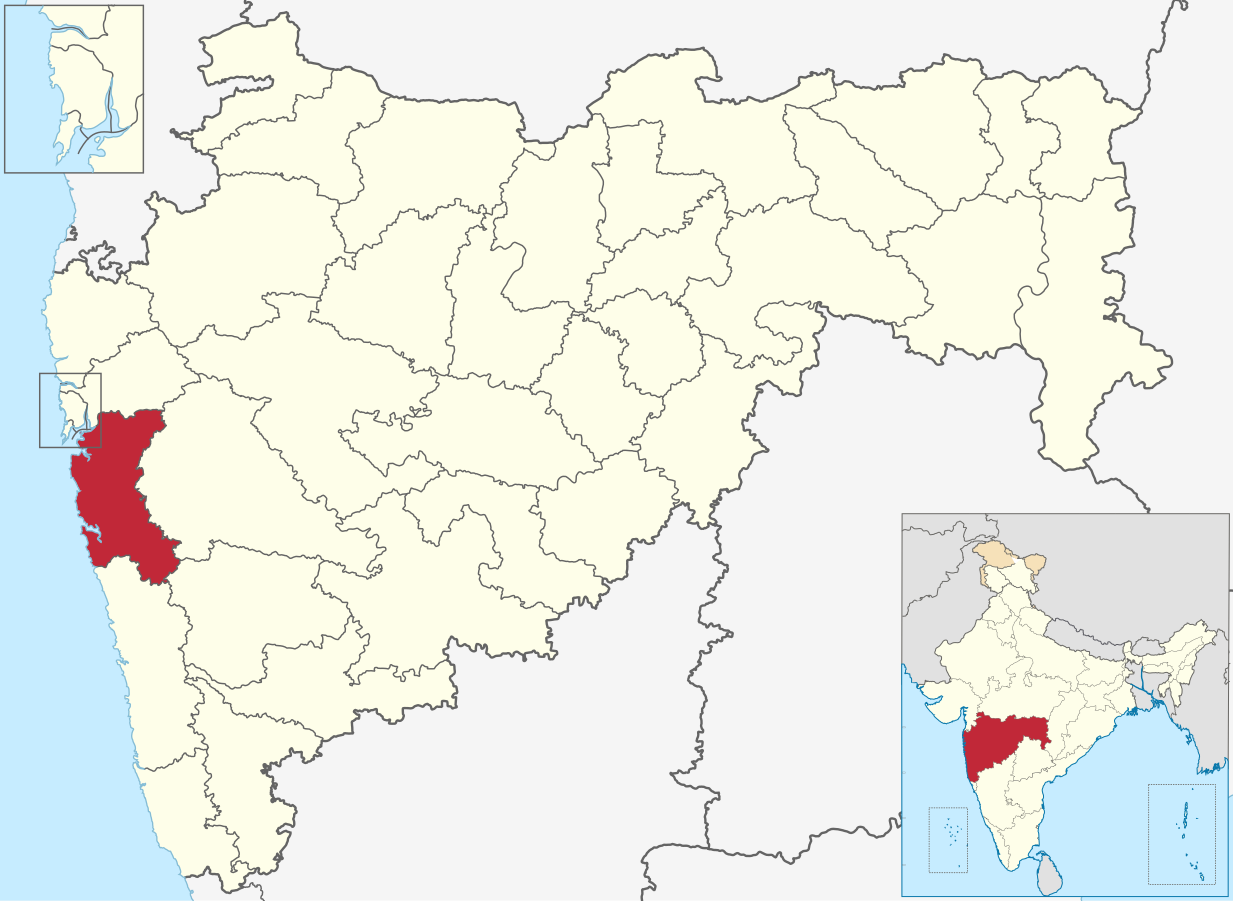
| 描述 | Map of Raigad district of Maharashtra |
| 日期 | 2 March 2021 |
| 來源 | Derivative of File:India Maharashtra location map.svg |
| 作者 | Own work based on User:Chumwa |
| 授權許可 (重用此檔案) |
此檔案採用共享創意 姓名標示-相同方式分享 3.0 未在地化版本授權條款。
|
檔案歷史
點選日期/時間以檢視該時間的檔案版本。
| 日期/時間 | 縮圖 | 尺寸 | 用戶 | 備註 | |
|---|---|---|---|---|---|
| 目前 | 2023年7月4日 (二) 17:50 | | 1,233 × 901(1.16 MB) | C1MM(對話 | 貢獻) | updated bounds |
| 2022年5月1日 (日) 05:03 |  | 1,146 × 838(805 KB) | C1MM(對話 | 貢獻) | updated bounds | |
| 2021年6月6日 (日) 15:11 |  | 1,223 × 894(1.24 MB) | C1MM(對話 | 貢獻) | c bounds | |
| 2021年3月3日 (三) 02:33 |  | 875 × 640(767 KB) | C1MM(對話 | 貢獻) | {{Information|Description=Map of Raigad district of Maharashtra|Source=Derivative of File:India Maharashtra location map.svg|Date=2 March 2021|Author=Own work based on User:Chumwa|Permission={{Cc-by-sa-3.0}}}} Category:Districts of Maharashtra |
無法覆蓋此檔案。
檔案用途
下列9個頁面有用到此檔案:
- Commons:Wiki Loves Monuments in India/Monuments/Heritage of Portuguese Influence/Maharashtra
- Commons:Wiki Loves Monuments in India/Monuments/National Importance/Maharashtra
- Commons:Wiki Loves Monuments in India/Monuments/Non-designated/forts/Maharashtra
- Commons:Wiki Loves Monuments in India/Monuments/State Protected/Maharashtra
- Category:Forts in Raigad district
- Category:Populated places in Raigad district
- Category:Raigad district
- Category:Railway stations in Raigad district
- Category:Villages in Raigad district
全域檔案使用狀況
以下其他 wiki 使用了這個檔案:
- ar.wikipedia.org 的使用狀況
- arz.wikipedia.org 的使用狀況
- bn.wikipedia.org 的使用狀況
- ca.wikipedia.org 的使用狀況
- de.wikipedia.org 的使用狀況
- en.wikipedia.org 的使用狀況
- Uran
- Alibag
- Matheran
- Karjat
- Roha
- Panvel
- Chaul
- Neral, India
- Kashid
- Revdanda
- Raigad district
- Khopoli
- Lonere
- Wahal
- Mahad
- Ambivali Tarf Tungaratan
- Birwadi
- Dhatau
- Kalundre
- Kegaon
- Kherdi
- Mhasla
- Mohpada
- Murud, Raigad
- Nagothane
- Poladpur
- Roha Ashtami
- Shrivardhan
- Taloje Panchnand
- Utekhol
- Sarasgad
- Rasayani
- Bamandongri
- Devale, Raigad
- Khalapur
- Mangaon
- Pen, India
- Pali, Raigad
- Mora, Maharashtra
- Shelu
- Chikhale, Panvel
- Rajpuri, Raigad
- Goregaon (Raigad)
- Bhivpuri
- Khandas
檢視此檔案的更多全域使用狀況。
.svg)
.svg&oldid=780292012)