File:Regions of the United States EPA.svg
跳至導覽
跳至搜尋

此 SVG 檔案的 PNG 預覽的大小:800 × 495 像素。 其他解析度:320 × 198 像素 | 640 × 396 像素 | 1,024 × 633 像素 | 1,280 × 791 像素 | 2,560 × 1,583 像素 | 959 × 593 像素。
原始檔案 (SVG 檔案,表面大小:959 × 593 像素,檔案大小:119 KB)
說明
說明
添加單行說明來描述出檔案所代表的內容
| 描述 |
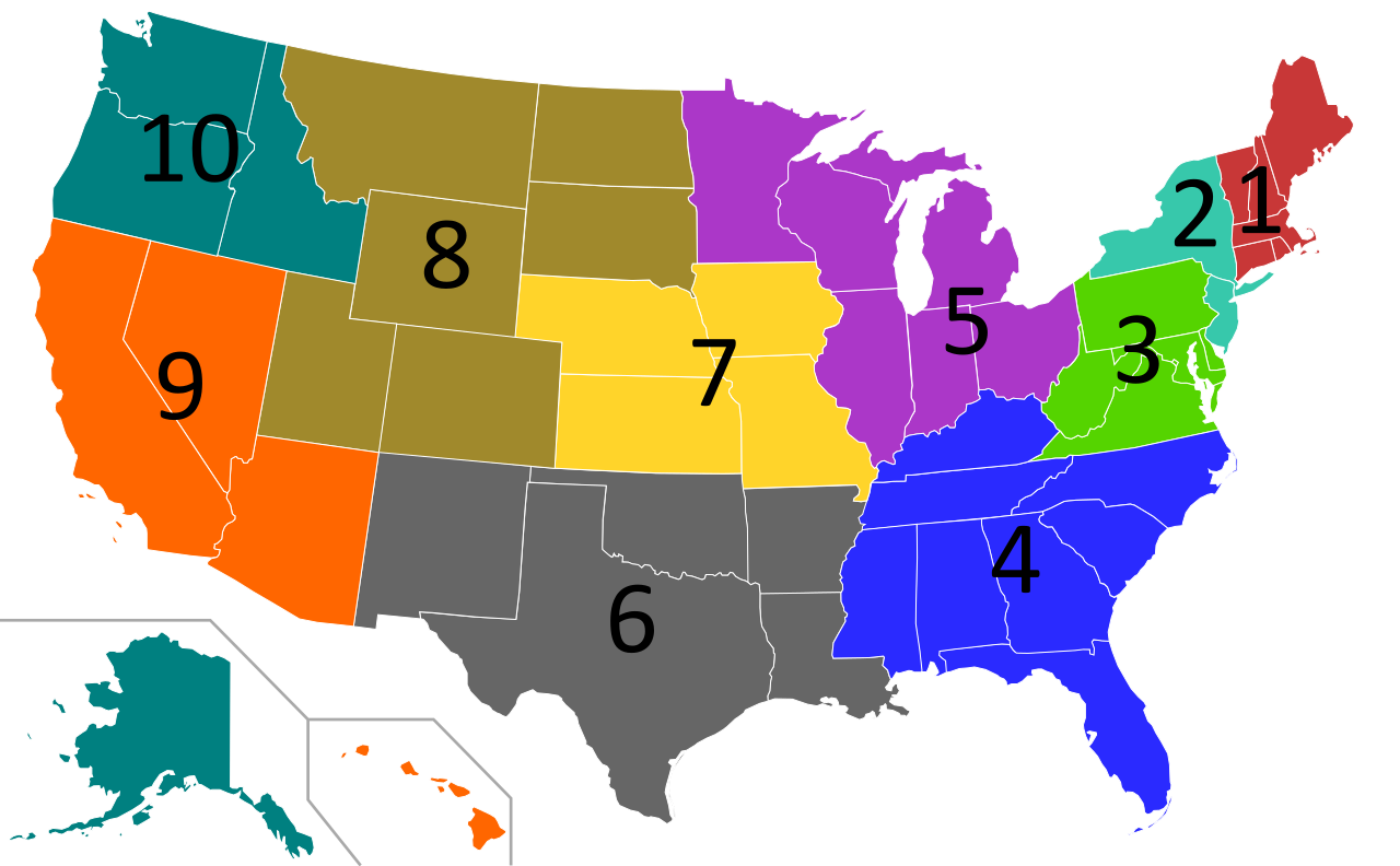
A map of the United States showing the 10 regions of the Environmental Protection Agency.
|
|
| 日期 | (UTC) | |
| 來源 | ||
| 作者 |
|
我,本作品的著作權持有者,決定用以下授權條款發佈本作品:
| 此檔案採用共享創意 姓名標示-相同方式分享 3.0 未在地化版本授權條款。 | ||
| ||
| 已新增授權條款標題至此檔案,作為GFDL授權更新的一部份。 |

|
已授權您依據自由軟體基金會發行的無固定段落、封面文字和封底文字GNU自由文件授權條款1.2版或任意後續版本,對本檔進行複製、傳播和/或修改。該協議的副本列在GNU自由文件授權條款中。 |
您可以選擇您需要的授權條款。
原始上傳日誌
[編輯]
This image is a derivative work of the following images:
- File:Blank_US_Map.svg licensed with Cc-by-sa-3.0-migrated, GFDL
- 2009-11-05T19:44:02Z NuclearVacuum 959x593 (91518 Bytes) minor fix from previous upload
- 2009-11-05T19:39:42Z NuclearVacuum 959x593 (88399 Bytes) Fixed up the borders so they are connected with each state and loosing that gap between them.
- 2008-10-09T16:36:40Z Howcheng 959x593 (80121 Bytes) Reverted to version as of 08:32, 14 June 2007
- 2008-03-12T00:20:02Z AMK1211 959x593 (174744 Bytes) Added borders: Light blue for water borders and black for land borders (international borders thicker).
- 2007-06-14T08:32:47Z Fibonacci 959x593 (80121 Bytes) Optimised code.
- 2006-07-12T23:00:30Z Theshibboleth 959x593 (90537 Bytes) The line framework around Alaska and Hawaii has been pushed a bit
- 2006-07-12T06:35:19Z Theshibboleth 959x593 (89828 Bytes) added DC
- 2006-07-12T06:05:05Z Theshibboleth 959x593 (89649 Bytes) {{Information |Description=A blank map of the United States in scalable vector form. |Source=Own work, based on [[:Image:Electorial map.svg]], inspired by [[:Image:BlankMap-World.png]] |Date=11 July 2006 |Author=[[User:Theshi
Uploaded with derivativeFX
檔案歷史
點選日期/時間以檢視該時間的檔案版本。
| 日期/時間 | 縮圖 | 尺寸 | 用戶 | 備註 | |
|---|---|---|---|---|---|
| 目前 | 2010年10月4日 (一) 19:54 | | 959 × 593(119 KB) | Ninjatacoshell(對話 | 貢獻) | {{Information |Description=A map of the United States showing the 10 regions of the Environmental Protection Agency.<br><br> Key: <br> <table border="0" cellspacing="0" cellpadding="1" style="background:transparent"> <tr valign="top"><td> {{Legend|#C8373 |
無法覆蓋此檔案。
檔案用途
下列頁面有用到此檔案:
全域檔案使用狀況
以下其他 wiki 使用了這個檔案:
- en.wikipedia.org 的使用狀況
- he.wikipedia.org 的使用狀況
- ig.wikipedia.org 的使用狀況
- simple.wikipedia.org 的使用狀況
- zh.wikipedia.org 的使用狀況