File:Relief Map of Poland.png
Salta a la navegació
Salta a la cerca
Mida d'aquesta previsualització: 617 × 600 píxels. Altres resolucions: 247 × 240 píxels | 494 × 480 píxels | 1.000 × 972 píxels.
Fitxer original (1.000 × 972 píxels, mida del fitxer: 1,46 Mo, tipus MIME: image/png)
Llegendes
Llegendes
Afegeix una explicació d'una línia del que representa aquest fitxer
Resum
[modifica]| Descripció |
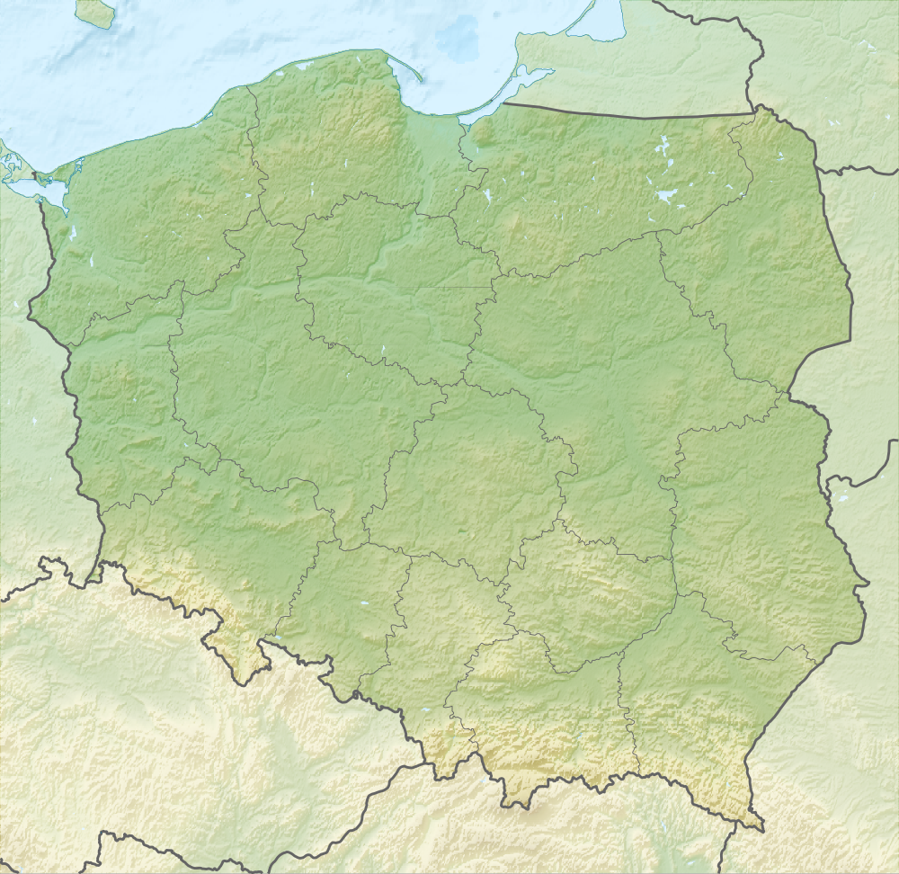
English: Relief map of Poland
Equirectangular projection, N/S stretching 160 %. Geographic limits of the map:
|
| Data | |
| Font |
|
| Autor | derivative work Виктор_В |
| Altres versions |
|


Llicència
[modifica]
Aquest fitxer està subjecte a la llicència de Creative Commons Reconeixement i Compartir Igual 3.0 No adaptada.
- Sou lliure de:
- compartir – copiar, distribuir i comunicar públicament l'obra
- adaptar – fer-ne obres derivades
- Amb les condicions següents:
- reconeixement – Heu de donar la informació adequada sobre l'autor, proporcionar un enllaç a la llicència i indicar si s'han realitzat canvis. Podeu fer-ho amb qualsevol mitjà raonable, però de cap manera no suggereixi que l'autor us dóna suport o aprova l'ús que en feu.
- compartir igual – Si modifiqueu, transformeu, o generareu amb el material, haureu de distribuir les vostres contribucions sota una llicència similar o una de compatible com l'original
Historial del fitxer
Cliqueu una data/hora per veure el fitxer tal com era aleshores.
| Data/hora | Miniatura | Dimensions | Usuari/a | Comentari | |
|---|---|---|---|---|---|
| actual | 18:02, 28 ago 2010 | | 1.000 × 972 (1,46 Mo) | Виктор В (discussió | contribucions) | рельеф дна |
| 12:08, 28 ago 2010 |  | 1.000 × 972 (1,43 Mo) | Виктор В (discussió | contribucions) | == {{int:filedesc}} == {{Information |Description={{en|Relief map of Poland}} Equirectangular projection, N/S stretching 160 %. Geographic limits of the map: * N: 55.2° N * S: 48.7° N * W: 13.8° E * E: 24.5° E |Source=*[[:File:Poland lo |
No podeu sobreescriure aquest fitxer.
Ús del fitxer
Les 37 pàgines següents utilitzen aquest fitxer:
- File:Greater Poland in Poland (relief).svg
- File:Greater Poland in Poland (relief + less opacity).svg
- File:Kuyavian-Pomeranian in Poland (relief).svg
- File:Kuyavian-Pomeranian in Poland (relief + less opacity).svg
- File:Lesser Poland in Poland (relief).svg
- File:Lesser Poland in Poland (relief + less opacity).svg
- File:Lodz in Poland (relief).svg
- File:Lodz in Poland (relief + less opacity).svg
- File:Lower Silesian in Poland (relief).svg
- File:Lower Silesian in Poland (relief + less opacity).svg
- File:Lublin in Poland (relief).svg
- File:Lublin in Poland (relief + less opacity).svg
- File:Lubusz in Poland (relief).svg
- File:Lubusz in Poland (relief + less opacity).svg
- File:Masovian in Poland (relief).svg
- File:Masovian in Poland (relief + less opacity).svg
- File:Opolskie in Poland (relief).svg
- File:Opolskie in Poland (relief + less opacity).svg
- File:Podkarpackie in Poland (relief).svg
- File:Podkarpackie in Poland (relief + less opacity).svg
- File:Podlaskie in Poland (relief).svg
- File:Podlaskie in Poland (relief + less opacity).svg
- File:Poland2 location map.svg
- File:Poland location map.svg
- File:Poland relief location map.png (fitxer redirigit)
- File:Pomeranian in Poland (relief).svg
- File:Pomeranian in Poland (relief + less opacity).svg
- File:Relief Map of Poland.png
- File:Relief Map of Poland.svg
- File:Silesian in Poland (relief).svg
- File:Silesian in Poland (relief + less opacity).svg
- File:Swietokrzyskie in Poland (relief).svg
- File:Swietokrzyskie in Poland (relief + less opacity).svg
- File:Warmian-Masurian in Poland (relief).svg
- File:Warmian-Masurian in Poland (relief + less opacity).svg
- File:West Pomeranian in Poland (relief).svg
- File:West Pomeranian in Poland (relief + less opacity).svg
.svg)
.svg)
.svg)
.svg)
.svg)
.svg)
.svg)
.svg)
.svg)
.svg)
.svg)
.svg)
.svg)
.svg)
.svg)
.svg)
.svg)
.svg)
.svg)
.svg)
.svg)
.svg)
.svg)
.svg)
.svg)
.svg)
.svg)
.svg)
.svg)
.svg)
.svg)
.svg)
Ús global del fitxer
Utilització d'aquest fitxer en altres wikis:
- Utilització a ar.wikipedia.org
- Utilització a as.wikipedia.org
- Utilització a av.wikipedia.org
- Utilització a be-tarask.wikipedia.org
- Utilització a be.wikipedia.org
- Заходні Буг
- Нараў
- Шаблон:На карце/Польшча
- Вісла
- Чорная Ганча
- Марыха
- Вепш
- Бебжа
- Свентакшыскія горы
- Снежка
- Піліца
- Віслока
- Рысы
- Рэга
- Варта
- Тарніца
- Нотаць
- Дзіўна
- Волін (востраў)
- Свіна (Польшча)
- Сабяшэўскі востраў
- Блэндоўская пустыня
- Лыса-Гура (Свентакшыскія горы)
- Ніда (рака)
- Востраў збожжасховішчаў
- Матлава
- Мёртвая Вісла
- Батанічны сад Уроцлаўскага ўніверсітэта
- Супрасль (рака)
- Utilització a bn.wikipedia.org
- Utilització a bs.wikipedia.org
- Utilització a ca.wikipedia.org
Vegeu més usos globals d'aquest fitxer.