File:Relief map of Crimea.jpg
Zur Navigation springen
Zur Suche springen
Greßi vu däre Vorschau: 800 × 542 Pixel. Wyteri Ufflösige: 320 × 217 Pixel | 640 × 434 Pixel | 1.024 × 694 Pixel | 1.200 × 813 Pixel.
Originaldatei (1.200 × 813 Pixel, Dateigrößi: 194 KB, MIME-Typ: image/jpeg)
Bildtexte
Kurzbeschreibungen
Ergänze eine einzeilige Erklärung, was diese Datei darstellt.
Bschryybig
[ändere]
| Bschryybig |
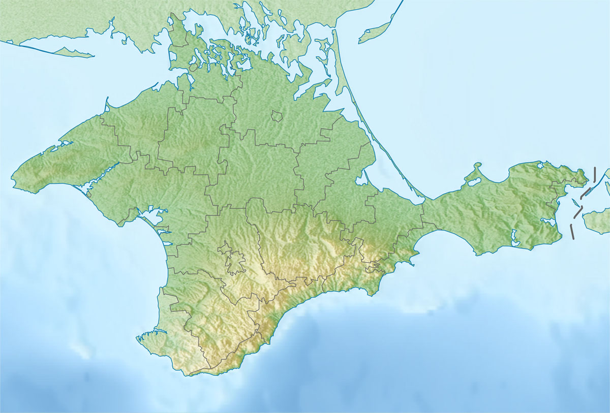
Русский: Физическая карта Автономной Республики Крым
Равноугольная проекция, стандартная параллель — 45°15′с.ш. Параметры шаблона (координаты краёв): English: Physical map of the Autonomous Republic of Crimea
Conformal projection, standard parallels — 45°15's.W. Template parameters (coordinates of the edges):
|
| Datum | |
| Quälle | |
| Urheber |
|
| Dieses Bild wurde digital nachbearbeitet. Das Originalbild kann hier eingesehen werden: Outline Map of Crimea.svg:
|
Lizänzierig
[ändere]
Ich haa s Urheberrächt an däm Wärch un vereffetlig s dodermit unter däre Lizänz:
| Ich, dr Urheberrächtsinhaber vu däm Wärch, tue s as gmeinfrej vereffentlige . Des giltet wältwyt. In mänke Staate chennt des rächtli nit megli syy. Wänn des imfall eso isch: Ich gib e jedem s bedingiglos Rächt, des Wärch jedwädere Zwäck z nutze, ußer s git gesetzlig erforderligi Bedingige. |
Orginal Logbuech vu uffegladene Datei
[ändere]
This image is a derivative work of the following images:
- File:Outline_Map_of_Crimea.svg licensed with PD-self
- 2010-12-06T19:49:04Z Виктор В 1000x678 (74604 Bytes) == {{int:filedesc}} == {{Information |Description={{ru|1=Позиционная карта Автономной Республики КрымРавноугольная проекция, стандартная параллел
Hochgeladen mit derivativeFX
Dateiversione
Klick uf e Zytpunkt zu aazeige, wie s dert usgsäh het.
| Version vom | Vorschaubild | Mäß | Benutzer | Kommentar | |
|---|---|---|---|---|---|
| aktuell | 23:01, 6. Jan. 2016 | | 1.200 × 813 (194 KB) | Janitoalevic (Diskussion | Byträg) | Found another version that is the change that i made File:Relief_map_of_Crimea_(disputed_status).jpg |
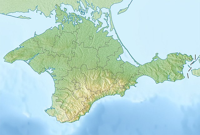
| 22:53, 6. Jan. 2016 |  | 1.200 × 813 (416 KB) | Janitoalevic (Diskussion | Byträg) | Neutrality of the map, just physical map. | |
| 19:41, 7. Dez. 2010 |  | 1.200 × 813 (194 KB) | Виктор В (Diskussion | Byträg) | {{Information |Description={{ru|1=Физическая карта Автономной Республики Крым<br>Равноугольная проекция, стандартная параллель — 45°15′с.ш.<br>Параметры шаб |
Du chasch die Datei nit iberschryybe.
Verwändig vu dr Datei
Die 43 Syte bruuche die Datei:
- Crimea
- Category:Administrative division in Crimean peninsula
- Category:Airports in Crimea
- Category:Ancient history of Crimea
- Category:Archaeology in Crimea
- Category:Architecture of Crimea
- Category:Association football clubs in Crimea
- Category:Autonomous Republic of Crimea
- Category:Awards of Crimea
- Category:Bodies of water in Crimea
- Category:Churches in Crimea
- Category:Companies based in Crimea
- Category:Crimea
- Category:Crimea by century
- Category:Crimea in the 19th century
- Category:Crimea in the 20th century
- Category:Eastern Orthodox monasteries in Crimea
- Category:Education in Crimea
- Category:Elections in Crimea
- Category:Events in Crimea
- Category:Geography of Crimea
- Category:Images of Crimea
- Category:Lakes of Crimea
- Category:Lighthouses in Crimea
- Category:Maps of Crimea
- Category:Ministers of the Autonomous Republic of Crimea
- Category:Monasteries in Crimea
- Category:Monuments and memorials in Crimea
- Category:Mosques in Crimea
- Category:Municipalities in Crimea
- Category:Organizations of Crimea
- Category:Politicians of Crimea
- Category:Politicians of the Autonomous Republic of Crimea
- Category:Politics of the Autonomous Republic of Crimea
- Category:Populated places in Crimea
- Category:Raions of the Autonomous Republic of Crimea
- Category:Rural settlements in Crimea
- Category:Sports in Crimea
- Category:Stadiums in Crimea
- Category:Views of Crimea
- Category:Visitor attractions in Crimea
- Category:Water transport in Crimea
- Category:Wind farms in Crimea
Wältwyti Dateinutzig
Die andere Wikis bruche die Datei:
- Gebruch uf als.wikipedia.org
- Gebruch uf ar.wikipedia.org
- Gebruch uf be.wikipedia.org
- Gebruch uf bg.wikipedia.org
- Севастопол
- Симферопол
- Ялта
- Ливадия (Крим)
- Феодосия
- Керч
- Перекоп
- Судак
- Алупка
- Гаспра
- Алуща
- Евпатория
- Джанкой
- Шаблон:ПК Украйна Крим
- Балаклавски залив
- Стари Крим
- Кишлав
- Балта Чокрак
- Керченски полуостров
- Учан Су (водопад)
- Ялтенска яйла
- Бахчисарай
- Кримски планини
- Мангуп
- Арабатски залив
- Каркинитски залив
- Тарханкутски полуостров
- Красноперекопск
- Черноморское
- Лебедски острови
- Gebruch uf bn.wikipedia.org
- Gebruch uf br.wikipedia.org
- Gebruch uf bs.wikipedia.org
- Gebruch uf ce.wikipedia.org
Wältwyti Verwändig vu däre Datei aaluege.