File:Rheinbrücke Emmerich Gesamtansicht.jpg

Originaldatei (3.050 × 1.100 Pixel, Dateigrößi: 1,13 MB, MIME-Typ: image/jpeg)
Bildtexte
Kurzbeschreibungen
Bschryybig[ändere]
| Bschryybig |
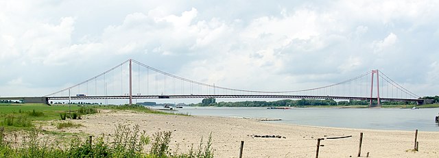
Deutsch: Rheinbrücke Emmerich
English: Brigde over the Rhine at Emmerich, Germany |
|||||||||||||||||
| Datum | ||||||||||||||||||
| Quälle | Eigeni Arbet | |||||||||||||||||
| Urheber |
|
|||||||||||||||||
| Gnähmigung (Wyternutzig vu däre Datei) |
|
|||||||||||||||||
| Namenännig (von der Lizenz verlangt) | © Raimond Spekking / | |||||||||||||||||


| Kameraposition | | Dieses und weitere Bilder auf OpenStreetMap |
|---|
Lizänzierig[ändere]
I have published this image as author under the Creative-Commons-Licence CC BY-SA 4.0.. This means that free online usage outside of Wikimedia projects under the following terms of licence is possible:
- The image is credited with "© Raimond Spekking / CC BY-SA 4.0 (via Wikimedia Commons)"
For all other kind of usages (books, journales, flyers, etc.) click on the following button. You will get all information needed.
I would be happy to receive a specimen copy or the URL of the website where the image is used.
Please write an email to raimond.spekking@gmail.com (GPG encrypted emails are welcome: Key-ID: 0xB12BE7A6), if you
- need the image in a higher resolution
- need my postal address for sending a specimen copy
- have further questions to the terms of licence
- Du derfsch:
- des Wärch an anderi wytergee – des Wärch kopiere, verbreite un ibertrage
- des Wärch verändere – des Wärch aapasse
- Unter däne Bedingige:
- Namenännig – Du muesch aagmässeni Aagabe zum Urheber un dr Rächt mache, e Link zue dr Lizänz zuefiege un aagee, eb Änderige gmacht wore sin. Die Aagabe chenne in ere aagmässene Art gmacht wäre, aber nit eso, ass dr Yydruck entstoht, ass dr Lizänzgeber Dii oder Dyy Gebruch vum Wärch unterstitze un guetheiße.
- Wytergab unter glyche Bedingige – Wänn du des Wärch veränderesch, umwandlesch oder druf ufböusch, no derfsch s Ergebnis nume unter dr glyche oder ere kumpatible Lizänz wie s Orginal vereffetlige.
Dateiversione
Klick uf e Zytpunkt zu aazeige, wie s dert usgsäh het.
| Version vom | Vorschaubild | Mäß | Benutzer | Kommentar | |
|---|---|---|---|---|---|
| aktuell | 20:03, 14. Sep. 2010 | 3.050 × 1.100 (1,13 MB) | Raymond (Diskussion | Byträg) | improved version | |
| 19:06, 7. Sep. 2006 | 2.000 × 578 (361 KB) | Raymond (Diskussion | Byträg) | {{Information |Description={{de|de:Rheinbrücke Emmerich}}{{en|Brigde over the Rhine at Emmerich, Germany}} |Source=own photography |Date=8. Jul. 2004 |Author=~~~ - Raimond Spekking |Permission= |other_versions= }} {{User:Raymond de/licence}} |
Du chasch die Datei nit iberschryybe.
Verwändig vu dr Datei
Die 6 Syte bruuche die Datei:
Wältwyti Dateinutzig
Die andere Wikis bruche die Datei:
- Gebruch uf als.wikipedia.org
- Gebruch uf arz.wikipedia.org
- Gebruch uf azb.wikipedia.org
- Gebruch uf be.wikipedia.org
- Gebruch uf de.wikipedia.org
- Gebruch uf de.wikivoyage.org
- Gebruch uf en.wikipedia.org
- Gebruch uf eo.wikipedia.org
- Gebruch uf fr.wikipedia.org
- Gebruch uf hr.wikipedia.org
- Gebruch uf hu.wikipedia.org
- Gebruch uf nl.wikipedia.org
- Gebruch uf ru.wikipedia.org
- Gebruch uf www.wikidata.org