File:Rio Tambo.png
跳至導覽
跳至搜尋
預覽大小:518 × 600 像素。 其他解析度:207 × 240 像素 | 414 × 480 像素 | 948 × 1,098 像素。
原始檔案 (948 × 1,098 像素,檔案大小:2.28 MB,MIME 類型:image/png)
說明
說明
添加單行說明來描述出檔案所代表的內容
摘要[編輯]
| 描述 |
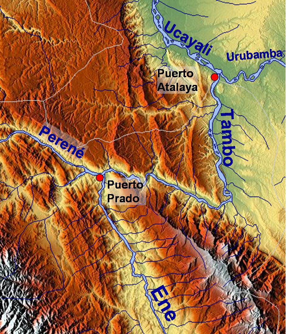
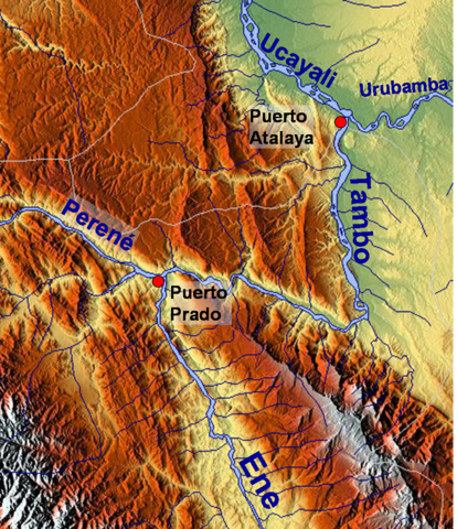
English: Map of the relief of the landscape around Tambo River, Peru |
| 日期 | |
| 來源 | http://www.maps-for-free.com/ |
| 作者 | Roar Johansen |
| 授權許可 (重用此檔案) |
http://www.maps-for-free.com/html/about.html |
授權條款[編輯]

|
已授權您依據自由軟體基金會發行的無固定段落、封面文字和封底文字GNU自由文件授權條款1.2版或任意後續版本,對本檔進行複製、傳播和/或修改。該協議的副本列在GNU自由文件授權條款中。 |
}}
檔案歷史
點選日期/時間以檢視該時間的檔案版本。
| 日期/時間 | 縮圖 | 尺寸 | 用戶 | 備註 | |
|---|---|---|---|---|---|
| 目前 | 2009年1月11日 (日) 12:26 | | 948 × 1,098(2.28 MB) | Roarjo(對話 | 貢獻) | {{Information |Description= |Source= |Date= |Author= |Permission= |other_versions= }} |
| 2009年1月10日 (六) 11:57 |  | 948 × 1,098(2.28 MB) | Roarjo(對話 | 貢獻) | == Description == {{Information |Description={{en|Map of the relief of the |Source=http://www.maps-for-free.com/ |Author=Roar Johansen |Date=2009 |Permission=http://www.maps-for-free.com/html/about.html |other_versions= }} == [[Commons:Co |
無法覆蓋此檔案。
檔案用途
沒有使用此檔案的頁面。
全域檔案使用狀況
以下其他 wiki 使用了這個檔案:
- ceb.wikipedia.org 的使用狀況
- cs.wikipedia.org 的使用狀況
- de.wikipedia.org 的使用狀況
- en.wikipedia.org 的使用狀況
- es.wikipedia.org 的使用狀況
- fr.wikipedia.org 的使用狀況
- hr.wikipedia.org 的使用狀況
- nl.wikipedia.org 的使用狀況
- nn.wikipedia.org 的使用狀況
- no.wikipedia.org 的使用狀況
- qu.wikipedia.org 的使用狀況
- sr.wikipedia.org 的使用狀況
- vi.wikipedia.org 的使用狀況
- www.wikidata.org 的使用狀況
- zh.wikipedia.org 的使用狀況