File:Rockaway Beach aerial view.jpg
ナビゲーションに移動
検索に移動
このプレビューのサイズ: 800 × 534 ピクセル。 その他の解像度: 320 × 214 ピクセル | 640 × 428 ピクセル | 1,024 × 684 ピクセル | 1,500 × 1,002 ピクセル。
元のファイル (1,500 × 1,002 ピクセル、ファイルサイズ: 536キロバイト、MIME タイプ: image/jpeg)
キャプション
キャプション
このファイルの内容を1行で記述してください
| 解説 |
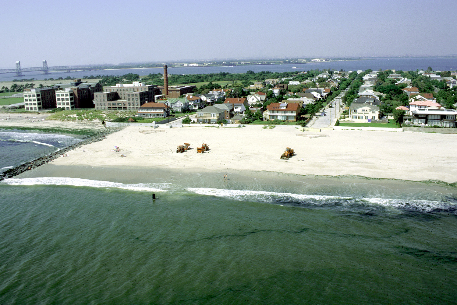
English: Aerial view of the beach area of Rockaway Park neighborhood, Queens, New York. The photograph appears to be taken from directly off the end of Beach 148th Street in the Neponsit area, next to Jacob Riis Park. The U.S. Army Corps of Engineers is working to replenish the sand on the beach. en:Marine Parkway-Gil Hodges Memorial Bridge in background left. |
|||
| 日付 | ||||
| 原典 |
U.S. Army Corps of Engineers Digital Visual Library Image page Image description page Digital Visual Library home page |
|||
| 作者 | Peter Shugert, U.S. Army Corps of Engineers | |||
| 許可 (ファイルの再利用) |
|
|||
| 場所 | Queens, New York City, New York, USA |
| 被写体の位置 | | 以下のサービスでこの位置を確認する: オープンストリートマップ |
|---|
ファイルの履歴
過去の版のファイルを表示するには、その版の日時をクリックしてください。
| 日付と時刻 | サムネイル | 寸法 | 利用者 | コメント | |
|---|---|---|---|---|---|
| 現在の版 | 2007年4月9日 (月) 03:49 | | 1,500 × 1,002 (536キロバイト) | DanMS (トーク | 投稿記録) | {{Information | Description = {{en|Aerial view of the beach area of Rockaway Park neighborhood, Queens, New York. The photograph appears to be taken from directly off the end of Beach 148th Street in the Neponsit area, next to Jacob Riis Park. The U.S. |
このファイルは上書きできません。
ファイルの使用状況
以下の 2 ページがこのファイルを使用しています:
グローバルなファイル使用状況
以下に挙げる他のウィキがこの画像を使っています:
- azb.wikipedia.org での使用状況
- de.wikipedia.org での使用状況
- en.wikipedia.org での使用状況
- en.wikivoyage.org での使用状況
- www.wikidata.org での使用状況
- Q62146
- Wikidata:Translatathon NYC/es
- Wikidata:Translatathon NYC/zh
- Wikidata:Translatathon NYC/ru
- Wikidata:Translatathon NYC/ro
- Wikidata:Translatathon NYC/el
- Wikidata:Translatathon NYC/de
- Wikidata:Translatathon NYC/fr
- Wikidata:Translatathon NYC/my
- Wikidata:Translatathon NYC/ar
- Wikidata:Translatathon NYC/bn
- Wikidata:Translatathon NYC/hi
- Wikidata:Translatathon NYC/jp
- Wikidata:Translatathon NYC/ko
- Wikidata:Translatathon NYC/pt
- Wikidata:Translatathon NYC/ht
- Wikidata:Translatathon NYC/uk
- Wikidata:Translatathon NYC/pa
- Wikidata:Translatathon NYC/tl
- Wikidata:Translatathon NYC/yi
- Wikidata:Translatathon NYC/ka