File:Roosevelt National Forest location in Colorado.png
原始檔案 (2,000 × 1,447 像素,檔案大小:1.74 MB,MIME 類型:image/png)
說明
說明
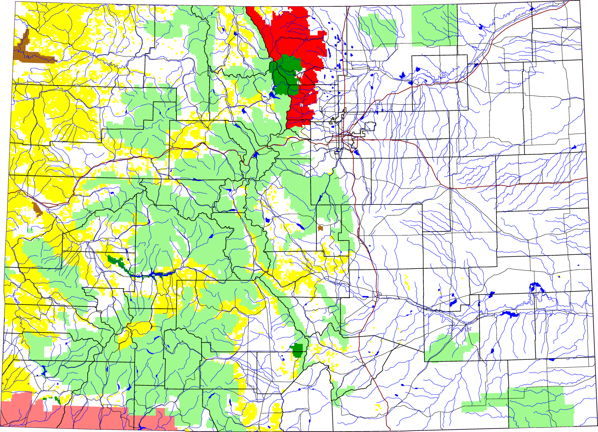
A map of Colorado, with Roosevelt National Forest highlighted in red. The light green is other Forest Service land, yellow is BLM land, dark green is National Park, brown is National Monument or National Historic Site, pink is Indian reservation. The reddish lines are Interstate Highways.
David Benbennick made this map with data from nationalatlas.gov.
The map uses the azimuthal equidistant projection, centered on (-105.7167, 39.1333) (degrees latitude, longitude). The area outside Colorado is transparent, so it should look nice on non-white backgrounds.
Eventually, I will upload the 4 megabyte Metapost script I used to make this map. In the mean time, see map.mp.
| 我,此作品的版權所有人,釋出此作品至公共領域。此授權條款在全世界均適用。 這可能在某些國家不合法,如果是的話: 我授予任何人有權利使用此作品於任何用途,除受法律約束外,不受任何限制。 |
檔案歷史
點選日期/時間以檢視該時間的檔案版本。
| 日期/時間 | 縮圖 | 尺寸 | 使用者 | 備註 | |
|---|---|---|---|---|---|
| 目前 | 2006年3月8日 (三) 19:46 | | 2,000 × 1,447(1.74 MB) | Dbenbenn(留言 | 貢獻) | thumbnail, since MediaWiki can't scale PNG images larger than 12.5 megapixels |
| 2005年8月8日 (一) 13:12 |  | 6,235 × 4,511(652 KB) | Dbenbenn(留言 | 貢獻) | by me, PD |
無法覆蓋此檔案。
檔案用途
沒有使用此檔案的頁面。
全域檔案使用狀況
以下其他 wiki 使用了這個檔案:
- ca.wikipedia.org 的使用狀況
- en.wikipedia.org 的使用狀況
- es.wikipedia.org 的使用狀況
- fa.wikipedia.org 的使用狀況
- zh.wikipedia.org 的使用狀況