File:Russian Occupation of Crimea.svg
跳至導覽
跳至搜尋

此 SVG 檔案的 PNG 預覽的大小:800 × 529 像素。 其他解析度:320 × 212 像素 | 640 × 423 像素 | 1,024 × 678 像素 | 1,280 × 847 像素 | 2,560 × 1,694 像素 | 1,587 × 1,050 像素。
原始檔案 (SVG 檔案,表面大小:1,587 × 1,050 像素,檔案大小:190 KB)
說明
說明
添加單行說明來描述出檔案所代表的內容
摘要
[編輯]| 描述 |
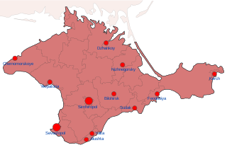
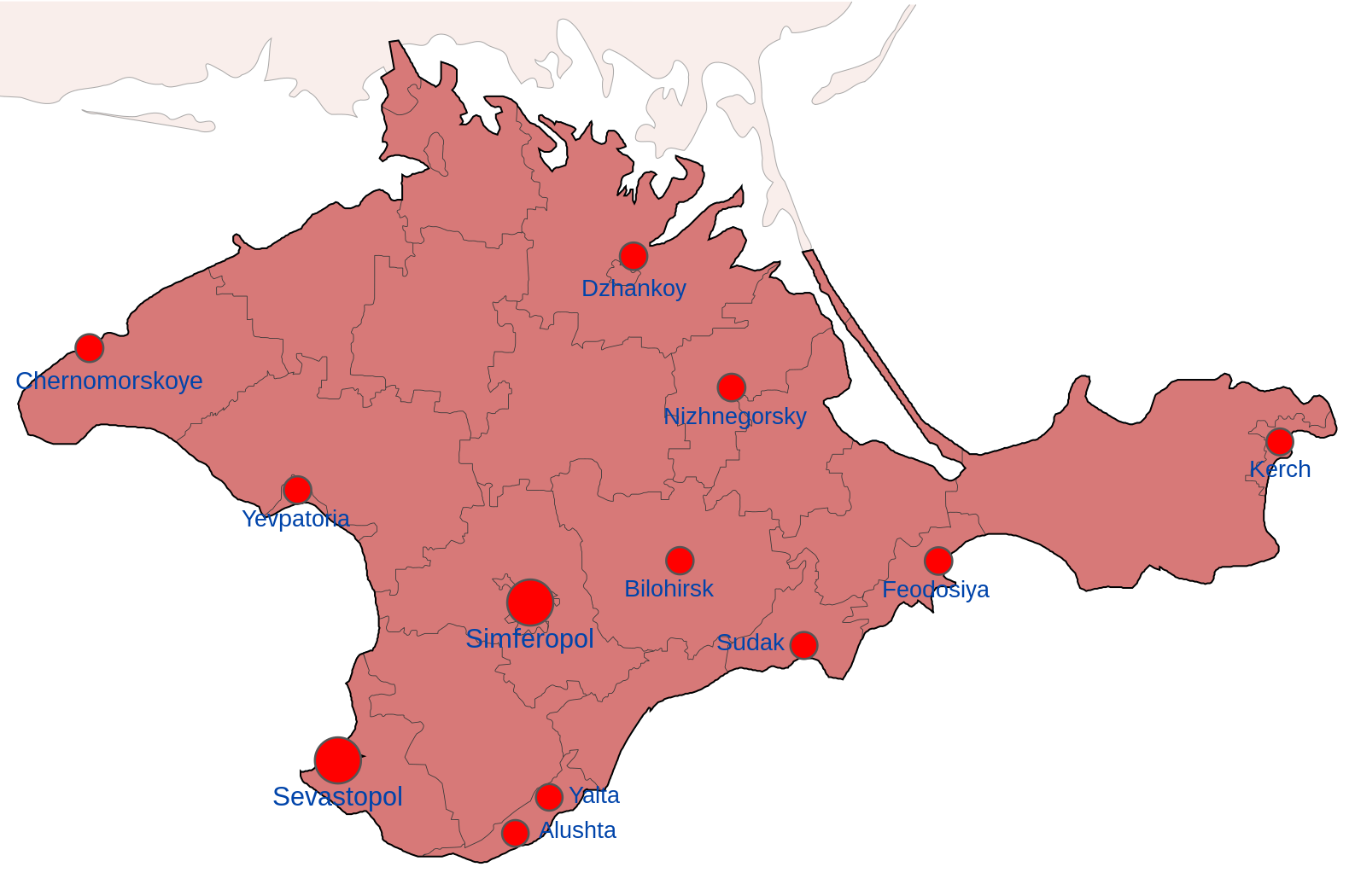
English: Map showing the various zones of Russian Occupation of Crimea:
= Ukrainian Controlled = Deoccupied by Ukraine = Russian occupied = Russian Controlled since 2014 |
| 日期 | |
| 來源 | 自己的作品 |
| 作者 | Nahabino |
| 其他版本 |
[]
|


.png)


.png)


授權條款
[編輯]
我,本作品的著作權持有者,決定用以下授權條款發佈本作品:
此檔案採用創用CC 姓名標示-相同方式分享 4.0 國際授權條款。
- 您可以自由:
- 分享 – 複製、發佈和傳播本作品
- 重新修改 – 創作演繹作品
- 惟需遵照下列條件:
- 姓名標示 – 您必須指名出正確的製作者,和提供授權條款的連結,以及表示是否有對內容上做出變更。您可以用任何合理的方式來行動,但不得以任何方式表明授權條款是對您許可或是由您所使用。
- 相同方式分享 – 如果您利用本素材進行再混合、轉換或創作,您必須基於如同原先的相同或兼容的條款,來分布您的貢獻成品。
檔案歷史
點選日期/時間以檢視該時間的檔案版本。
| 日期/時間 | 縮圖 | 尺寸 | 使用者 | 備註 | |
|---|---|---|---|---|---|
| 目前 | 2022年10月6日 (四) 23:15 | | 1,587 × 1,050(190 KB) | Nahabino(留言 | 貢獻) | Correct Nizhnegorsky naming |
| 2022年10月5日 (三) 01:00 |  | 1,587 × 1,050(190 KB) | Nahabino(留言 | 貢獻) | test with transparent water | |
| 2022年10月5日 (三) 00:57 |  | 1,549 × 1,026(203 KB) | Nahabino(留言 | 貢獻) | Uploaded own work with UploadWizard |
無法覆蓋此檔案。
檔案用途
下列54個頁面有用到此檔案:
- Ukraine Regional Occupation Maps
- User:Jcornelius/Angola/2022 October 1-10
- User:Magog the Ogre/Maps of conflicts/2022 October
- User talk:Physeters/Archive 2023
- File:Dnipropetrovsk-poltava oblast occupation.png
- File:Dnipropetrovsk Oblast border skirmishes.png
- File:Kharkiv Oblast Control Evolution.png
- File:Kherson military–civilian administration.png
- File:Kherson military–civilian administration hatched.svg
- File:Occupation of Mykolaiv Oblast by Russia (With Cities).png
- File:Poltava oblast border skirmishes.png
- File:Russian Occupation of Chernihiv Oblast.svg
- File:Russian Occupation of Crimea.svg
- File:Russian Occupation of Dnipropetrovsk & Poltava Oblasts.svg
- File:Russian Occupation of Dnipropetrovsk Oblast.svg
- File:Russian Occupation of Donetsk Oblast.svg
- File:Russian Occupation of Kharkiv Oblast.svg
- File:Russian Occupation of Kherson Oblast.svg
- File:Russian Occupation of Kyiv Oblast.png
- File:Russian Occupation of Kyiv Oblast.svg
- File:Russian Occupation of Mykolaiv Oblast.svg
- File:Russian Occupation of Poltava Oblast.svg
- File:Russian Occupation of Sumy Oblast.svg
- File:Russian Occupation of Zaporizhzhia Oblast.svg
- File:Russian Occupation of Zhytomyr Oblast.svg
- File:Russian occupation of Chernihiv Oblast.png
- File:Russian occupation of Chernihiv Oblast peak.png
- File:Russian occupation of Donetsk Oblast.png
- File:Russian occupation of Kharkiv Oblast.png
- File:Russian occupation of Luhansk Oblast.png
- File:Russian occupation of Luhansk Oblast.svg
- File:Russian occupation of Mykolaiv Oblast.png
- File:Russian occupation of Sumy Oblast.png
- File:Russian occupation of Zhytomyr Oblast.png
- File:Zaporizhzhia frontline.png
- File:Zaporizhzhia military–civilian administration hatched.svg
- File:Zaporizhzhia region.png
- File:Днепропетровская область.png
- File:Донецкая область или Донецкая народная Республика.png
- File:Житомирская область.png
- File:Запорожская область.png
- File:Карта звільнених територій Житомирської області.png
- File:Киев.png
- File:Киевская область.png
- File:Крым (Автономная Республика).png
- File:Луганская область или Луганская Народная Республика.png
- File:Николаевская область 2.png
- File:Одесская область 2.png
- File:Полтавская область.png
- File:Севастополь.png
- File:Сумская область.png
- File:Харьковская область 2.png
- File:Херсонская область.png
- File:Черниговская область 2.png
全域檔案使用狀況
以下其他 wiki 使用了這個檔案:
- be-tarask.wikipedia.org 的使用狀況
- be.wikipedia.org 的使用狀況
- en.wikipedia.org 的使用狀況
- fi.wikipedia.org 的使用狀況
- hr.wikipedia.org 的使用狀況
- id.wikipedia.org 的使用狀況
- ko.wikipedia.org 的使用狀況
- lv.wikipedia.org 的使用狀況
- uk.wikipedia.org 的使用狀況
- www.wikidata.org 的使用狀況
- zh.wikipedia.org 的使用狀況