File:Saint-Barthélemy collectivity location map.svg
跳至導覽
跳至搜尋

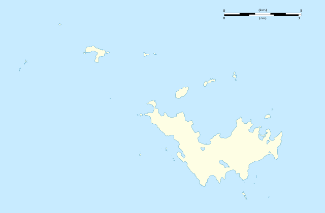
此 SVG 檔案的 PNG 預覽的大小:800 × 526 像素。 其他解析度:320 × 210 像素 | 640 × 420 像素 | 1,024 × 673 像素 | 1,280 × 841 像素 | 2,560 × 1,682 像素 | 1,175 × 772 像素。
原始檔案 (SVG 檔案,表面大小:1,175 × 772 像素,檔案大小:82 KB)
說明
說明
添加單行說明來描述出檔案所代表的內容
摘要[編輯]
| 拍攝地點 | | 位於此地的本圖片與其他圖片: OpenStreetMap |
|---|
| 描述 |
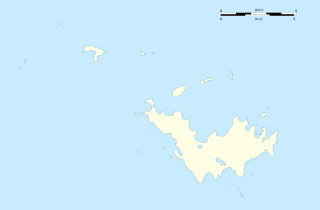
English: Blank administrative map of the overseas collectivity of Saint Barthélemy, France, for geo-location purpose.
Français : Carte administrative vierge de la collectivité d'outre-mer de Saint-Barthélemy, France, destinée à la géolocalisation. Estimated scales: 1:200,000 (precision: 50 m)
Geographic limits of the map:
|
||
| 日期 | |||
| 來源 |
自己的作品
|
||
| 作者 | Eric Gaba (Sting - fr:Sting) | ||
| 授權許可 (重用此檔案) |
|
||
| 其他版本 |
|


授權條款[編輯]
Eric Gaba, Wikimedia Commons user Sting,此作品的版權所有人,決定用以下授權條款發佈本作品:
此檔案採用創用CC 姓名標示-相同方式分享 3.0 未在地化版本授權條款。
姓名標示: Eric Gaba, Wikimedia Commons user Sting
- 您可以自由:
- 分享 – 複製、發佈和傳播本作品
- 重新修改 – 創作演繹作品
- 惟需遵照下列條件:
- 姓名標示 – 您必須指名出正確的製作者,和提供授權條款的連結,以及表示是否有對內容上做出變更。您可以用任何合理的方式來行動,但不得以任何方式表明授權條款是對您許可或是由您所使用。
- 相同方式分享 – 如果您利用本素材進行再混合、轉換或創作,您必須基於如同原先的相同或兼容的條款,來分布您的貢獻成品。

|
已授權您依據自由軟體基金會發行的無固定段落、封面文字和封底文字GNU自由文件授權條款1.2版或任意後續版本,對本檔進行複製、傳播和/或修改。該協議的副本列在GNU自由文件授權條款中。 |
您可以選擇您需要的授權條款。
檔案歷史
點選日期/時間以檢視該時間的檔案版本。
| 日期/時間 | 縮圖 | 尺寸 | 使用者 | 備註 | |
|---|---|---|---|---|---|
| 目前 | 2010年2月26日 (五) 01:44 | | 1,175 × 772(82 KB) | Sting(留言 | 貢獻) | == {{int:filedesc}} == {{Location|17|55|30|N|62|51|45|W|scale:50000}} <br/> {{Information |Description={{en|Blank administrative map of the overseas collectivity of Saint Barthélemy, [[:en:France|Fr |
無法覆蓋此檔案。
檔案用途
下列8個頁面有用到此檔案:
- User:Sting/Gallery: Location and locator maps
- File:EP-constituencies.svg
- File:EP-constituencies 2019.svg
- File:EP2009-constituencies.svg
- File:EP2014-constituencies.svg
- File:France (+overseas), administrative divisions - Nmbrs (zoom).svg
- File:Saint-Barthélemy collectivity location map with quartiers.svg
- File:Saint-Barthélemy collectivity relief location map.jpg
,_administrative_divisions_-_Nmbrs_(zoom).svg)
全域檔案使用狀況
以下其他 wiki 使用了這個檔案:
- af.wikipedia.org 的使用狀況
- an.wikipedia.org 的使用狀況
- ar.wikipedia.org 的使用狀況
- ast.wikipedia.org 的使用狀況
- bs.wikipedia.org 的使用狀況
- ceb.wikipedia.org 的使用狀況
- ckb.wikipedia.org 的使用狀況
- da.wikipedia.org 的使用狀況
- de.wikipedia.org 的使用狀況
- en.wikipedia.org 的使用狀況
- eo.wikipedia.org 的使用狀況
- es.wikipedia.org 的使用狀況
- fa.wikipedia.org 的使用狀況
- fr.wikipedia.org 的使用狀況
- Phare de Gustavia
- Gustavia (Saint-Barthélemy)
- Projet:Cartographie/Cartes standards/France
- Aéroport de Saint-Barthélemy-Rémy-de-Haenen
- Modèle:Géolocalisation/Saint-Barthélemy
- Église Notre-Dame-de-l'Assomption de Gustavia
- Clocher suédois de Gustavia
- Église de Lorient de Saint-Barthélemy
- Maison des Gouverneurs de Gustavia
- Maison Dinzey
- Presbytère de l'église catholique de Gustavia
- Batterie suédoise du fort Gustav III
- Fort Karl
- Le P'tit Collectionneur
- Pandémie de Covid-19 à Saint-Barthélemy
- Comité de rugby de Guadeloupe
- Vol Air Caraïbes 1501
- hr.wikipedia.org 的使用狀況
- hu.wikipedia.org 的使用狀況
- id.wikipedia.org 的使用狀況
- ja.wikipedia.org 的使用狀況
- ka.wikipedia.org 的使用狀況
- kbd.wikipedia.org 的使用狀況
檢視此檔案的更多全域使用狀況。