File:Saint Paul Island Alaska aerial view.jpg
跳至導覽
跳至搜尋

預覽大小:800 × 523 像素。 其他解析度:320 × 209 像素 | 640 × 419 像素 | 1,024 × 670 像素 | 1,500 × 981 像素。
原始檔案 (1,500 × 981 像素,檔案大小:589 KB,MIME 類型:image/jpeg)
說明
說明
添加單行說明來描述出檔案所代表的內容
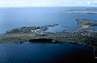
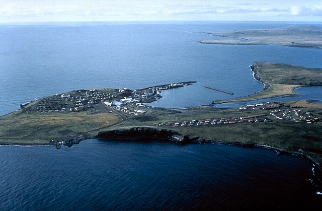
| 描述 | Aerial view of St. Paul Island | |||
| 圖中地點 | St. Paul Island, Alaska, USA |
|||
| 日期 | not specified or unknown | |||
| 來源 |
U.S. Army Corps of Engineers Digital Visual Library Image page Image description page Digital Visual Library home page |
|||
| 作者 | U.S. Army Corps of Engineers, photographer not specified or unknown | |||
| 授權許可 (重用此檔案) |
|
| 拍攝地點 | | 位於此地的本圖片與其他圖片: OpenStreetMap |
|---|
| 目標地點 | | 位於此地的本圖片與其他圖片: OpenStreetMap |
|---|
檔案歷史
點選日期/時間以檢視該時間的檔案版本。
| 日期/時間 | 縮圖 | 尺寸 | 使用者 | 備註 | |
|---|---|---|---|---|---|
| 目前 | 2007年3月20日 (二) 01:44 | | 1,500 × 981(589 KB) | DanMS(留言 | 貢獻) | {{Information | Description = Aerial view of St. Paul Island | Source = U.S. Army Corps of Engineers Digital Visual Library<br />[http://images.usace.army.mil/images/Hires/4414-19.Jpg Image page]<br />[http://images.usace.army.mil/scripts/PortW |
無法覆蓋此檔案。
檔案用途
沒有使用此檔案的頁面。
全域檔案使用狀況
以下其他 wiki 使用了這個檔案:
- az.wikipedia.org 的使用狀況
- be.wikipedia.org 的使用狀況
- br.wikipedia.org 的使用狀況
- ceb.wikipedia.org 的使用狀況
- de.wikipedia.org 的使用狀況
- en.wikipedia.org 的使用狀況
- es.wikipedia.org 的使用狀況
- fi.wikipedia.org 的使用狀況
- fr.wikipedia.org 的使用狀況
- gl.wikipedia.org 的使用狀況
- ja.wikipedia.org 的使用狀況
- pt.wikipedia.org 的使用狀況
- ru.wikipedia.org 的使用狀況
- www.wikidata.org 的使用狀況
- zh.wikipedia.org 的使用狀況