File:Satellite Image of Lake Manas.png
跳至導覽
跳至搜尋

預覽大小:800 × 500 像素。 其他解析度:320 × 200 像素 | 640 × 400 像素 | 1,024 × 639 像素 | 1,278 × 798 像素。
原始檔案 (1,278 × 798 像素,檔案大小:2.39 MB,MIME 類型:image/png)
說明
說明
添加單行說明來描述出檔案所代表的內容
摘要
[編輯]
| 描述 |
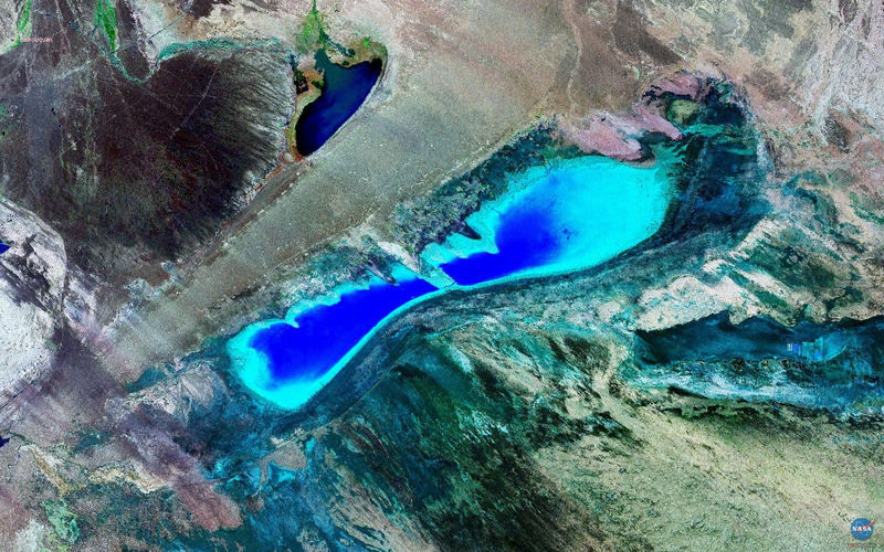
English: Satellite Image of Lake Manas, Xinjiang, China
中文:新疆玛纳斯湖卫星图像 |
| 來源 | NASA Landsat Image |
| 作者 | NASA |
| 拍攝地點 | | 位於此地的本圖片與其他圖片: OpenStreetMap |
|---|
授權條款
[編輯]
| 本作品由NASA創作,屬於公有領域。根據NASA的版權政策:“NASA的創作除非另有聲明否則不受版權保護。”(參見:Template:PD-USGov/zh,NASA版權政策或JPL圖像使用政策) | ||
 |
警告:
|
檔案歷史
點選日期/時間以檢視該時間的檔案版本。
| 日期/時間 | 縮圖 | 尺寸 | 用戶 | 備註 | |
|---|---|---|---|---|---|
| 目前 | 2009年3月18日 (三) 13:36 | | 1,278 × 798(2.39 MB) | Camphora(對話 | 貢獻) | {{Information |Description={{en|1=Satellite Image of Lake Manas, Xinjiang, China}} {{zh|1=新疆玛纳斯湖卫星图像}} |Source=NASA Landsat Image |Author=NASA |Date= |Permission= |other_versions= }} [location |45|48|N|85|58|E|scale:1000000_type:Waterb |
無法覆蓋此檔案。
檔案用途
下列頁面有用到此檔案:
全域檔案使用狀況
以下其他 wiki 使用了這個檔案:
- en.wikipedia.org 的使用狀況
- fa.wikipedia.org 的使用狀況
- ja.wikipedia.org 的使用狀況
- pa.wikipedia.org 的使用狀況
- sr.wikipedia.org 的使用狀況
- te.wikipedia.org 的使用狀況
- tr.wikipedia.org 的使用狀況
- zh.wikipedia.org 的使用狀況