File:Satellite image of 2015 Southeast Asian haze - 20150924.jpg
跳至導覽
跳至搜尋

預覽大小:800 × 533 像素。 其他解析度:320 × 213 像素 | 640 × 427 像素 | 1,024 × 683 像素 | 1,280 × 853 像素 | 2,560 × 1,707 像素 | 7,200 × 4,800 像素。
原始檔案 (7,200 × 4,800 像素,檔案大小:6.15 MB,MIME 類型:image/jpeg)
說明
說明
添加單行說明來描述出檔案所代表的內容
摘要
[編輯]
| 描述 |
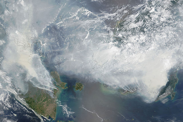
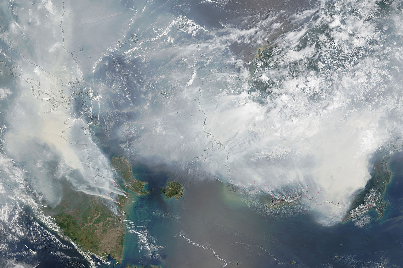
English: As seen in this September 24 image from the Moderate Resolution Imaging Spectroradiometer (MODIS) on NASA’s Terra satellite, Red outlines indicate hot spots where the sensor detected unusually warm surface temperatures associated with fires. Thick gray smoke hovers over both islands and has triggered air quality alerts and health warnings in Indonesia and neighboring countries. Visibility has plummeted.
العربية: صورةٌ عبرَ الأقمار الصناعيّة التابعة لوكالة ناسا وتُظهر مدى الضباب الذي ضربَ جنوب شرق آسيا في 24 أيلول/سبتمبر 2015
Caption by Adam Voiland. |
| 日期 | |
| 來源 | http://earthobservatory.nasa.gov/IOTD/view.php?id=86681 |
| 作者 | NASA image by Adam Voiland (NASA Earth Observatory) and Jeff Schmaltz (LANCE MODIS Rapid Response) |
授權條款
[編輯]
| 本作品由NASA創作,屬於公有領域。根據NASA的版權政策:“NASA的創作除非另有聲明否則不受版權保護。”(參見:Template:PD-USGov/zh,NASA版權政策或JPL圖像使用政策) | ||
 |
警告:
|
檔案歷史
點選日期/時間以檢視該時間的檔案版本。
| 日期/時間 | 縮圖 | 尺寸 | 用戶 | 備註 | |
|---|---|---|---|---|---|
| 目前 | 2015年9月28日 (一) 09:19 | | 7,200 × 4,800(6.15 MB) | RectorRocks(對話 | 貢獻) | {{subst:Upload marker added by en.wp UW}} {{Information |Description = {{en|As seen in this September 24 image from the Moderate Resolution Imaging Spectroradiometer (MODIS) on NASA’s... |
無法覆蓋此檔案。
檔案用途
沒有使用此檔案的頁面。
全域檔案使用狀況
以下其他 wiki 使用了這個檔案:
- ar.wikipedia.org 的使用狀況
- bg.wikipedia.org 的使用狀況
- bg.wikinews.org 的使用狀況
- en.wikipedia.org 的使用狀況
- es.wikipedia.org 的使用狀況
- fr.wikipedia.org 的使用狀況
- ha.wikipedia.org 的使用狀況
- id.wikipedia.org 的使用狀況
- ms.wikipedia.org 的使用狀況
- no.wikipedia.org 的使用狀況
- zh.wikipedia.org 的使用狀況