File:Second world war asia 1943-1945 map de.png
跳转到导航
跳转到搜索

本预览的尺寸:780 × 600像素。 其他分辨率:312 × 240像素 | 624 × 480像素 | 999 × 768像素 | 1,298 × 998像素。
原始文件 (1,298 × 998像素,文件大小:193 KB,MIME类型:image/png)
说明
说明
添加一行文字以描述该文件所表现的内容

|
此military map图片可使用矢量图形重新创建为SVG文件。这具有很多好处;更多信息请参见共享资源:待清理媒体。如果存在此图片的SVG格式,请将其上传,然后将此模板替换为
{{vector version available|新图片名称}}。
建议您将SVG命名为“Second world war asia 1943-1945 map de.svg”,这样在使用Vector version available(或Vva)模板时就不需要填写新图片名称参数。 |
摘要
[编辑]
English
[编辑]
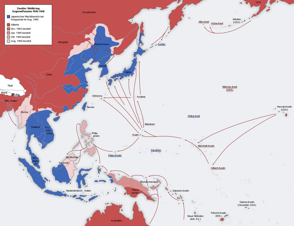
- Description: Second World War Asia 1943-1945, map German
- Source: Own map, based on the maps of the University of Texas Libraries
- Author: San Jose, 26. April 2005
Deutsch
[编辑]
- Beschreibung: Zweiter Weltkrieg Asien 1943-1945, Karte de
- Quelle: Eigene Karte, basierend auf den Karten der University of Texas Libraries
- Autor: San Jose, 26. April 2005
许可协议
[编辑]

|
已授权您依据自由软件基金会发行的无固定段落及封面封底文字(Invariant Sections, Front-Cover Texts, and Back-Cover Texts)的GNU自由文件许可协议1.2版或任意后续版本的条款,复制、传播和/或修改本文件。该协议的副本请见“GNU Free Documentation License”。 |
| 本文件采用知识共享署名-相同方式共享 3.0 未本地化版本许可协议授权。 | ||
| ||
| 本许可协议标签作为GFDL许可协议更新的组成部分被添加至本文件。 |
Other versions
[编辑]
A French version is available: Image:Second world war asia 1943-1945 map fr-1.png
文件历史
点击某个日期/时间查看对应时刻的文件。
| 日期/时间 | 缩略图 | 大小 | 用户 | 备注 | |
|---|---|---|---|---|---|
| 当前 | 2010年3月9日 (二) 20:39 | | 1,298 × 998(193 KB) | Ras67(留言 | 贡献) | cropped |
| 2005年8月21日 (日) 12:20 |  | 1,300 × 1,000(160 KB) | Rony(留言 | 贡献) |
您不可以覆盖此文件。
文件用途
以下4个页面使用本文件:
全域文件用途
以下其他wiki使用此文件:
- da.wikipedia.org上的用途
- de.wikipedia.org上的用途
- en.wikipedia.org上的用途
- he.wikipedia.org上的用途
- id.wikipedia.org上的用途
- it.wikipedia.org上的用途
- ja.wikipedia.org上的用途
- ms.wikipedia.org上的用途
- nds.wikipedia.org上的用途
- rm.wikipedia.org上的用途
- ru.wikipedia.org上的用途
- sq.wikipedia.org上的用途
- vi.wikipedia.org上的用途
- zh.wikipedia.org上的用途