File:Seine-et-Marne department location map.svg
跳至導覽
跳至搜尋

此 SVG 檔案的 PNG 預覽的大小:461 × 599 像素。 其他解析度:184 × 240 像素 | 369 × 480 像素 | 590 × 768 像素 | 787 × 1,024 像素 | 1,575 × 2,048 像素 | 1,225 × 1,593 像素。
原始檔案 (SVG 檔案,表面大小:1,225 × 1,593 像素,檔案大小:1,019 KB)
說明
說明
添加單行說明來描述出檔案所代表的內容
摘要[編輯]
| 拍攝地點 | | 位於此地的本圖片與其他圖片: OpenStreetMap |
|---|
| 描述 |
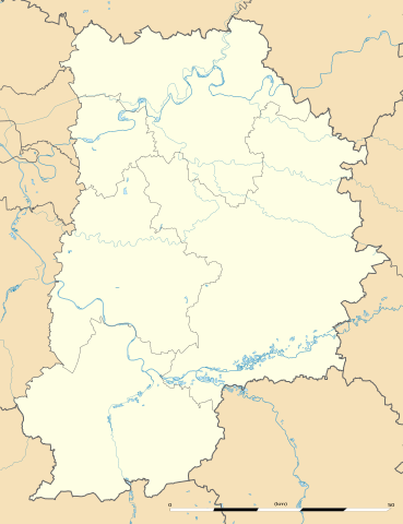
English: Blank administrative map of the department of the Seine-et-Marne, France, as in February 2015, for geo-location purpose, with distinct boundaries for regions, departments and arrondissements.
Français : Carte administrative vierge du département des Seine-et-Marne, France, tel qu'en février 2015, destinée à la géolocalisation, avec limite distincte des régions, départements et arrondissements. Estimated scale: 1:300,000 (precision: 75 m)
Geographic limits of the map:
|
||
| 日期 | |||
| 來源 |
自己的作品
|
||
| 作者 | Eric Gaba (Sting - fr:Sting) | ||
| 授權許可 (重用此檔案) |
|
||
| 其他版本 |
|

授權條款[編輯]
Eric Gaba, Wikimedia Commons user Sting,此作品的版權所有人,決定用以下授權條款發佈本作品:
此檔案採用共享創意 姓名標示-相同方式分享 3.0 未在地化版本授權條款。
姓名標示: Eric Gaba, Wikimedia Commons user Sting
- 您可以自由:
- 分享 – 複製、發佈和傳播本作品
- 重新修改 – 創作演繹作品
- 惟需遵照下列條件:
- 姓名標示 – 您必須指名出正確的製作者,和提供授權條款的連結,以及表示是否有對內容上做出變更。您可以用任何合理的方式來行動,但不得以任何方式表明授權條款是對您許可或是由您所使用。
- 相同方式分享 – 如果您利用本素材進行再混合、轉換或創作,您必須基於如同原先的相同或兼容的條款,來分布您的貢獻成品。
檔案歷史
點選日期/時間以檢視該時間的檔案版本。
| 日期/時間 | 縮圖 | 尺寸 | 用戶 | 備註 | |
|---|---|---|---|---|---|
| 目前 | 2015年2月10日 (二) 22:08 | | 1,225 × 1,593(1,019 KB) | Sting(對話 | 貢獻) | == {{int:filedesc}} == {{Location|48|36|45|N|02|58|30|E|scale:500000}} {{Information |Description={{en|Blank administrative map of the department of the Seine-et-Marne, France, as in February 2015, for geo-location purpose, with... |
無法覆蓋此檔案。
檔案用途
下列3個頁面有用到此檔案:
全域檔案使用狀況
以下其他 wiki 使用了這個檔案:
- als.wikipedia.org 的使用狀況
- de.wikipedia.org 的使用狀況
- eo.wikipedia.org 的使用狀況
- Torcy (Seine-et-Marne)
- Ozoir-la-Ferrière
- Dammarie-lès-Lys
- Champs-sur-Marne
- Flagy (Seine-et-Marne)
- Dormelles
- Combs-la-Ville
- Villemaréchal
- Rumont (Seine-et-Marne)
- Coulommiers
- Tournan-en-Brie
- Gretz-Armainvilliers
- Roissy-en-Brie
- Émerainville
- Villeparisis
- Cesson
- Boissise-le-Roi
- Saint-Fargeau-Ponthierry
- Nandy
- Savigny-le-Temple
- Moissy-Cramayel
- Lieusaint (Seine-et-Marne)
- Montereau-Fault-Yonne
- Trilport
- Pringy (Seine-et-Marne)
- Compans
- Thieux (Seine-et-Marne)
- Nantouillet
- Juilly (Seine-et-Marne)
- Saint-Mard (Seine-et-Marne)
- Thomery
- Saint-Mammès
- Moret-sur-Loing
- Veneux-les-Sablons
- Moret-Loing-et-Orvanne
- Montigny-sur-Loing
- Esbly
- Bois-le-Roi (Seine-et-Marne)
- Fontaine-le-Port
- Bourron-Marlotte
- Grez-sur-Loing
- Nemours
檢視此檔案的更多全域使用狀況。