File:Seto Inland Sea satellite.jpg
跳转到导航
跳转到搜索

本预览的尺寸:800 × 544像素。 其他分辨率:320 × 218像素 | 640 × 435像素 | 1,024 × 696像素。
原始文件 (1,024 × 696像素,文件大小:242 KB,MIME类型:image/jpeg)
说明
说明
添加一行文字以描述该文件所表现的内容
| 描述 |
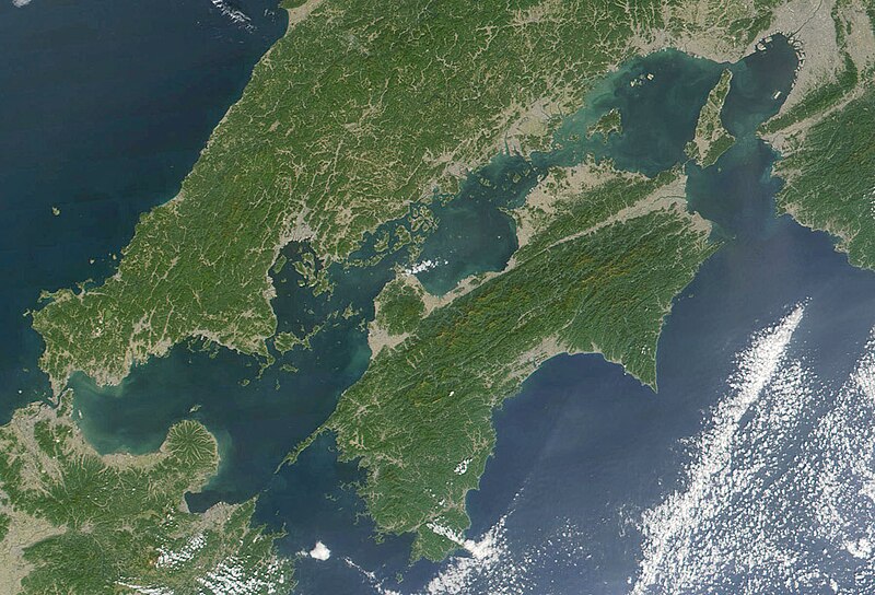
日本語: 瀬戸内海 Seto-naikai
Deutsch: Die Seto-Inlandsee ist ein Binnenmeer das die japanischen Inseln Honshū, Shikoku und Kyūshū voneinander trennt.
English: Formally named the Seto Inland Sea, the Inland Sea is the body of water separating Honshū, Shikoku, two of the main islands of Japan, and Kyūshū. |
| 日期 | |
| 来源 | Cropped from: http://visibleearth.nasa.gov/view_rec.php?id=2206 |
| 作者 | Jacques Descloitres, MODIS Land Rapid Response Team, NASA/GSFC |
| 本文件完全由NASA创作,在美国属于公有领域。根据NASA的版权方针,NASA的材料除非另有声明否则不受版权保护。(参见Template:PD-USGov/zh、NASA版权方针页面或JPL图片使用方针。) | ||
 |
警告:
|
文件历史
点击某个日期/时间查看对应时刻的文件。
| 日期/时间 | 缩略图 | 大小 | 用户 | 备注 | |
|---|---|---|---|---|---|
| 当前 | 2004年11月22日 (一) 21:21 | | 1,024 × 696(242 KB) | Tsui(留言 | 贡献) | Japan, the Seto inland-lake |
您不可以覆盖此文件。
文件用途
以下2个页面使用本文件:
全域文件用途
以下其他wiki使用此文件:
- en.wikipedia.org上的用途
- fr.wikipedia.org上的用途
- it.wikivoyage.org上的用途
- ja.wikipedia.org上的用途
- ja.wikibooks.org上的用途
- ko.wikipedia.org上的用途
- pl.wiktionary.org上的用途
- tr.wikipedia.org上的用途
- www.wikidata.org上的用途
- wuu.wikipedia.org上的用途
- zh-classical.wikipedia.org上的用途
- zh-min-nan.wikipedia.org上的用途
- zh.wikipedia.org上的用途