File:Shanghai commuter rail 2025.png
跳至導覽
跳至搜尋

預覽大小:528 × 599 像素。 其他解析度:211 × 240 像素 | 423 × 480 像素 | 677 × 768 像素 | 902 × 1,024 像素 | 1,804 × 2,048 像素 | 6,223 × 7,064 像素。
原始檔案 (6,223 × 7,064 像素,檔案大小:5.45 MB,MIME 類型:image/png)
說明
說明
添加單行說明來描述出檔案所代表的內容
摘要
[編輯]
| 描述 |
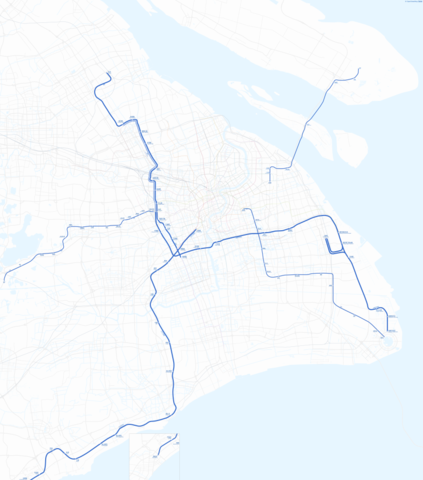
中文(中国大陆):上海市域轨道交通规划图(2025年) |
| 日期 | |
| 來源 | Openstreetmap+Own work |
| 作者 | QFA7301 |
授權條款
[編輯]
底图来源为OpenStreetMap及其贡献者。采用开放数据共享开放数据库许可协议(ODbL)授权。 版权信息详见:https://www.openstreetmap.org/copyright
| This work contains information from OpenStreetMap, which is made available under the Open Database License (ODbL).
The ODbL does not require any particular license for maps produced from ODbL data. Prior to 1 August 2020, map tiles produced by the OpenStreetMap Foundation were licensed under the CC-BY-SA-2.0 license. Maps produced by other people may be subject to other licences. |
此檔案採用共享創意 姓名標示-相同方式分享 2.0 通用版授權條款。
- 您可以自由:
- 分享 – 複製、發佈和傳播本作品
- 重新修改 – 創作演繹作品
- 惟需遵照下列條件:
- 姓名標示 – 您必須指名出正確的製作者,和提供授權條款的連結,以及表示是否有對內容上做出變更。您可以用任何合理的方式來行動,但不得以任何方式表明授權條款是對您許可或是由您所使用。
- 相同方式分享 – 如果您利用本素材進行再混合、轉換或創作,您必須基於如同原先的相同或兼容的條款,來分布您的貢獻成品。
檔案歷史
點選日期/時間以檢視該時間的檔案版本。
| 日期/時間 | 縮圖 | 尺寸 | 用戶 | 備註 | |
|---|---|---|---|---|---|
| 目前 | 2021年4月30日 (五) 08:27 | | 6,223 × 7,064(5.45 MB) | Renamed user 074e0147cdc(對話 | 貢獻) | 两港快线 |
| 2021年4月24日 (六) 07:23 |  | 6,257 × 7,064(5.44 MB) | Renamed user 074e0147cdc(對話 | 貢獻) | 重画 | |
| 2021年1月5日 (二) 16:49 |  | 4,600 × 3,933(922 KB) | Renamed user 074e0147cdc(對話 | 貢獻) | 风格简约一点 | |
| 2020年12月26日 (六) 18:44 |  | 4,600 × 3,933(971 KB) | Renamed user 074e0147cdc(對話 | 貢獻) | 总体调整,并增加两港和沪平 | |
| 2020年11月15日 (日) 10:21 |  | 4,600 × 3,933(945 KB) | Renamed user 074e0147cdc(對話 | 貢獻) | 直通运行。新成路站少了。 | |
| 2020年11月14日 (六) 07:01 |  | 4,600 × 3,933(873 KB) | Renamed user 074e0147cdc(對話 | 貢獻) | 嘉闵线。申通式站名。 | |
| 2019年4月13日 (六) 15:39 |  | 4,600 × 3,933(800 KB) | Renamed user 074e0147cdc(對話 | 貢獻) | update | |
| 2019年1月11日 (五) 18:20 |  | 4,600 × 3,933(925 KB) | Renamed user 074e0147cdc(對話 | 貢獻) | 春申站。 | |
| 2019年1月6日 (日) 08:49 |  | 4,600 × 3,942(1,019 KB) | Renamed user 074e0147cdc(對話 | 貢獻) | 修正英文站名 | |
| 2019年1月6日 (日) 06:23 |  | 4,600 × 3,942(1.01 MB) | Renamed user 074e0147cdc(對話 | 貢獻) | User created page with UploadWizard |
無法覆蓋此檔案。
檔案用途
下列10個頁面有用到此檔案:
- User:Chumwa/OgreBot/Potential transport maps/2019 April 11-20
- User:Chumwa/OgreBot/Public transport information/2019 April 11-20
- User:Chumwa/OgreBot/Public transport information/2020 December 21-31
- User:Chumwa/OgreBot/Public transport information/2020 November 11-20
- User:Chumwa/OgreBot/Public transport information/2021 January 1-10
- User:Chumwa/OgreBot/Transport Maps/2019 April 11-20
- User:Chumwa/OgreBot/Transport Maps/2020 December 21-31
- User:Chumwa/OgreBot/Transport Maps/2020 November 11-20
- User:Chumwa/OgreBot/Transport Maps/2021 January 1-10
- User:Chumwa/OgreBot/Travel and communication maps/2019 April 11-20
全域檔案使用狀況
以下其他 wiki 使用了這個檔案:
- fr.wikipedia.org 的使用狀況
- www.wikidata.org 的使用狀況