File:Socotra satview.jpg
Spring til navigation
Spring til søgning
Størrelse af denne forhåndsvisning: 800 × 593 pixels. Andre opløsninger: 320 × 237 pixels | 640 × 474 pixels | 1.024 × 758 pixels | 1.280 × 948 pixels.
Oprindelig fil (1.280 × 948 billedpunkter, filstørrelse: 159 KB, MIME-type: image/jpeg)
Captions
Captions
Tilføj en kort forklaring på en enkelt linje om hvad filen viser
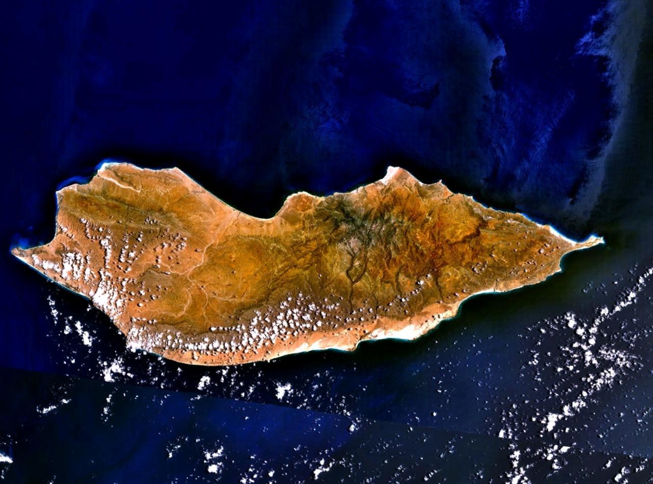
Socotra Island, Yemen
Beskrivelse
[redigér]
Satellite image over Socotra Island (سُقُطْرَى ; Suquṭra), made using NASA World Wind using Landsat imagery.
Licensering
[redigér]
| This image is in the public domain because it is a screenshot from NASA’s globe software World Wind using a public domain layer, such as Blue Marble, MODIS, Landsat, SRTM, USGS or GLOBE.
|
 |
Oprindelig oplægningslog
[redigér]
All following user names refer to en.wikipedia.
- 2005-07-15 18:16 Finlay McWalter 1280×948×8 (163257 bytes) Satellite image of [[Socotra]], made using [[NASA World Wind]] using [[Landsat]] imagery. {{PD-USGov-NASA}}
| Annotations | This image is annotated: View the annotations at Commons |
Filhistorik
Klik på en dato/tid for at se filen som den så ud på det tidspunkt.
| Dato/tid | Miniaturebillede | Dimensioner | Bruger | Kommentar | |
|---|---|---|---|---|---|
| nuværende | 7. jan. 2007, 16:16 | | 1.280 × 948 (159 KB) | EskoG-67 (diskussion | bidrag) | {{Information |Description= Satellite image over Socotra island |Source=NASA Landsat |Date= 7.1.2007 |Author= |Permission= |other_versions= }} |
Du kan ikke overskrive denne fil.
Filanvendelse
De følgende 4 sider bruger denne fil:
Global filanvendelse
Følgende andre wikier anvender denne fil:
- Anvendelser på af.wikipedia.org
- Anvendelser på ar.wikipedia.org
- Anvendelser på ast.wikipedia.org
- Anvendelser på az.wikipedia.org
- Anvendelser på be-tarask.wikipedia.org
- Anvendelser på be.wikipedia.org
- Anvendelser på bg.wikipedia.org
- Anvendelser på bn.wikipedia.org
- Anvendelser på ca.wikipedia.org
- Anvendelser på cs.wikipedia.org
- Anvendelser på cv.wikipedia.org
- Anvendelser på cy.wikipedia.org
- Anvendelser på da.wikipedia.org
- Anvendelser på de.wikipedia.org
- Anvendelser på diq.wikipedia.org
- Anvendelser på el.wikipedia.org
- Anvendelser på en.wikipedia.org
- Anvendelser på eo.wikipedia.org
- Anvendelser på es.wikipedia.org
- Anvendelser på et.wikipedia.org
- Anvendelser på eu.wikipedia.org
- Anvendelser på fa.wikipedia.org
- Anvendelser på fi.wikipedia.org
- Anvendelser på fr.wikipedia.org
Vis flere globale anvendelser af denne fil.