File:Solomon islands.jpg
跳转到导航
跳转到搜索
本预览的尺寸:738 × 600像素。 其他分辨率:295 × 240像素 | 591 × 480像素 | 769 × 625像素。
原始文件 (769 × 625像素,文件大小:122 KB,MIME类型:image/jpeg)
说明
说明
添加一行文字以描述该文件所表现的内容
摘要
[编辑]
| 描述 |
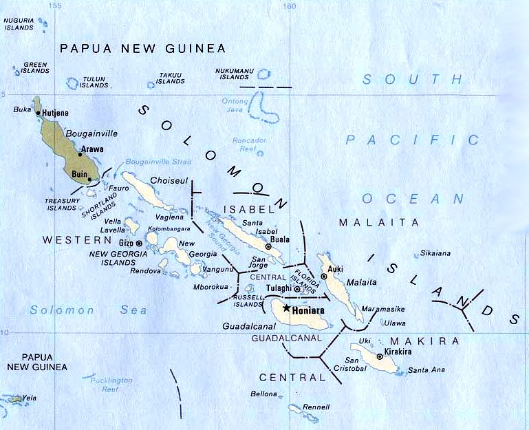
English: Locator map of the Autonomous Region of Bougainville (shaded brown) — in eastern Papua New Guinea
Deutsch: Bougainville in den Salomonen.
|
| 日期 | |
| 来源 | Bibliothek der Uni-Texas (Austin), U.S. Central Intelligence Agency |
| 作者 | U.S. Central Intelligence Agency |
许可协议
[编辑]
此作品在美国属于公有领域,因为其是由美国政府的官员或雇员,基于其个人公务目的制作的作品,参考美国法典第17篇第1章第105条。
注意︰本模板仅适用于美国联邦政府的原创作品,不适用于任何美国州、属地、联邦个体、县、市或任何次级政府的作品。本模板也不适用于1978年以后由美国邮政署出版的邮票图案(参看美国版权局实践纲领第313.6(C)(1)条)。也不适用于部分美国硬币;参看美国铸币局使用条款。 |
 | |
| 本文件已被确认为免除已知的著作权法限制(包括所有相关权利)。 | ||
原始上传日志
[编辑]
The original description page was here. All following user names refer to de.wikipedia.
- 2004-07-28 09:52 W.wolny 769×625× (124954 bytes)
文件历史
点击某个日期/时间查看对应时刻的文件。
| 日期/时间 | 缩略图 | 大小 | 用户 | 备注 | |
|---|---|---|---|---|---|
| 当前 | 2011年9月5日 (一) 02:08 | | 769 × 625(122 KB) | File Upload Bot (Magnus Manske)(留言 | 贡献) | {{BotMoveToCommons|de.wikipedia|year={{subst:CURRENTYEAR}}|month={{subst:CURRENTMONTHNAME}}|day={{subst:CURRENTDAY}}}} {{Information |Description={{de|Bougainville in den Salomonen}} |Source=Transferred from [http://de.wikipedia.org de.wikipedia]; transf |
您不可以覆盖此文件。
文件用途
以下页面使用本文件:
全域文件用途
以下其他wiki使用此文件:
- als.wikipedia.org上的用途
- ceb.wikipedia.org上的用途
- de.wikipedia.org上的用途
- dsb.wikipedia.org上的用途
- frr.wikipedia.org上的用途
- gl.wikipedia.org上的用途
- hsb.wikipedia.org上的用途
- ka.wikipedia.org上的用途
- ru.wikipedia.org上的用途
- www.wikidata.org上的用途
- xmf.wikipedia.org上的用途
- zh.wikipedia.org上的用途
查看此文件的更多全域用途。