File:South Africa Free State relief location map.svg
Pāriet uz navigāciju
Pāriet uz meklēšanu

Size of this PNG preview of this SVG file: 672 × 599 pikseļi. Citi izmēri: 269 × 240 pikseļi | 538 × 480 pikseļi | 861 × 768 pikseļi | 1 148 × 1 024 pikseļi | 2 296 × 2 048 pikseļi | 1 130 × 1 008 pikseļi.
Sākotnējais fails (SVG fails, definētais izmērs 1 130 × 1 008 pikseļi, faila izmērs: 2,24 MB)
Captions
Captions
Pievieno vienas rindiņas aprakstu, ko šis fails attēlo
| Apraksts |
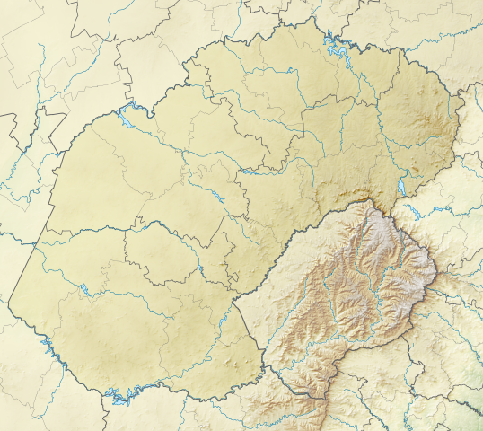
English: Relief location map of the Free State
Equirectangular projection, N/S stretching 114%. Geographic limits of the map:
|
| Datums | |
| Avots | |
| Autors | Htonl |
| Atļauja: (Šī faila izmantošana citur) |
Es, šī darba autortiesību īpašnieks, publicēju to saskaņā ar šo licenci: Šis fails tiek izplatīts saskaņā ar licences Creative Commons Atsauce-Līdzīgi Noteikumi 3.0 Vispārējiem noteikumiem.
|
| Citas versijas | File:South Africa Free State location map.svg |
Faila hronoloģija
Uzklikšķini uz datums/laiks kolonnā esošās saites, lai apskatītos, kā šis fails izskatījās tad.
| Datums/Laiks | Attēls | Izmēri | Dalībnieks | Komentārs | |
|---|---|---|---|---|---|
| tagadējais | 2013. gada 5. janvāris, plkst. 23.58 | | 1 130 × 1 008 (2,24 MB) | Htonl (diskusija | devums) | {{Information |Description ={{en|1=Relief location map of the Free State Equirectangular projection, N/S stretching 114%. Geographic limits of the map: * N: 26.5° S * S: 31° S * W: 24.25° E * E: 30° E}} |Source ... |
Šo failu nevar pārrakstīt.
Faila lietojums
Šo failu neizmanto nevienā lapā.
Globālais faila lietojums
Šīs Vikipēdijas izmanto šo failu:
- Izmantojums ar.wikipedia.org
- Izmantojums bg.wikipedia.org
- Izmantojums ceb.wikipedia.org
- Izmantojums de.wikipedia.org
- Izmantojums en.wikipedia.org
- Phuthaditjhaba
- 1 Special Service Battalion
- Golden Gate Highlands National Park
- Caledon Nature Reserve
- Sandveld Nature Reserve
- Koppies Dam Nature Reserve
- Koppies Dam
- Module:Location map/data/South Africa Free State/doc
- Willem Pretorius Game Reserve
- Kroonstad Airport
- Module:Location map/data/South Africa Free State
- Schoeman Park Open
- 2022 Jagersfontein dam collapse
- Izmantojums eo.wikipedia.org
- Izmantojums es.wikipedia.org
- Izmantojums frr.wikipedia.org
- Izmantojums fr.wikipedia.org
- Izmantojums he.wikipedia.org
- Izmantojums ja.wikipedia.org
- Izmantojums kn.wikipedia.org
- Izmantojums lv.wikipedia.org
- Izmantojums os.wikipedia.org
- Izmantojums pl.wikipedia.org
- Izmantojums pl.wikibooks.org
- Izmantojums ru.wikipedia.org
- Izmantojums si.wikipedia.org
Skatīt šī faila pilno globālo izmantojumu.