File:South Asia non political, with rivers.jpg
ナビゲーションに移動
検索に移動

このプレビューのサイズ: 648 × 600 ピクセル。 その他の解像度: 259 × 240 ピクセル | 519 × 480 ピクセル | 830 × 768 ピクセル | 1,106 × 1,024 ピクセル | 2,324 × 2,151 ピクセル。
元のファイル (2,324 × 2,151 ピクセル、ファイルサイズ: 5.15メガバイト、MIME タイプ: image/jpeg)
キャプション
キャプション
このファイルの内容を1行で記述してください
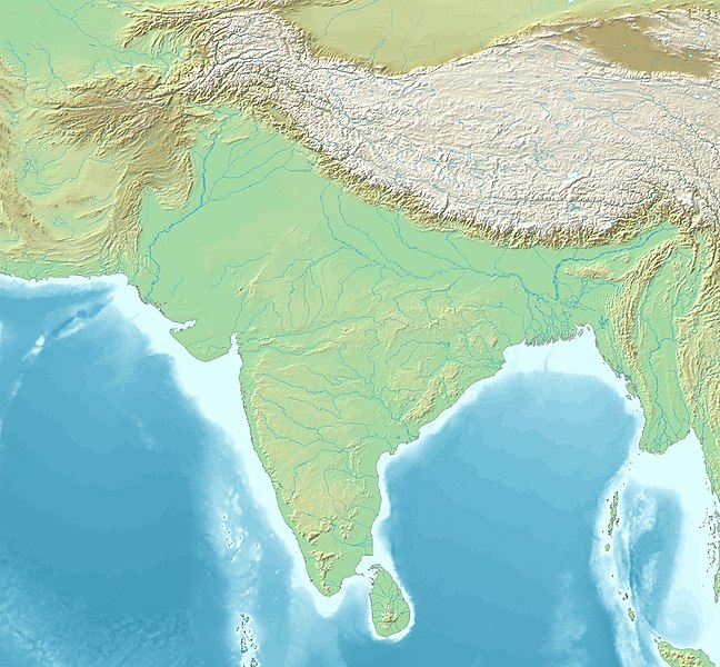
South Asia
概要[編集]
Topographic map 90deg, North latitude: 0 - 90, East longitude: 60 - 150[編集]
Topographic map 90deg, North latitude: 0 - 90, East longitude: 60 - 150
|
| ||||||||||||||||||||||||


Map created from DEMIS Mapserver[dead link], which are public domain. Koba-chan
| 解説 |
English: South Asia non political, with rivers |
| 日付 | |
| 原典 | Map created from DEMIS Mapserver, which are public domain. |
| 作者 | DEMIS Mapserver, पाटलिपुत्र (トーク) |
ライセンス[編集]

|
この文書は、フリーソフトウェア財団発行のGNUフリー文書利用許諾書 (GNU Free Documentation License) 1.2またはそれ以降のバージョンの規約に基づき、複製や再配布、改変が許可されます。不可変更部分、表紙、背表紙はありません。このライセンスの複製は、GNUフリー文書利用許諾書という章に含まれています。 |
| このファイルはクリエイティブ・コモンズ 表示-継承 3.0 非移植ライセンスのもとに利用を許諾されています。 | ||
| ||
| このライセンスのテンプレートは、GFDLのライセンス・アップデートによりこのファイルに追加されたものです。 |
ファイルの履歴
過去の版のファイルを表示するには、その版の日時をクリックしてください。
| 日付と時刻 | サムネイル | 寸法 | 利用者 | コメント | |
|---|---|---|---|---|---|
| 現在の版 | 2023年2月11日 (土) 15:40 | | 2,324 × 2,151 (5.15メガバイト) | पाटलिपुत्र (トーク | 投稿記録) | Saturation -10% |
| 2023年2月11日 (土) 15:33 |  | 2,324 × 2,151 (5.12メガバイト) | पाटलिपुत्र (トーク | 投稿記録) | Reverted to version as of 13:45, 31 January 2023 (UTC) | |
| 2023年2月11日 (土) 15:32 |  | 2,324 × 2,151 (5.29メガバイト) | पाटलिपुत्र (トーク | 投稿記録) | colors | |
| 2023年2月11日 (土) 15:16 |  | 2,324 × 2,151 (5.31メガバイト) | पाटलिपुत्र (トーク | 投稿記録) | tweak | |
| 2023年2月11日 (土) 15:13 |  | 2,324 × 2,151 (5.03メガバイト) | पाटलिपुत्र (トーク | 投稿記録) | drab | |
| 2023年1月31日 (火) 13:45 |  | 2,324 × 2,151 (5.12メガバイト) | पाटलिपुत्र (トーク | 投稿記録) | Reverted to version as of 08:23, 6 February 2020 (UTC) | |
| 2023年1月31日 (火) 13:37 |  | 2,324 × 2,151 (6.33メガバイト) | पाटलिपुत्र (トーク | 投稿記録) | colors | |
| 2023年1月31日 (火) 13:27 |  | 2,324 × 2,151 (5.93メガバイト) | पाटलिपुत्र (トーク | 投稿記録) | light | |
| 2023年1月31日 (火) 13:24 |  | 2,324 × 2,151 (5.93メガバイト) | पाटलिपुत्र (トーク | 投稿記録) | contrast | |
| 2023年1月31日 (火) 10:55 |  | 2,324 × 2,151 (5.82メガバイト) | पाटलिपुत्र (トーク | 投稿記録) | Reverted to version as of 10:18, 31 January 2023 (UTC) |
このファイルは上書きできません。
ファイルの使用状況
以下の 58 ページがこのファイルを使用しています:
- User talk:Avantiputra7
- File:Adil Shahis.png
- File:Bengal Basin.svg
- File:Hussain Shahis of Bengal.png
- File:Karkota Empire map.jpg
- File:Khaljis of Malwa.png
- File:Map of Paradan.png
- File:Map of Sind and Shri coinage circa 425 CE.png
- File:Map of Sindh (Rais).png
- File:Map of Sogdia.jpg
- File:Map of the Bahmani Sultanate.png
- File:Map of the Cahamanas.png
- File:Map of the Caliphal Province of Sind.png
- File:Map of the Candellas.png
- File:Map of the Chachas circa 650 CE.png
- File:Map of the Chalukyas.png
- File:Map of the Chaulukyas.png
- File:Map of the Early Kalachuris.png
- File:Map of the Eastern Gangas.png
- File:Map of the Gahadavalas.png
- File:Map of the Ghaznavid Empire.png
- File:Map of the Gupta Empire.png
- File:Map of the Gurjara-Pratiharas (circa 800-950 CE).png
- File:Map of the Habbarid Emirate.png
- File:Map of the Habbarid and Multan Emirates.png
- File:Map of the Hindu Shahis.png
- File:Map of the Hindu Shahis (Hindu Kush).png
- File:Map of the Indo-Greeks.png
- File:Map of the Indo-Parthians.png
- File:Map of the Indo-Scythians.png
- File:Map of the Kakatiyas.png
- File:Map of the Khaljis of Bengal.png
- File:Map of the Kushan Empire.png
- File:Map of the Langah Sultanate circa 1475 CE.png
- File:Map of the Later Guptas.jpg
- File:Map of the Later Kalacuris.png
- File:Map of the Lodi Sultanate.png
- File:Map of the Maha-Meghavahanas.png
- File:Map of the Maukharis.png
- File:Map of the Multan Emirate.png
- File:Map of the Northern Satraps (Northern Sakas).jpg
- File:Map of the Pala Empire.png
- File:Map of the Paramaras.png
- File:Map of the Pushyabhutis.png
- File:Map of the Rashtrakuta Empire.png
- File:Map of the Satavahanas.png
- File:Map of the Senas.png
- File:Map of the Shashankas.png
- File:Map of the Shungas.png
- File:Map of the Southern Hunas (territory).png
- File:Map of the Sur Empire.png
- File:Map of the Vakatakas.png
- File:Map of the Varmans.png
- File:Map of the Western Satraps.png
- File:Map of the Yadavas.png
- File:Maurya Empire diagram of networks.png
- File:Maurya Empire map of possible boundaries.png
- File:Sangamas of the Vijayanagara Empire.png
.png)
.png)
.png)
.jpg)
.png)
グローバルなファイル使用状況
以下に挙げる他のウィキがこの画像を使っています:
- ar.wikipedia.org での使用状況
- ban.wikipedia.org での使用状況
- bh.wikipedia.org での使用状況
- bn.wikipedia.org での使用状況
- কুয়াকাটা
- পাল সাম্রাজ্য
- শাহ আমানত আন্তর্জাতিক বিমানবন্দর
- মডিউল:অবস্থান মানচিত্র/উপাত্ত/দক্ষিণ এশিয়া
- মডিউল:অবস্থান মানচিত্র/উপাত্ত/দক্ষিণ এশিয়া/নথি
- কুমহালি ভাষা
- রক্তমৃত্তিকা মহাবিহার
- ২০২৪ সাফ ক্লাব চ্যাম্পিয়নশিপ
- কার্কোট রাজবংশ
- টেমপ্লেট:৮০০ খ্রিস্টাব্দে ভারতীয় উপমহাদেশ
- অহিচ্ছত্র
- শ্রীলঙ্কার কেন্দ্রীয় উচ্চভূমি
- খায়ের খানহ্
- অশোকের শিলালিপি
- টেমপ্লেট:Map of the Edicts of Ashoka
- de.wikipedia.org での使用状況
- en.wikipedia.org での使用状況
- Ashoka
- Harappa
- Kandahar
- Makran
- Mehrgarh
- Rajasthan
- Hoysala Kingdom
- Mohenjo-daro
- Gondwana (India)
- Lothal
- Menander I
- Tiruchirappalli
- Nalanda mahavihara
- Gupta Empire
- Samudragupta
- Sanchi
- First Battle of Panipat
- Middle kingdoms of India
- Delhi Sultanate
- Kandy
- Hephthalites
- Rawalpindi
- Kushan Empire
- Licchavis of Nepal
- Palk Strait
このファイルのグローバル使用状況を表示する。