File:Strelley Pool formation.jpg
Salta a la navegació
Salta a la cerca

Mida d'aquesta previsualització: 600 × 600 píxels. Altres resolucions: 240 × 240 píxels | 480 × 480 píxels | 768 × 768 píxels | 1.024 × 1.024 píxels | 2.048 × 2.048 píxels | 5.412 × 5.412 píxels.
Fitxer original (5.412 × 5.412 píxels, mida del fitxer: 4,88 Mo, tipus MIME: image/jpeg)
Llegendes
Llegendes
Afegeix una explicació d'una línia del que representa aquest fitxer
Resum[modifica]
| Descripció |
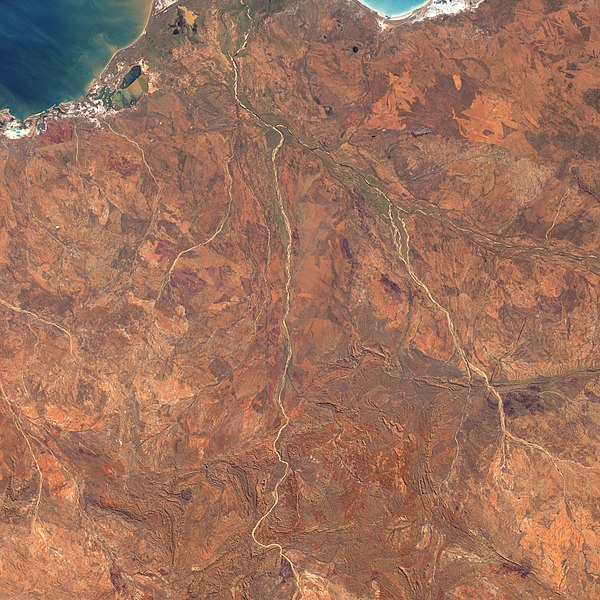
English: This picture is a composite of images acquired by the Landsat-7 satellite on May 19, 2000 (in the north), and June 23, 2001 (in the south). The Shaw River channel runs through the middle of the image. The Strelley Pool Chert rock formation appears near the bottom of the image, on the east side of the river. |
| Data | i 2001 |
| Font | NASA Earth Observatory |
| Autor | NASA |
Llicència[modifica]
| Aquest fitxer és en el domini públic perquè ha estat creat per la NASA. L'avís legal de la NASA diu que «el material de la NASA no està protegit per copyright si no es diu el contrari». (NASA copyright policy page o JPL Image Use Policy). | ||
 |
Atenció:
|
Historial del fitxer
Cliqueu una data/hora per veure el fitxer tal com era aleshores.
| Data/hora | Miniatura | Dimensions | Usuari/a | Comentari | |
|---|---|---|---|---|---|
| actual | 12:15, 28 jul 2020 | | 5.412 × 5.412 (4,88 Mo) | Leptictidium (discussió | contribucions) | {{Information |description= This picture is a composite of images acquired by the Landsat-7 satellite on May 19, 2000 (in the north), and June 23, 2001 (in the south). The Shaw River channel runs through the middle of the image. The Strelley Pool Chert rock formation appears near the bottom of the image, on the east side of the river. |date= 2000 and 2001 |source= [https://earthobservatory.nasa.gov/images/6664/strelley-pool-chert-and-early-life NASA Earth Observatory] |author= NASA |permissio... |
No podeu sobreescriure aquest fitxer.
Ús del fitxer
No hi ha pàgines que utilitzin aquest fitxer.
Ús global del fitxer
Utilització d'aquest fitxer en altres wikis:
- Utilització a ca.wikipedia.org
- Utilització a www.wikidata.org