File:SubsidedRoad.jpg
跳转到导航
跳转到搜索

本预览的尺寸:800 × 525像素。 其他分辨率:320 × 210像素 | 640 × 420像素 | 948 × 622像素。
原始文件 (948 × 622像素,文件大小:132 KB,MIME类型:image/jpeg)
说明
说明
添加一行文字以描述该文件所表现的内容
摘要
[编辑]
| 相机位置 | | 在以下服务上查看本图像和附近其他图像: OpenStreetMap |
|---|
| 描述 |
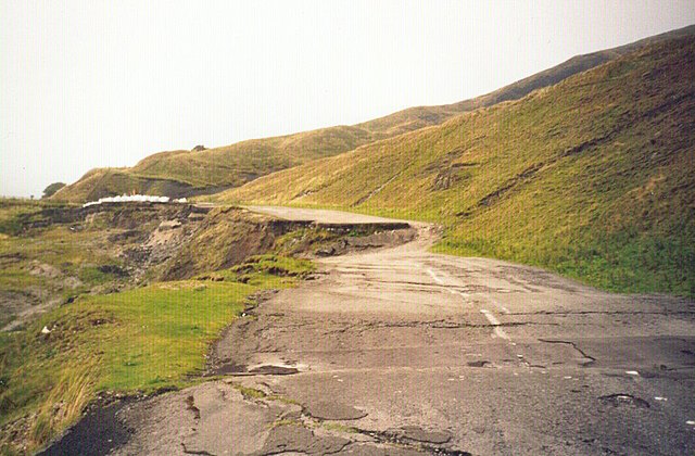
English: A section of the A6187 road, near Castleton, UK, destroyed by geological subsidence. Now permanently closed.
See en:Mam Tor, en:A625 road. See the plaque erected by the council for an explanation |
| 日期 | 2005年2月15日 (原始上传日期) |
| 来源 | Transferred from en.wikipedia to Commons. |
| 作者 | 英语维基百科的AJB83 |
许可协议
[编辑]
| 本作品已被作者英语维基百科的AJB83释出到公有领域。这适用于全世界。 在一些国家这可能不合法;如果是这样的话,那么: AJB83无条件地授予任何人以任何目的使用本作品的权利,除非这些条件是法律规定所必需的。 |
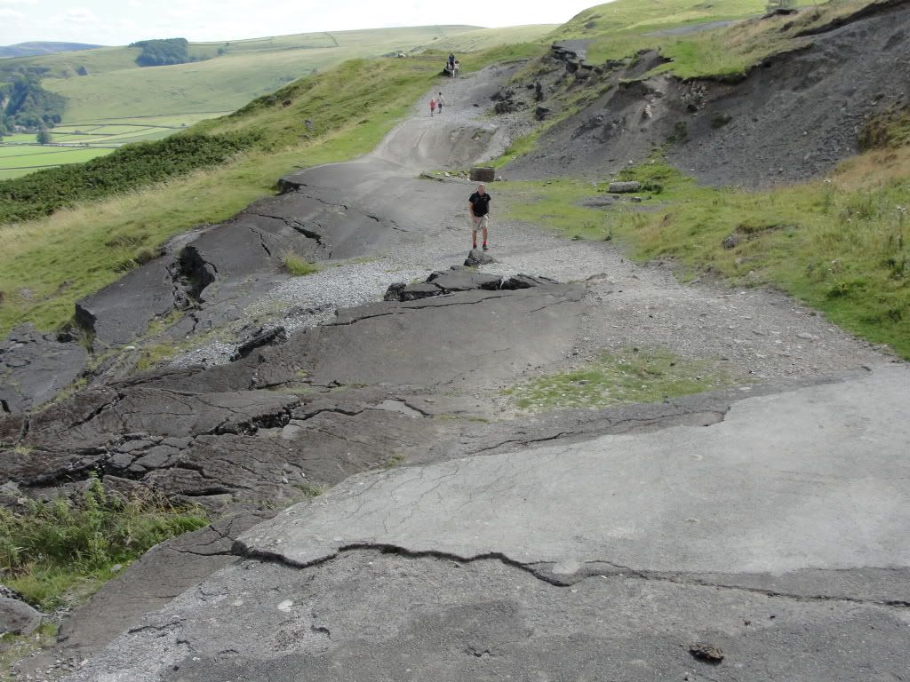
[IMG]http://i876.photobucket.com/albums/ab324/muffinthemule/DSC02140.jpg[/IMG] the road today 24-8-11
原始上传日志
[编辑]
The original description page was here. All following user names refer to en.wikipedia.
- 2005-02-15 22:09 AJB83 948×622×8 (134991 bytes) {{PD-user|AJB83}} A section of the A6187, near Castleton, UK, destroyed by geological subsidence. Now permanently closed.
文件历史
点击某个日期/时间查看对应时刻的文件。
| 日期/时间 | 缩略图 | 大小 | 用户 | 备注 | |
|---|---|---|---|---|---|
| 当前 | 2007年8月16日 (四) 10:27 | | 948 × 622(132 KB) | Woudloper(留言 | 贡献) | {{Information |Description=A section of the en:A6187 road, near Castleton, UK, destroyed by geological subsidence. Now permanently closed. See en:Mam Tor, en:A625 road. See the [http://www.pberry.plus.com/ukroads/road_trips/mam_tor/plaque |
您不可以覆盖此文件。
文件用途
全域文件用途
以下其他wiki使用此文件:
- ar.wikipedia.org上的用途
- ca.wikipedia.org上的用途
- cs.wikipedia.org上的用途
- de.wikipedia.org上的用途
- en.wikipedia.org上的用途
- fr.wikipedia.org上的用途
- gl.wikipedia.org上的用途
- he.wikipedia.org上的用途
- it.wikipedia.org上的用途
- ms.wikipedia.org上的用途
- nl.wikipedia.org上的用途
- pt.wikipedia.org上的用途
- ro.wikipedia.org上的用途
- simple.wikipedia.org上的用途
- sl.wikipedia.org上的用途
- ta.wikipedia.org上的用途
- uk.wikipedia.org上的用途
- zh.wikipedia.org上的用途