File:TC Dina 23 jan 2002 0640Z.jpg
跳至導覽
跳至搜尋

預覽大小:452 × 600 像素。 其他解析度:181 × 240 像素 | 362 × 480 像素 | 579 × 768 像素 | 772 × 1,024 像素 | 1,544 × 2,048 像素 | 6,000 × 7,960 像素。
原始檔案 (6,000 × 7,960 像素,檔案大小:7.01 MB,MIME 類型:image/jpeg)
說明
說明
添加單行說明來描述出檔案所代表的內容
摘要
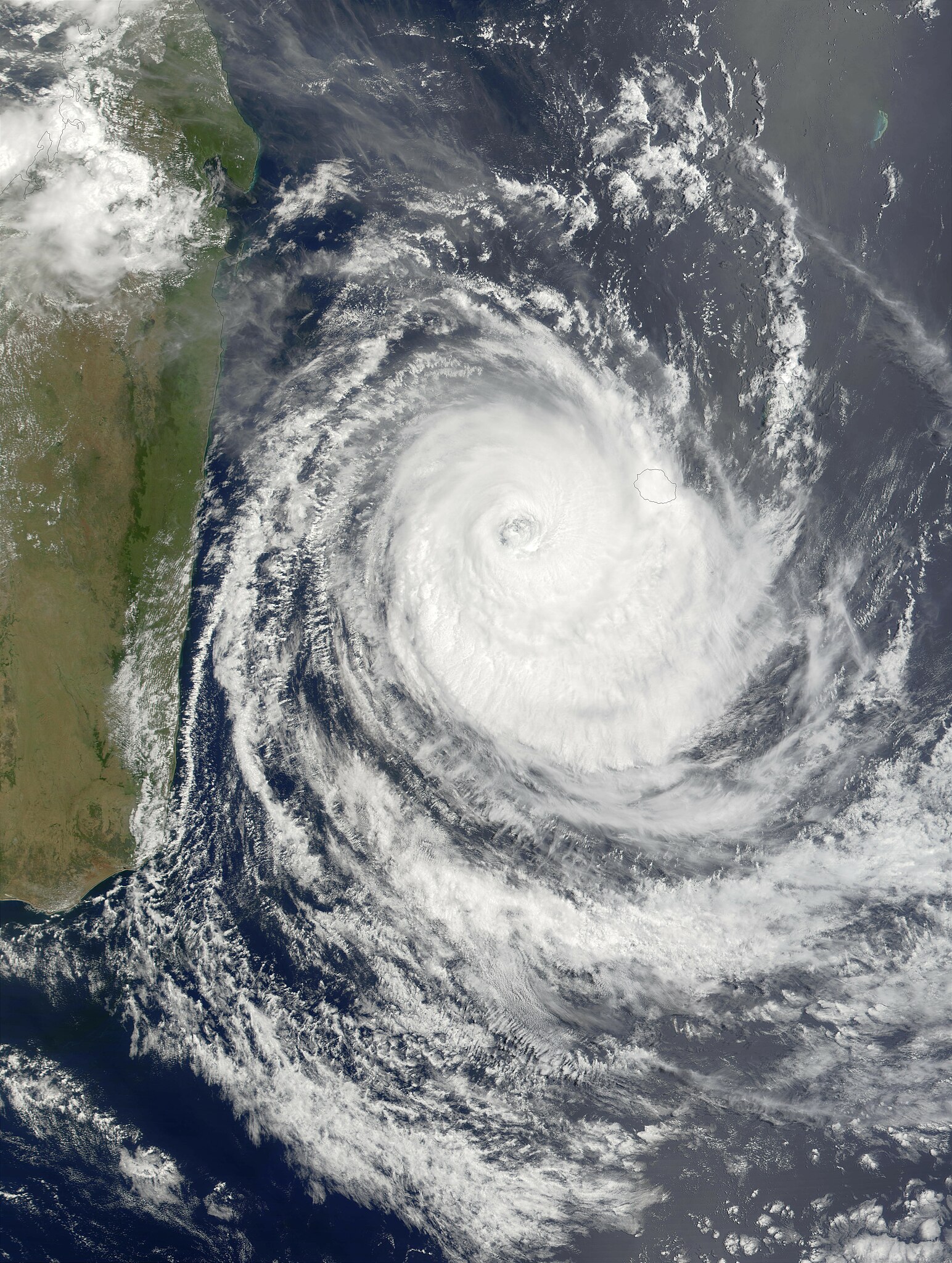
[編輯]| 描述 | Maximum sustained winds in Cyclone Dina had dropped to about 130 miles per hour as of Wednesday morning, January 23, 2002, and were predicted to continue dropping as the storm pursued a west-southwestward track that will likely shift more toward the south, keeping the center of the storm away from the island of Madagascar. In this true-color MODIS image made from data acquired on the morning of January 23, the storm had cleared Mauritius (eastern-most island) but was still covering Riunion. The outer bands of clouds were skirting the southeast coast of Madagascar. | |||||
| 日期 | ||||||
| 來源 | http://visibleearth.nasa.gov/view_rec.php?id=2402 | |||||
| 作者 | Jacques Descloitres, MODIS Land Rapid Response Team, NASA/GSFC | |||||
| 授權許可 (重用此檔案) |
|

檔案歷史
點選日期/時間以檢視該時間的檔案版本。
| 日期/時間 | 縮圖 | 尺寸 | 用戶 | 備註 | |
|---|---|---|---|---|---|
| 目前 | 2006年12月3日 (日) 20:18 | | 6,000 × 7,960(7.01 MB) | Good kitty(對話 | 貢獻) | == Summary == {{Information |Description=Maximum sustained winds in Cyclone Dina had dropped to about 130 miles per hour as of Wednesday morning, January 23, 2002, and were predicted to continue dropping as the storm pursued a west-southwestward track tha |
無法覆蓋此檔案。
檔案用途
沒有使用此檔案的頁面。
全域檔案使用狀況
以下其他 wiki 使用了這個檔案:
- en.wikipedia.org 的使用狀況
- zh.wikipedia.org 的使用狀況