File:TL 09U 2020-03-11 0620Z.jpg
跳转到导航
跳转到搜索
本预览的尺寸:449 × 599像素。 其他分辨率:180 × 240像素 | 360 × 480像素 | 576 × 768像素 | 767 × 1,024像素 | 1,535 × 2,048像素 | 3,430 × 4,576像素。
原始文件 (3,430 × 4,576像素,文件大小:2.63 MB,MIME类型:image/jpeg)
说明
说明
添加一行文字以描述该文件所表现的内容
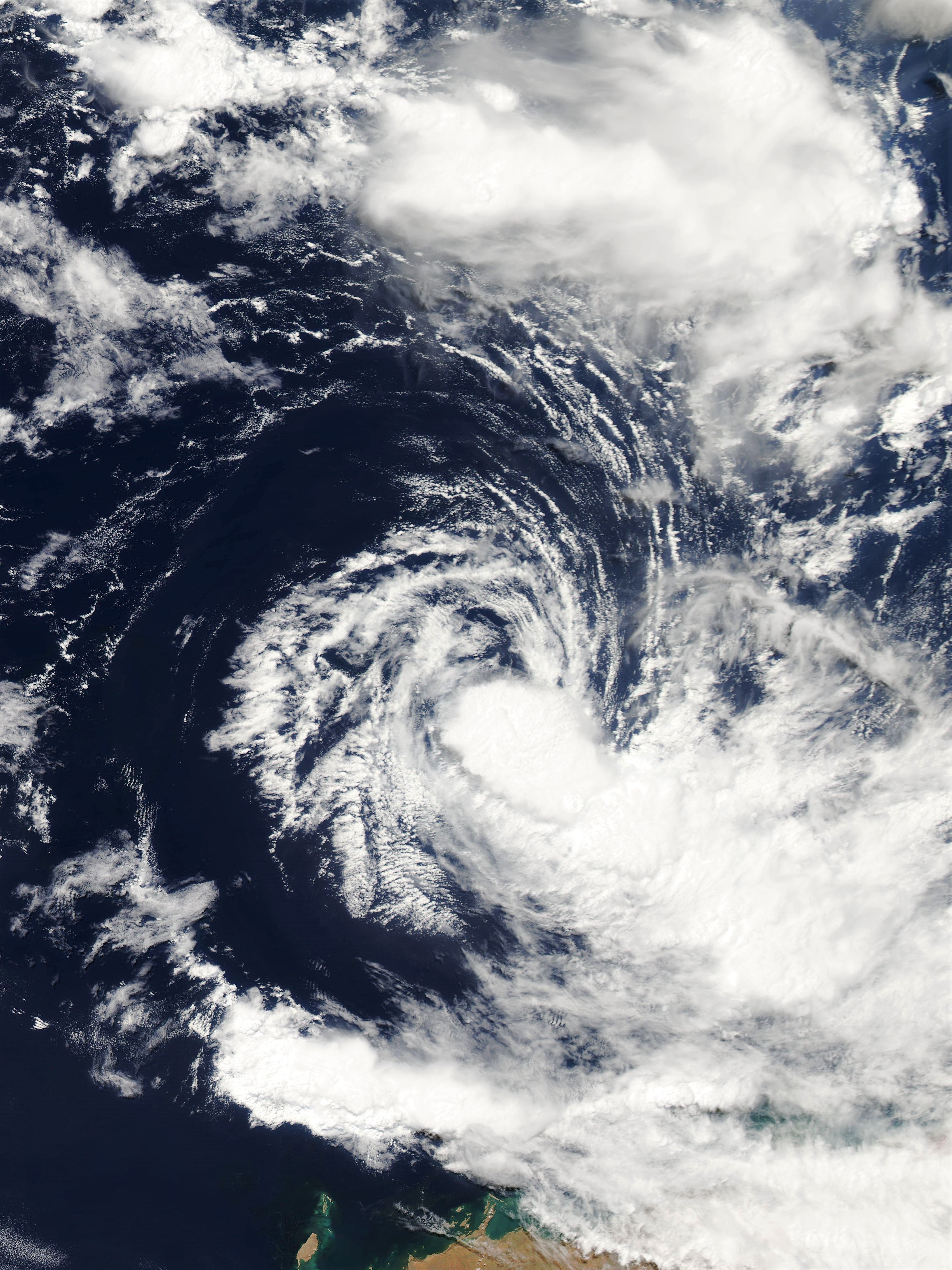
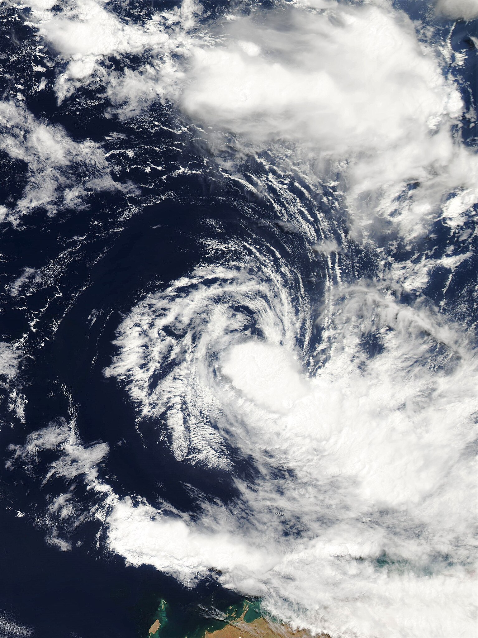
Tropical low 09U located off the coast of Western Australia on 11 March 2020.
摘要
[编辑]
| 描述 |
English: Tropical low 09U located off the coast of Western Australia on 11 March 2020. The system is classified as a tropical storm by the Joint Typhoon Warning Center. |
| 日期 | |
| 来源 | NASA Worldview |
| 作者 | National Aeronautics and Space Administration (NASA) – 'Aqua' satellite |
许可协议
[编辑]
| 本文件完全由NASA创作,在美国属于公有领域。根据NASA的版权方针,NASA的材料除非另有声明否则不受版权保护。(参见Template:PD-USGov/zh、NASA版权方针页面或JPL图片使用方针。) | ||
 |
警告:
|
文件历史
点击某个日期/时间查看对应时刻的文件。
| 日期/时间 | 缩略图 | 大小 | 用户 | 备注 | |
|---|---|---|---|---|---|
| 当前 | 2020年3月11日 (三) 11:16 | | 3,430 × 4,576(2.63 MB) | ChocolateTrain(留言 | 贡献) | Uploaded a work by National Aeronautics and Space Administration (NASA) – 'Aqua' satellite from [https://worldview.earthdata.nasa.gov/?v=90.47934182123092,-26.42088847778546,136.74446402075392,-4.372666179575285&l=OrbitTracks_Aqua_Ascending(hidden),Reference_Labels(hidden),Reference_Features(hidden),Coastlines(hidden),VIIRS_SNPP_CorrectedReflectance_TrueColor(hidden),MODIS_Aqua_CorrectedReflectance_TrueColor,MODIS_Terra_CorrectedReflectance_TrueColor(hidden) NASA Worldview] with UploadWizard |
您不可以覆盖此文件。
文件用途
以下页面使用本文件:
全域文件用途
以下其他wiki使用此文件:
- de.wikipedia.org上的用途
- en.wikipedia.org上的用途
- th.wikipedia.org上的用途
- vi.wikipedia.org上的用途
- zh.wikipedia.org上的用途