File:TS Chantal 21 aug 2001 1924Z.jpg
跳至導覽
跳至搜尋
預覽大小:728 × 600 像素。 其他解析度:292 × 240 像素 | 583 × 480 像素 | 933 × 768 像素 | 1,244 × 1,024 像素 | 1,700 × 1,400 像素。
原始檔案 (1,700 × 1,400 像素,檔案大小:620 KB,MIME 類型:image/jpeg)
說明
說明
添加單行說明來描述出檔案所代表的內容
摘要
[編輯]
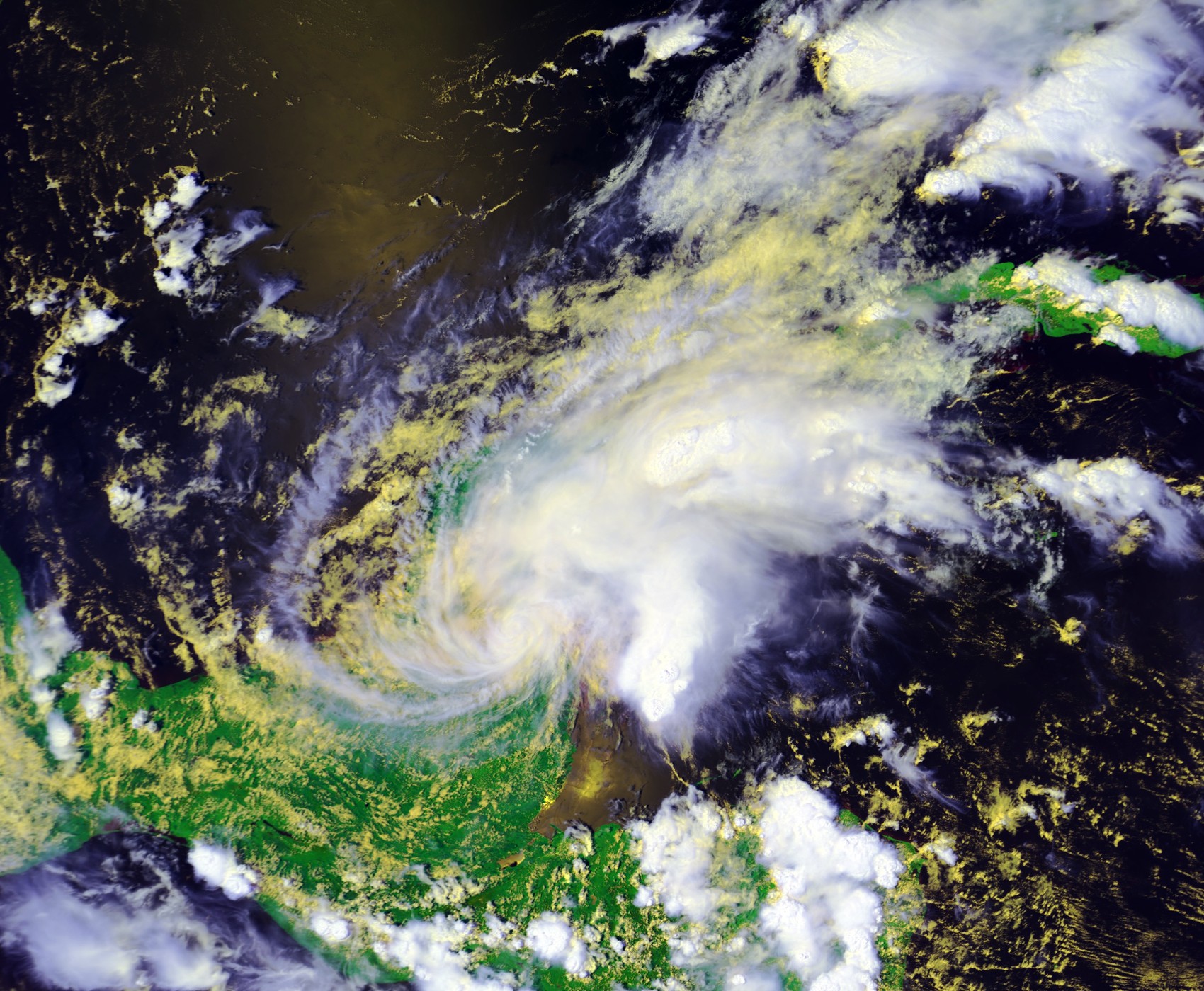
| 描述 | Tropical Storm Chantal at landfall on August 21 at 1924 UTC. This image was produced from data from NOAA-16, provided by NOAA. The storm's maximum sustained winds were 40 mph. | |||
| 日期 | ||||
| 來源 | Inventory ID:2382219, Dataset Name:NSS.HRPT.NL.D01233.S1924.E1938.B0471616.WI | |||
| 作者 | NOAA / Satellite and Information Service | |||
| 授權許可 (重用此檔案) |
|
檔案歷史
點選日期/時間以檢視該時間的檔案版本。
| 日期/時間 | 縮圖 | 尺寸 | 用戶 | 備註 | |
|---|---|---|---|---|---|
| 目前 | 2007年2月13日 (二) 03:18 | | 1,700 × 1,400(620 KB) | Good kitty(對話 | 貢獻) | == Summary == {{Information |Description=Tropical Storm Chantal at landfall on August 21 at 1924 UTC. This image was produced from data from NOAA-16, provided by NOAA. The storm's maximum sustained winds were 40 mph. |Source=http://www.class.noaa.gov/</br |
無法覆蓋此檔案。
檔案用途
沒有使用此檔案的頁面。
全域檔案使用狀況
以下其他 wiki 使用了這個檔案:
- cs.wikipedia.org 的使用狀況
- zh.wikipedia.org 的使用狀況