File:TS Norman 09 oct 2006 1849Z.jpg
跳至導覽
跳至搜尋
預覽大小:476 × 599 像素。 其他解析度:190 × 240 像素 | 381 × 480 像素 | 610 × 768 像素 | 813 × 1,024 像素 | 1,626 × 2,048 像素 | 5,400 × 6,800 像素。
原始檔案 (5,400 × 6,800 像素,檔案大小:6.18 MB,MIME 類型:image/jpeg)
說明
說明
添加單行說明來描述出檔案所代表的內容
摘要
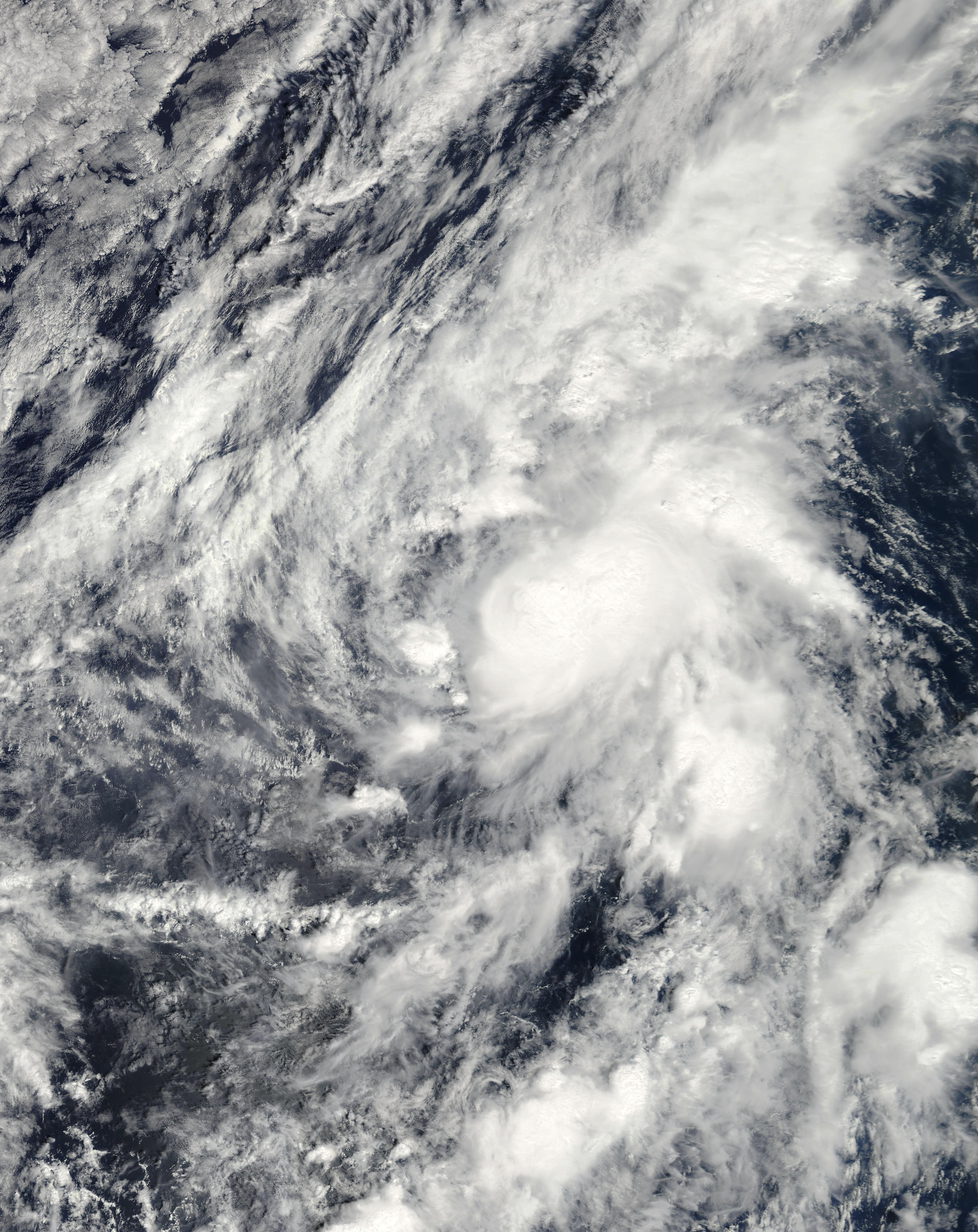
[編輯]| 描述 | This image of Tropical Storm Norman was captured by the MODIS instrument on NASA's Terra satellite at 1849 UTC on October 9, 2006 when it was located in the eastern Pacific Ocean. At the time, maximum sustained winds were 45 mph and the minimum pressure was approximately 1002 mb. | ||||||
| 日期 | |||||||
| 來源 | http://www.nrlmry.navy.mil/tc_pages/tc_home.html | ||||||
| 作者 | Naval Research Laboratory | ||||||
| 授權許可 (重用此檔案) |
|
||||||

檔案歷史
點選日期/時間以檢視該時間的檔案版本。
| 日期/時間 | 縮圖 | 尺寸 | 用戶 | 備註 | |
|---|---|---|---|---|---|
| 目前 | 2020年11月7日 (六) 19:12 | | 5,400 × 6,800(6.18 MB) | FleurDeOdile(對話 | 貢獻) | m |
| 2019年6月14日 (五) 20:45 |  | 4,401 × 4,401(7.23 MB) | TheAustinMan(對話 | 貢獻) | Soften cloud brightnesses | |
| 2018年5月21日 (一) 00:41 |  | 4,401 × 4,401(1.8 MB) | CooperScience(對話 | 貢獻) | True color | |
| 2006年10月11日 (三) 01:09 |  | 3,972 × 3,972(2.19 MB) | Good kitty(對話 | 貢獻) | == Summary == {{Information |Description=This image of Tropical Storm Norman was captured by the MODIS instrument on NASA's Terra satellite at 1849 UTC on October 9, 2006 when it was located in the eastern Pacific Ocean. At the time, maximum sustained win |
無法覆蓋此檔案。
檔案用途
全域檔案使用狀況
以下其他 wiki 使用了這個檔案:
- de.wikipedia.org 的使用狀況
- en.wikipedia.org 的使用狀況
- es.wikipedia.org 的使用狀況
- nl.wikipedia.org 的使用狀況
- pt.wikipedia.org 的使用狀況
- simple.wikipedia.org 的使用狀況
- zh.wikipedia.org 的使用狀況