File:Talas 2017-07-16 0610Z.jpg
跳转到导航
跳转到搜索

本预览的尺寸:478 × 599像素。 其他分辨率:191 × 240像素 | 383 × 480像素 | 613 × 768像素 | 817 × 1,024像素 | 1,634 × 2,048像素 | 6,367 × 7,980像素。
原始文件 (6,367 × 7,980像素,文件大小:7.51 MB,MIME类型:image/jpeg)
说明
说明
添加一行文字以描述该文件所表现的内容
摘要
[编辑]
| 描述 |
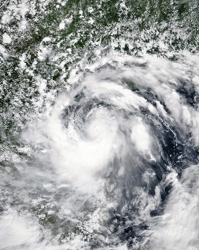
English: A satellite image of Tropical Storm Talas over the southeastern part of the Gulf of Tonkin at 06:10 UTC on 16 July 2017. The cyclone's sustained winds are 45 knots (gusting to 65 knots), and central pressure is 990 hPa. The cyclone is only three hours away from intensifying into a severe tropical storm, and a faint depression where the eye or circulation centre would be is just visible in the image. |
| 日期 | |
| 来源 | NASA Worldview |
| 作者 | National Aeronautics and Space Administration (NASA) - 'Suomi NPP' satellite |
| 相机位置 | | 在以下服务上查看本图像和附近其他图像: OpenStreetMap |
|---|
许可协议
[编辑]
| 本文件完全由NASA创作,在美国属于公有领域。根据NASA的版权方针,NASA的材料除非另有声明否则不受版权保护。(参见Template:PD-USGov/zh、NASA版权方针页面或JPL图片使用方针。) | ||
 |
警告:
|
文件历史
点击某个日期/时间查看对应时刻的文件。
| 日期/时间 | 缩略图 | 大小 | 用户 | 备注 | |
|---|---|---|---|---|---|
| 当前 | 2017年7月16日 (日) 12:57 | | 6,367 × 7,980(7.51 MB) | ChocolateTrain(留言 | 贡献) | Thin, unintended black border removed |
| 2017年7月16日 (日) 10:59 |  | 6,469 × 8,103(6.38 MB) | ChocolateTrain(留言 | 贡献) | User created page with UploadWizard |
您不可以覆盖此文件。
文件用途
没有页面使用本文件。
全域文件用途
以下其他wiki使用此文件:
- vi.wikipedia.org上的用途
- zh.wikipedia.org上的用途