File:Tarrant County Texas Incorporated Areas Bedford highlighted.svg
Aller à la navigation
Aller à la recherche

Taille de cet aperçu PNG pour ce fichier SVG : 800 × 436 pixels. Autres résolutions : 320 × 175 pixels | 640 × 349 pixels | 1 024 × 559 pixels | 1 280 × 698 pixels | 2 560 × 1 396 pixels.
Fichier d’origine (Fichier SVG, nominalement de 1 100 × 600 pixels, taille : 235 kio)
Légendes
Légendes
Ajoutez en une ligne la description de ce que représente ce fichier
Description[modifier]
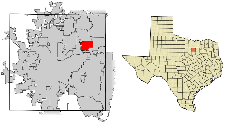
| Description | This map shows the incorporated areas in Tarrant County, Texas. Bedford is highlighted in red. I created it in Inkscape using data from the following links: North Central Texas Council of Governments Maps Website, City of Fort Worth Interactive Zoning Map |
| Date | |
| Source | My own work, based on government information. Though I strove to be as accurate in the detail as possible, the information shown is not guaranteed to be completely accurate. |
| Auteur | Ixnayonthetimmay |
| Autorisation (Réutilisation de ce fichier) |
Public Domain |
| Autres versions | See Category:Maps of Tarrant County, Texas for other versions of this image. |
Conditions d’utilisation[modifier]
| Moi, propriétaire des droits d’auteur sur cette œuvre, la place dans le domaine public. Ceci s'applique dans le monde entier. Dans certains pays, ceci peut ne pas être possible ; dans ce cas : J’accorde à toute personne le droit d’utiliser cette œuvre dans n’importe quel but, sans aucune condition, sauf celles requises par la loi. |
Historique du fichier
Cliquer sur une date et heure pour voir le fichier tel qu'il était à ce moment-là.
| Date et heure | Vignette | Dimensions | Utilisateur | Commentaire | |
|---|---|---|---|---|---|
| actuel | 4 septembre 2007 à 10:39 | | 1 100 × 600 (235 kio) | Ixnayonthetimmay (d | contributions) | == Summary == {{Information |Description=This map shows the incorporated areas in Tarrant County, Texas. Bedford is highlighted in red. I created it in [[en:Inkscape|I |
Vous ne pouvez pas remplacer ce fichier.
Utilisations locales du fichier
La page suivante utilise ce fichier :
Utilisations du fichier sur d’autres wikis
Les autres wikis suivants utilisent ce fichier :
- Utilisation sur ar.wikipedia.org
- Utilisation sur arz.wikipedia.org
- Utilisation sur ca.wikipedia.org
- Utilisation sur cy.wikipedia.org
- Utilisation sur de.wikipedia.org
- Utilisation sur en.wikipedia.org
- Utilisation sur eu.wikipedia.org
- Utilisation sur fa.wikipedia.org
- Utilisation sur fr.wikipedia.org
- Utilisation sur ht.wikipedia.org
- Utilisation sur it.wikipedia.org
- Utilisation sur no.wikipedia.org
- Utilisation sur pl.wikipedia.org
- Utilisation sur simple.wikipedia.org
- Utilisation sur sr.wikipedia.org
- Utilisation sur tt.wikipedia.org
- Utilisation sur ur.wikipedia.org
- Utilisation sur vi.wikipedia.org
- Utilisation sur vo.wikipedia.org
- Utilisation sur www.wikidata.org