File:Tenerife sentinel 2.jpg
Originaldatei (1.106 × 1.001 Pixel, Dateigröße: 434 KB, MIME-Typ: image/jpeg)
Bildtexte
Kurzbeschreibungen
Beschreibung
[Bearbeiten]| Beschreibung |
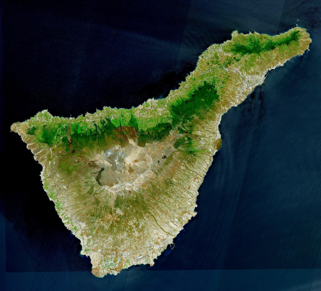
English: This image acquired by one of the Copernicus Sentinel-2 satellites on 30 April 2023 shows the Canary Islands, a Spanish archipelago located off the coast of northwest Africa and renowned for its unique ecosystems and stunning natural beauty.
The Canary Islands are now facing the dire consequences of climate change, including rising sea levels, extreme weather events, and the potential displacement of local communities. If current climate change trends are to continue, the archipelago could lose half of its beaches and 10% of its housing. Considering these challenges, the local administration is calling for greater control over the islands’ governance and decision-making processes. It argues that increased autonomy would provide it with the necessary tools and resources to implement effective measures to mitigate the effects of climate change and safeguard the future of local communities. |
| Datum | |
| Quelle | https://www.copernicus.eu/en/media/image-day-gallery/canary-islands-demand-greater-autonomy-escape-climate-change-apocalypse |
| Urheber | European Union, Copernicus Sentinel-2 imagery |
| Andere Versionen |

Lizenz
[Bearbeiten]

|
This image contains data from a satellite in the Copernicus Programme, such as Sentinel-1, Sentinel-2 or Sentinel-3. Attribution is required when using this image.
Namensnennung: Contains modified Copernicus Sentinel data 2023
The use of Copernicus Sentinel Data is regulated under EU law (Commission Delegated Regulation (EU) No 1159/2013 and Regulation (EU) No 377/2014). Relevant excerpts:
Free access shall be given to GMES dedicated data [...] made available through GMES dissemination platforms [...].
Access to GMES dedicated data [...] shall be given for the purpose of the following use in so far as it is lawful:
GMES dedicated data [...] may be used worldwide without limitations in time.
GMES dedicated data and GMES service information are provided to users without any express or implied warranty, including as regards quality and suitability for any purpose. |
Dateiversionen
Klicke auf einen Zeitpunkt, um diese Version zu laden.
| Version vom | Vorschaubild | Maße | Benutzer | Kommentar | |
|---|---|---|---|---|---|
| aktuell | 16:17, 25. Mai 2023 | | 1.106 × 1.001 (434 KB) | PalauanLibertarian (Diskussion | Beiträge) | File:20230525 CanaryIslands.jpg cropped 67 % horizontally, 49 % vertically using CropTool with precise mode. |
Du kannst diese Datei nicht überschreiben.
Dateiverwendung
Die folgende Seite verwendet diese Datei:
Globale Dateiverwendung
Die nachfolgenden anderen Wikis verwenden diese Datei: