File:The boundary between Oberpallen and Tontelange - Borne 121 - 2 - Bernard Piette.jpg
Salta a la navegació
Salta a la cerca
Mida d'aquesta previsualització: 800 × 600 píxels. Altres resolucions: 320 × 240 píxels | 640 × 480 píxels | 960 × 720 píxels.
Fitxer original (960 × 720 píxels, mida del fitxer: 139 Ko, tipus MIME: image/jpeg)
Llegendes
Llegendes
Afegeix una explicació d'una línia del que representa aquest fitxer
Resum
[modifica]| Descripció |
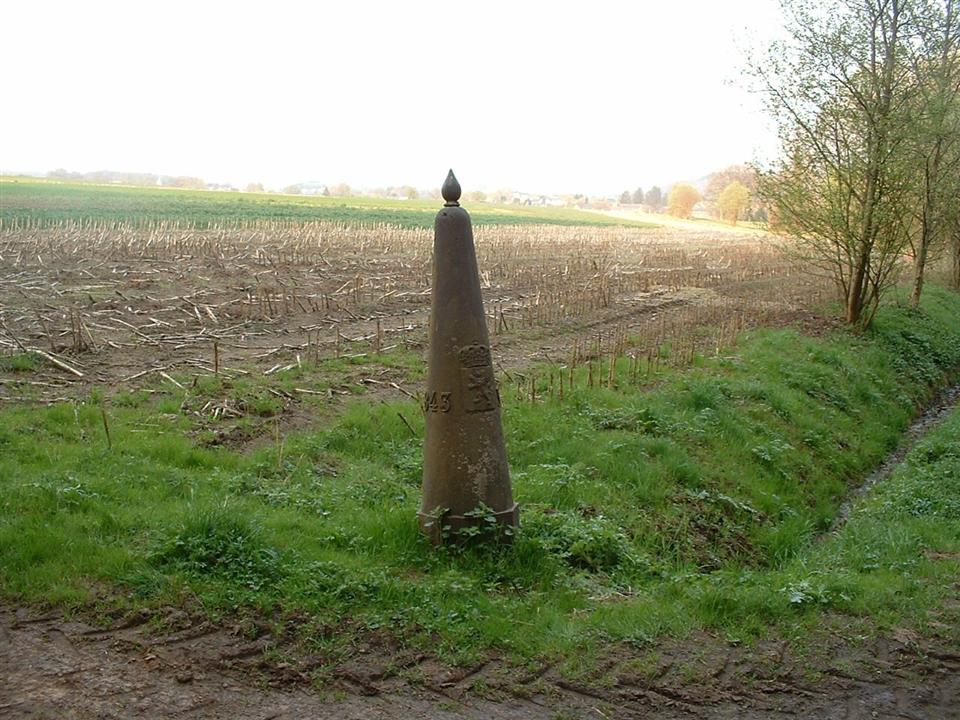
English: The boundary between the Grand Duchy of Luxembourg ( Oberpallen ) and Belgium ( Tontelange ) - Registrations are : The date when the Boundary stone was placed, its number 121, the coat of arms of the Grand Duchy of Luxembourg and that of Belgium
Français : La borne frontière entre le Grand-Duché de Luxembourg ( Oberpallen ) et la Belgique ( Tontelange ) - Les inscriptions sont : La date où la borne a été placée, son numéro 121, les armoiries du Grand-Duché de Luxembourg et celui de la Belgique |
|||
| Data | ||||
| Font | Treball propi | |||
| Autor | Bernard Piette | |||
| Permís (Com reutilitzar aquest fitxer) |
|
|||
| Altres versions |
 |


| Posició de la càmera | | Aquesta i altres imatges properes a: OpenStreetMap |
|---|
Historial del fitxer
Cliqueu una data/hora per veure el fitxer tal com era aleshores.
| Data/hora | Miniatura | Dimensions | Usuari/a | Comentari | |
|---|---|---|---|---|---|
| actual | 08:23, 15 abr 2009 | | 960 × 720 (139 Ko) | Bernard Piette (discussió | contribucions) | {{Information |Description={{en|1=The boundary between the Grand Duchy of Luxembourg ( [http://fr.wikipedia.org/wiki/Oberpallen Oberpallen] ) and Belgium ( [http://fr.wikipedia.org/wiki/Tontelange Tontelange] ) - Registrations are : The date when the Bou |
No podeu sobreescriure aquest fitxer.
Ús del fitxer
Les 7 pàgines següents utilitzen aquest fitxer:
- File:The boundary between Oberpallen and Tontelange - Borne 121 - 1 - Bernard Piette.jpg
- File:The boundary between Oberpallen and Tontelange - Borne 121 - 2 - Bernard Piette.jpg
- File:The boundary between Oberpallen and Tontelange - Borne 121 - 3 - Bernard Piette.jpg
- File:The boundary between Oberpallen and Tontelange - Borne 121 - 4 - Bernard Piette.jpg
- File:The boundary between Oberpallen and Tontelange - Borne 121 - 5 - Bernard Piette.jpg
- File:The boundary between Oberpallen and Tontelange - Borne 121 - 6 - Bernard Piette.jpg
- Category:Borders of Belgium-Luxembourg
Ús global del fitxer
Utilització d'aquest fitxer en altres wikis:
- Utilització a ca.wikipedia.org
- Utilització a fr.wikipedia.org
- Utilització a lb.wikipedia.org
- Utilització a li.wikipedia.org
- Utilització a nl.wikipedia.org
- Utilització a wa.wikipedia.org
- Utilització a www.wikidata.org