File:Thessaly.jpg
来自Wikimedia Commons
跳转到导航
跳转到搜索

本预览的尺寸:665 × 600像素。 其他分辨率:266 × 240像素 | 532 × 480像素 | 894 × 806像素。
原始文件 (894 × 806像素,文件大小:1.18 MB,MIME类型:image/jpeg)
文件信息
结构化数据
说明
说明
添加一行文字以描述该文件所表现的内容
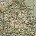
Map of Thessaly, cropped from old public domain map of Greece, from the Perry-Castañeda Library Map Collection, Historical Atlas by William R. Shepherd north, south
| This image is a copy or a derivative work of greece_ancient_n_ref_1926.jpg, from the map collection of the Perry–Castañeda Library (PCL) of the University of Texas at Austin.
This tag does not indicate the copyright status of the attached work. A normal copyright tag is still required. See Commons:Licensing for more information. |
本文件采用知识共享署名 3.0 未本地化版本许可协议授权。
- 您可以自由地:
- 共享 – 复制、发行并传播本作品
- 修改 – 改编作品
- 惟须遵守下列条件:
- 署名 – 您必须对作品进行署名,提供授权条款的链接,并说明是否对原始内容进行了更改。您可以用任何合理的方式来署名,但不得以任何方式表明许可人认可您或您的使用。
文件历史
点击某个日期/时间查看对应时刻的文件。
| 日期/时间 | 缩略图 | 大小 | 用户 | 备注 | |
|---|---|---|---|---|---|
| 当前 | 2021年11月1日 (一) 12:40 |  | 894 × 806(1.18 MB) | Claude Zygiel(留言 | 贡献) | Lighter |
| 2010年10月2日 (六) 15:44 |  | 894 × 806(680 KB) | Cplakidas(留言 | 贡献) | widened to include Magnesia, which was considered part of wider Thessaly | |
| 2006年12月12日 (二) 08:22 |  | 769 × 778(226 KB) | Roke~commonswiki(留言 | 贡献) | Map of Thessaly, cropped from old public domain map of Greece, from the Perry-Castañeda Library Map Collection, Historical Atlas by William R. Shepherd [http://www.lib.utexas.edu/maps/historical/shepherd/greece_ancient_n_ref_1926.jpg north], [http://www. |
您不可以覆盖此文件。
文件用途
没有页面使用本文件。
全域文件用途
以下其他wiki使用此文件:
- an.wikipedia.org上的用途
- bg.wikipedia.org上的用途
- ca.wikipedia.org上的用途
- ceb.wikipedia.org上的用途
- cs.wikipedia.org上的用途
- de.wikipedia.org上的用途
- el.wikipedia.org上的用途
- en.wikipedia.org上的用途
- Thessaly
- Pagasae
- Demetrias
- Phylace (Thessaly)
- Pherae
- Tripolis Larisaia
- Tripolis (Perrhaebia)
- Pythion
- Doliche (Thessaly)
- History of Thessaly
- Palaepharsalus
- Argissa Magoula
- Eurymenae
- Amphrysus
- Gomphi
- Halos (Thessaly)
- Homolium
- Rhizus
- Tricca
- Phalanna
- Perrhaebia
- Pelasgiotis
- Ancient Thessaly
- Pimpleia
- Pelinna
- Pharcadon
- Argos Pelasgikon
- Boebe (Thessaly)
查看此文件的更多全域用途。
元数据
此文件含有额外信息,这些信息可能是创建或数字化该文件时使用的数码相机或扫描仪所添加的。如果文件已从其原始状态修改,某些详细信息可能无法完全反映修改后的文件。
| 方向 | 正常 |
|---|---|
| 水平分辨率 | 200 dpi |
| 垂直分辨率 | 200 dpi |
| 色彩空间 | sRGB |