File:Tokashiki Island gsi-200811.jpg
跳至導覽
跳至搜尋

預覽大小:317 × 599 像素。 其他解析度:127 × 240 像素 | 254 × 480 像素 | 406 × 768 像素 | 542 × 1,024 像素 | 1,084 × 2,048 像素 | 4,500 × 8,500 像素。
原始檔案 (4,500 × 8,500 像素,檔案大小:8.2 MB,MIME 類型:image/jpeg)
說明
說明
添加單行說明來描述出檔案所代表的內容
摘要
[編輯]| 描述 |
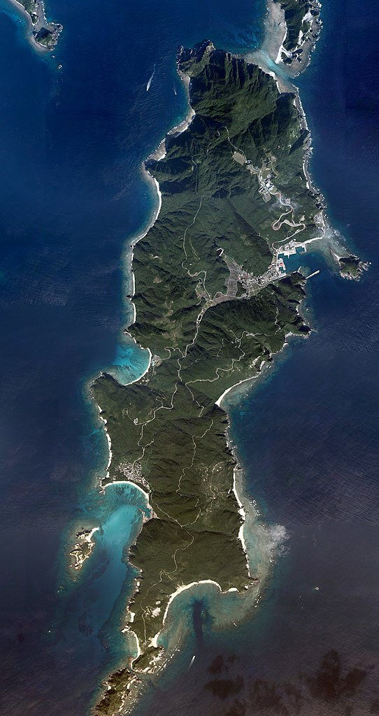
English: Tokashiki Island, Tokashiki, Okinawa, Japan. Combined 18 aerial photos taken by Geospatial Information Authority of Japan.
日本語: 渡嘉敷島
国土交通省の地図・空中写真閲覧サービスを元に作成。18枚の航空写真を使用。
|
| 日期 | |
| 來源 | COK20083X-C7-11, C7-12, C7-13, C7-14, C7-15, C8-8, C8-9, C8-10, C8-11, C8-12, C10-12, C10-13, C10-14, C10-15, C11-8, C11-9, C11-10, C11-11 |
| 作者 |
English: Geospatial Information Authority of Japan
日本語: 国土地理院 |
| 拍攝地點 | | 位於此地的本圖片與其他圖片: OpenStreetMap |
|---|
| 這是一張修飾過的圖片,即本圖片是用軟體修改過後的版本,修改的方式或內容有:Combined 18 aerial photos and cropped。修改者:Kugel~commonswiki。
|
授權條款
[編輯]
|
本檔案的著作權持有者,Ministry of Land, Infrastructure, Transport and Tourism,在註明所有人姓名的前提下,允許任何人使用本檔案於任何用途。包含再散布、衍生作品、商業用途及其他用途。 |
姓名標示:
National Land Image Information (Color Aerial Photographs), created by Ministry of Land, Infrastructure, Transport and Tourism, distributed by Geospatial Information Authority of Japan
|

檔案歷史
點選日期/時間以檢視該時間的檔案版本。
| 日期/時間 | 縮圖 | 尺寸 | 使用者 | 備註 | |
|---|---|---|---|---|---|
| 目前 | 2017年3月17日 (五) 07:43 | | 4,500 × 8,500(8.2 MB) | Kugel~commonswiki(留言 | 貢獻) | {{Information |description={{en|Tokashiki Island, Tokashiki, Okinawa, Japan. Combined 18 aerial photos taken by Geospatial Information Authority of Japan. *Reference Number : COK20083X *Location : Kerama Islands *Course and Photo Number : C7-11~15, C8-... |
無法覆蓋此檔案。
檔案用途
下列2個頁面有用到此檔案:
全域檔案使用狀況
以下其他 wiki 使用了這個檔案:
- ceb.wikipedia.org 的使用狀況
- de.wikipedia.org 的使用狀況
- en.wikipedia.org 的使用狀況
- en.wikivoyage.org 的使用狀況
- it.wikivoyage.org 的使用狀況
- ja.wikipedia.org 的使用狀況
- www.wikidata.org 的使用狀況
- zh-min-nan.wikipedia.org 的使用狀況
- zh.wikipedia.org 的使用狀況