File:Topographisch-militairische Charte von Teutschland - Section 039.png
Zur Navigation springen
Zur Suche springen

Größe dieser Vorschau: 766 × 600 Pixel. Weitere Auflösungen: 307 × 240 Pixel | 613 × 480 Pixel | 981 × 768 Pixel | 1.280 × 1.002 Pixel | 2.560 × 2.005 Pixel | 3.463 × 2.712 Pixel.
Originaldatei (3.463 × 2.712 Pixel, Dateigröße: 21,88 MB, MIME-Typ: image/png)
Bildtexte
Kurzbeschreibungen
Ergänze eine einzeilige Erklärung, was diese Datei darstellt.
Beschreibung
[Bearbeiten]
| Beschreibung |
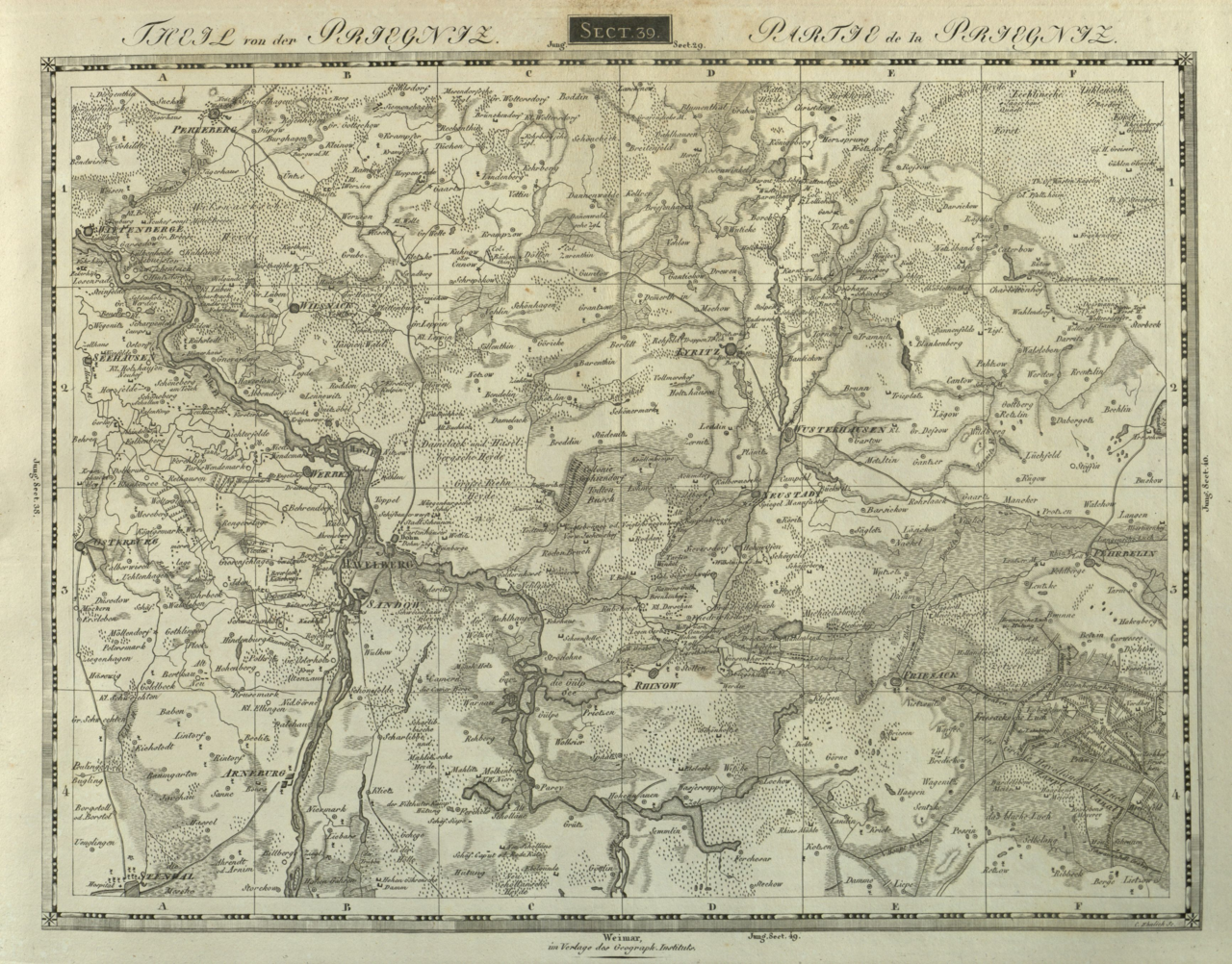
English: Topographisch-militairische Charte von Teutschland |
| Datum | bis 1814 |
| Quelle | Bestand Universität Greifswald |
| Urheber | F. W. Streit, Geographisches Institut zu Weimar |
Lizenz
[Bearbeiten]
|
Dieses Werk ist gemeinfrei, weil seine urheberrechtliche Schutzfrist abgelaufen ist. Dieses Werk ist gemeinfrei in den Vereinigten Staaten, weil es vor dem 1. Januar 1929 veröffentlicht (oder beim U.S. Copyright Office registriert) wurde. | |
| Es wurde festgestellt, dass diese Datei frei von bekannten Beschränkungen durch das Urheberrecht ist, alle verbundenen und verwandten Rechte eingeschlossen. | |
Dateiversionen
Klicke auf einen Zeitpunkt, um diese Version zu laden.
| Version vom | Vorschaubild | Maße | Benutzer | Kommentar | |
|---|---|---|---|---|---|
| aktuell | 07:44, 4. Aug. 2018 | | 3.463 × 2.712 (21,88 MB) | Woodie Wood (Diskussion | Beiträge) | User created page with UploadWizard |
Du kannst diese Datei nicht überschreiben.
Dateiverwendung
Keine Seiten verwenden diese Datei.
Globale Dateiverwendung
Die nachfolgenden anderen Wikis verwenden diese Datei:
- Verwendung auf de.wikipedia.org