File:Tour du Qatar 2015 (A2).jpg
Salta a la navegació
Salta a la cerca
Mida d'aquesta previsualització: 370 × 600 píxels. Altres resolucions: 148 × 240 píxels | 296 × 480 píxels | 474 × 768 píxels | 632 × 1.024 píxels | 1.264 × 2.048 píxels | 3.150 × 5.104 píxels.
Fitxer original (3.150 × 5.104 píxels, mida del fitxer: 3,3 Mo, tipus MIME: image/jpeg)
Llegendes
Llegendes
Afegeix una explicació d'una línia del que representa aquest fitxer
| Descripció |
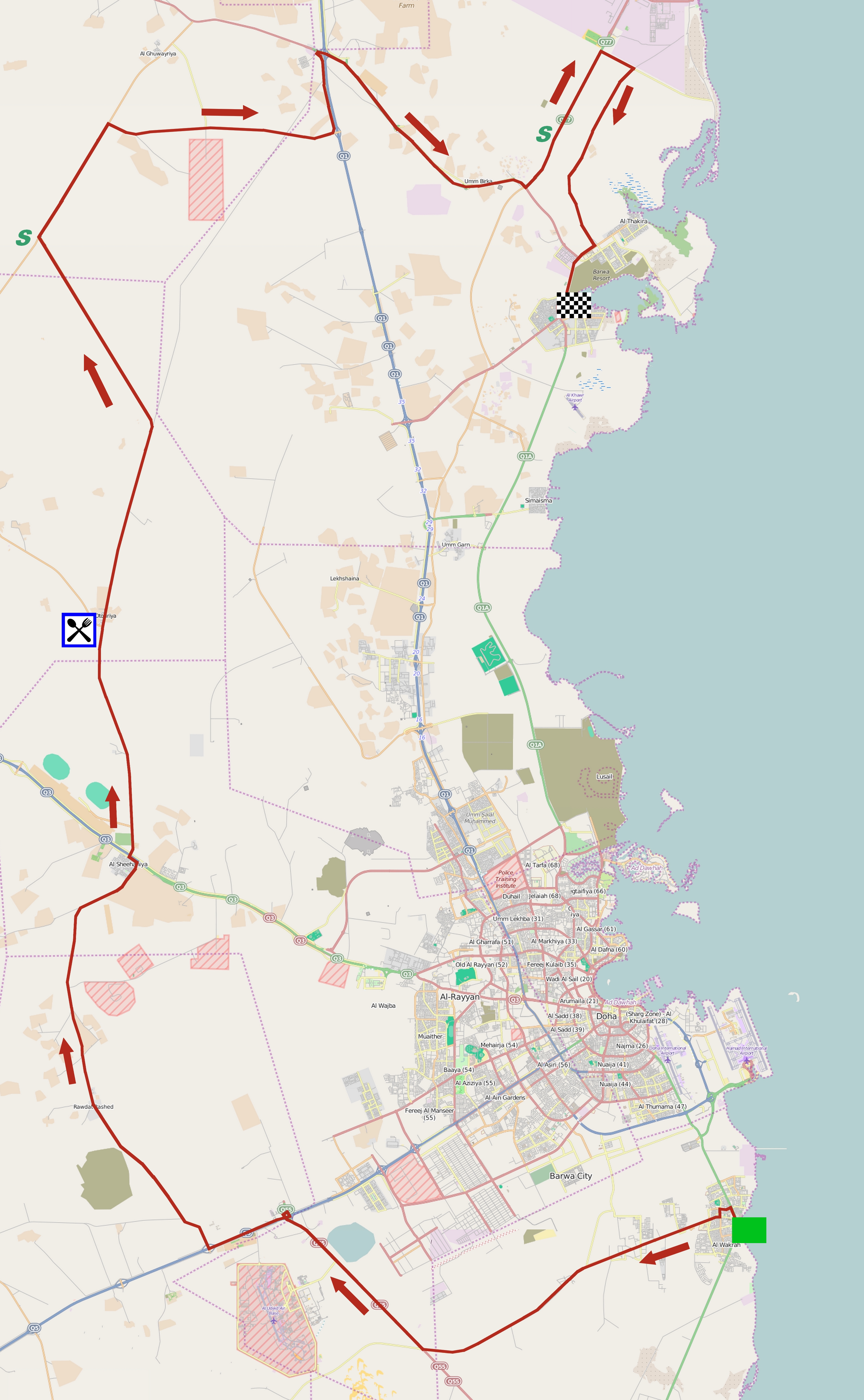
Parcours de la deuxième étape du Tour du Qatar 2015. This map was created from OpenStreetMap project data, collected by the community. This map may be incomplete, and may contain errors. Don't rely solely on it for navigation. |
|||
| Data | ||||
| Font | You may find a page on the OpenStreetMap wiki page for Tour du Qatar 2015, étape 2 | |||
| Creador |
OpenStreetMap contributors, Jérémy-Günther-Heinz Jähnick, d'après une carte réalisée par les organisateurs du Tour du Qatar 2015. OpenStreetMap contributors |
|||
| Permís (Com reutilitzar aquest fitxer) |
OpenStreetMap data is available under the Open Database License (details). Map tiles are licensed under the Creative Commons Attribution-ShareAlike 2.0 license (CC-BY-SA 2.0).
Aquest fitxer està publicat sota la llicència de Creative Commons Reconeixement i Compartir Igual 2.0 Genèrica.
|
|||
| Georeferencing | If inappropriate please set warp_status = skip to hide. | |||
| Altres versions |

Historial del fitxer
Cliqueu una data/hora per veure el fitxer tal com era aleshores.
| Data/hora | Miniatura | Dimensions | Usuari/a | Comentari | |
|---|---|---|---|---|---|
| actual | 15:34, 28 gen 2015 | | 3.150 × 5.104 (3,3 Mo) | Jérémy-Günther-Heinz Jähnick (discussió | contribucions) | {{OpenStreetMap |name = Tour du Qatar 2015, étape 2 |location = |description = Parcours de la deuxième étape du Tour du Qatar 2015. |top = |bottom = |left = |right = |date = 2015-01-28 |authors = OpenStreetMap con... |
No podeu sobreescriure aquest fitxer.
Ús del fitxer
La pàgina següent utilitza aquest fitxer:
Ús global del fitxer
Utilització d'aquest fitxer en altres wikis:
- Utilització a ca.wikipedia.org
- Utilització a en.wikipedia.org
- Utilització a es.wikipedia.org
- Utilització a fr.wikipedia.org
- Utilització a fr.wikinews.org
- Utilització a nl.wikipedia.org
.jpg&oldid=488624256)