File:TransPecosTexas.svg
跳至導覽
跳至搜尋

此 SVG 檔案的 PNG 預覽的大小:512 × 512 像素。 其他解析度:240 × 240 像素 | 480 × 480 像素 | 768 × 768 像素 | 1,024 × 1,024 像素 | 2,048 × 2,048 像素。
原始檔案 (SVG 檔案,表面大小:512 × 512 像素,檔案大小:305 KB)
說明
說明
添加單行說明來描述出檔案所代表的內容
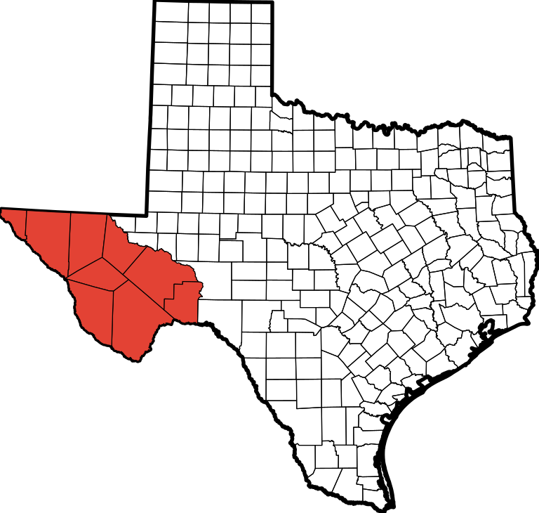
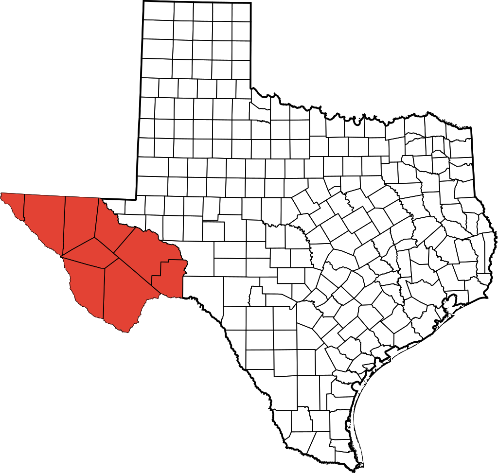
| 描述 | This is a locator map showing Jeff Davis County in Texas. David Benbennick made this map. For more information, see Commons:United States county locator maps. |
| 日期 | (UTC) |
| 來源 | |
| 作者 |
|
| 這是一張修飾過的圖片,即本圖片是用軟體修改過後的版本,修改的方式或內容有:Colored Trans-Pecos region。原版圖片來源:TexasRegions.svg。修改者:Fortguy。
|
我,本作品的著作權持有者,決定用以下授權條款發佈本作品:
| 我,此作品的版權所有人,釋出此作品至公共領域。此授權條款在全世界均適用。 這可能在某些國家不合法,如果是的話: 我授予任何人有權利使用此作品於任何用途,除受法律約束外,不受任何限制。 |
原始上傳日誌
[編輯]
This image is a derivative work of the following images:
- File:TexasRegions.svg licensed with PD-self
- 2009-08-15T22:40:01Z Fortguy 512x512 (314803 Bytes) {{Information |Description=This is a locator map showing [[w:Jeff Davis County, Texas|Jeff Davis County]] in Texas. [[User:Dbenbenn|David Benbennick]] made this map. For more information, see [[Commons:United States county
Uploaded with derivativeFX
檔案歷史
點選日期/時間以檢視該時間的檔案版本。
| 日期/時間 | 縮圖 | 尺寸 | 使用者 | 備註 | |
|---|---|---|---|---|---|
| 目前 | 2009年8月16日 (日) 14:52 | | 512 × 512(305 KB) | Fortguy(留言 | 貢獻) | {{Information |Description=This is a locator map showing Jeff Davis County in Texas. David Benbennick made this map. For more information, see Commons:United States county locator maps. |Source=*[[:Fi |
無法覆蓋此檔案。
檔案用途
沒有使用此檔案的頁面。
全域檔案使用狀況
以下其他 wiki 使用了這個檔案:
- cs.wikipedia.org 的使用狀況
- en.wikipedia.org 的使用狀況
- fr.wikipedia.org 的使用狀況
- lt.wikipedia.org 的使用狀況
- no.wikipedia.org 的使用狀況
- zh.wikipedia.org 的使用狀況