File:Trondheim map 1898.jpg

Rozmiar pierwotny (2548 × 2080 pikseli, rozmiar pliku: 4,66 MB, typ MIME: image/jpeg)
Podpisy
Podpisy
Opis[edytuj]
Licencja[edytuj]
|
Ten materiał przeszedł do domeny publicznej w kraju pochodzenia, jak również w państwach i terytoriach, gdzie prawo autorskie wygasa w ciągu 70 lat po śmierci autora.
| |
| Plik rozpoznano jako wolny od znanych ograniczeń praw autorskich, włącznie z prawami zależnymi i pokrewnymi. | |
Historia pliku
Kliknij na odpowiedniej dacie/czasie, aby zobaczyć wersję pliku z tamtego okresu.
| Data/czas | Miniatura | Wymiary | Użytkownik | Opis | |
|---|---|---|---|---|---|
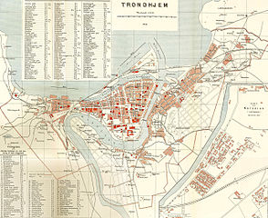
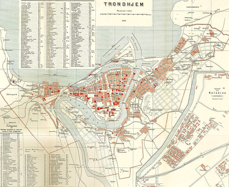
| aktualny | 09:23, 3 cze 2008 | | 2548 × 2080 (4,66 MB) | Mahlum (dyskusja | edycje) | {{Information |Description={{en|1=Trondheim city map, 1898}} {{no|1=Kart over Trondheim, 1898}} |Source=Amund Helland: ''Norges Land og Folk. Søndre Trondhjems Amt'' |Author=Lithografisk Anstalt |Date=1898 |Permission= |other_versions= }} {{ImageUpload| |
Nie możesz nadpisać tego pliku.
Lokalne wykorzystanie pliku
Poniższa strona korzysta z tego pliku:
Globalne wykorzystanie pliku
Ten plik jest wykorzystywany także w innych projektach wiki:
- Wykorzystanie na ast.wikipedia.org
- Wykorzystanie na ca.wikipedia.org
- Wykorzystanie na cs.wikipedia.org
- Wykorzystanie na da.wikipedia.org
- Wykorzystanie na el.wikipedia.org
- Wykorzystanie na en.wikipedia.org
- Wykorzystanie na es.wikipedia.org
- Wykorzystanie na no.wikipedia.org
- Wykorzystanie na pl.wikipedia.org
- Wykorzystanie na sl.wikipedia.org
- Wykorzystanie na sv.wikipedia.org