File:Tropical Depression 25 oct 2002 0838Z.jpg
跳至導覽
跳至搜尋
預覽大小:580 × 600 像素。 其他解析度:232 × 240 像素 | 464 × 480 像素 | 743 × 768 像素 | 1,180 × 1,220 像素。
原始檔案 (1,180 × 1,220 像素,檔案大小:370 KB,MIME 類型:image/jpeg)
說明
說明
添加單行說明來描述出檔案所代表的內容
摘要
[編輯]
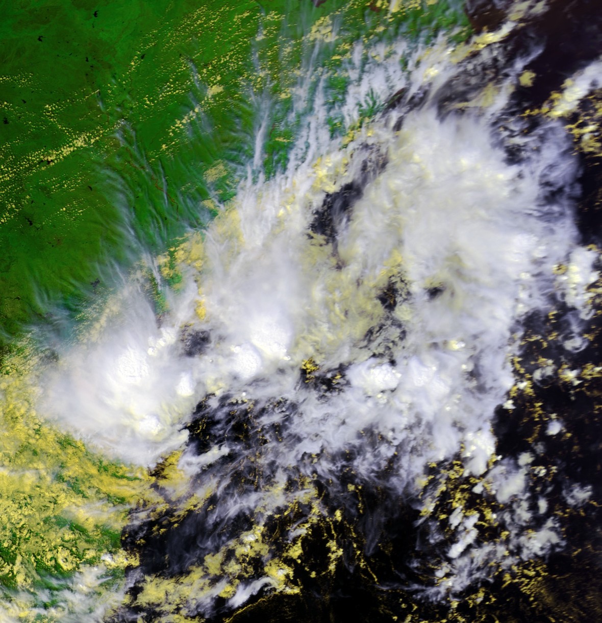
| 描述 | Satellite image of a tropical depression in the Bay of Bengal from October 25 at 0838 UTC. Maximum sustained winds were about 35 mph at the time. | |||
| 日期 | ||||
| 來源 | Inventory ID:2577737, Dataset Name:NSS.LHRR.NL.D02298.S0838.E0849.B1077676.GC | |||
| 作者 | NOAA / Satellite and Information Service | |||
| 授權許可 (重用此檔案) |
|
檔案歷史
點選日期/時間以檢視該時間的檔案版本。
| 日期/時間 | 縮圖 | 尺寸 | 用戶 | 備註 | |
|---|---|---|---|---|---|
| 目前 | 2007年2月8日 (四) 01:51 | | 1,180 × 1,220(370 KB) | Good kitty(對話 | 貢獻) | == Summary == {{Information |Description=Satellite image of a tropical depression in the Bay of Bengal from October 25 at 0838 UTC. Maximum sustained winds were about 35 mph at the time. |Source=http://www.class.noaa.gov/</br> Inventory ID:2577737, Datas |
無法覆蓋此檔案。
檔案用途
沒有使用此檔案的頁面。
全域檔案使用狀況
以下其他 wiki 使用了這個檔案:
- en.wikipedia.org 的使用狀況
- zh.wikipedia.org 的使用狀況