File:Typh longwang sept28.jpg
跳至導覽
跳至搜尋

預覽大小:600 × 600 像素。 其他解析度:240 × 240 像素 | 480 × 480 像素 | 768 × 768 像素 | 1,024 × 1,024 像素 | 2,048 × 2,048 像素 | 7,800 × 7,800 像素。
原始檔案 (7,800 × 7,800 像素,檔案大小:9.49 MB,MIME 類型:image/jpeg)
說明
說明
添加單行說明來描述出檔案所代表的內容
| 警告 | 部分瀏覽器在瀏覽此圖片的完整大小時可能會遇到困難:該圖片中有數量巨大的像素點,可能無法完全載入或者導致您的瀏覽器停止回應。 |
|---|
摘要[編輯]
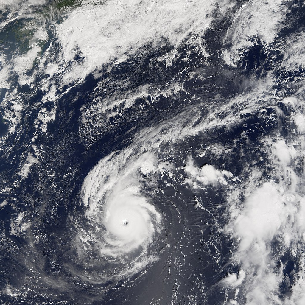
| 描述 | Typhoon Longwang was a small but well-organized and powerful storm system when the Moderate Resolution Imaging Spectroradiometer (MODIS) on NASA’s Terra satellite captured this image at 10:30 a.m. local time, on September 28, 2005. At the time of this MODIS observation, Longwang was 900 kilometers (590 miles) from Okinawa and a comparable distance south of Honshu (the main island in the Japanese chain at the top of this image). It was travelling roughly westward towards the Chinese coast on a track that would take it through the southern fringe of the Japanese islands. Typhoon Longwang had sustained winds of 200 kilometers per hour (125 miles per hour) near the storm’s center, and it was projected to continue to strengthen slightly in the following days. | |||||
| 日期 | ||||||
| 來源 | http://earthobservatory.nasa.gov/NaturalHazards/natural_hazards_v2.php3?img_id=13169 | |||||
| 作者 | NASA image created by Jesse Allen, Earth Observatory, using data courtesy of the MODIS Rapid Response team. | |||||
| 授權許可 (重用此檔案) |
|

檔案歷史
點選日期/時間以檢視該時間的檔案版本。
| 日期/時間 | 縮圖 | 尺寸 | 使用者 | 備註 | |
|---|---|---|---|---|---|
| 目前 | 2006年9月6日 (三) 23:11 | | 7,800 × 7,800(9.49 MB) | Good kitty(留言 | 貢獻) | == Summary == {{Information |Description=Typhoon Longwang was a small but well-organized and powerful storm system when the Moderate Resolution Imaging Spectroradiometer (MODIS) on NASA’s Terra satellite captured this image at 10:30 a.m. local time, on |
無法覆蓋此檔案。
檔案用途
沒有使用此檔案的頁面。
全域檔案使用狀況
以下其他 wiki 使用了這個檔案:
- fr.wikipedia.org 的使用狀況
- zh-min-nan.wikipedia.org 的使用狀況