File:Typhoon Chataan 11 july 2002 0120Z.jpg
跳至導覽
跳至搜尋

預覽大小:646 × 599 像素。 其他解析度:259 × 240 像素 | 517 × 480 像素 | 828 × 768 像素 | 1,104 × 1,024 像素 | 2,208 × 2,048 像素 | 3,730 × 3,460 像素。
原始檔案 (3,730 × 3,460 像素,檔案大小:5.06 MB,MIME 類型:image/jpeg)
說明
說明
添加單行說明來描述出檔案所代表的內容
Typhoon Chataan 11 july 2002
摘要
[編輯]| 描述 |
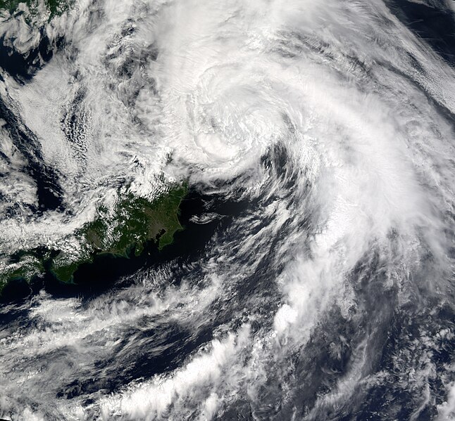
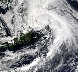
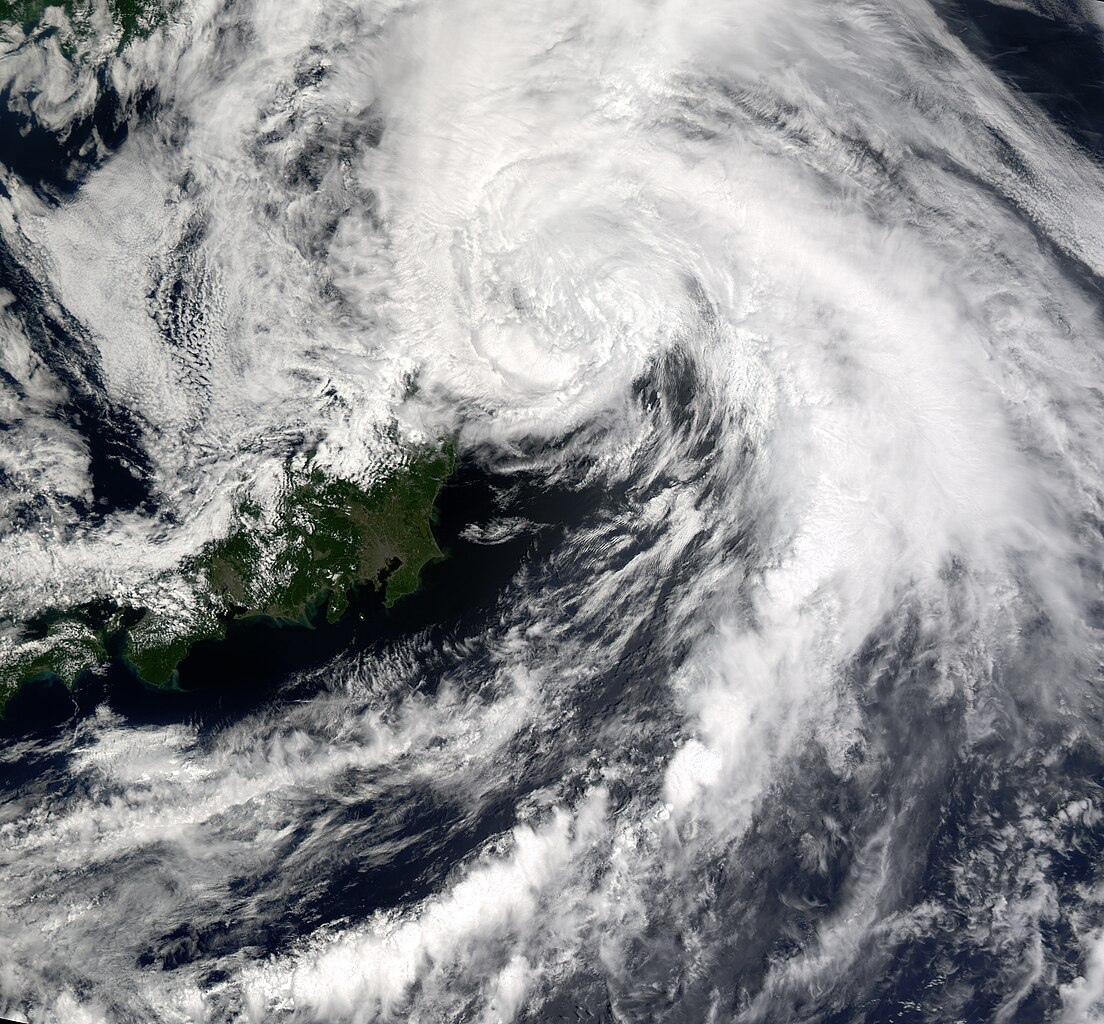
Slowly winding its way down, Typhoon Chataan had dropped to tropical storm status by Thursday, July 11, 2002, when this image from the Moderate Resolution Imaging Spectroradiometer (MODIS) was captured. In the image, the storm is located off the east coast of central Japan in the Pacific Ocean. The storm is much less organized than it was in the previous day's image. Through a gap in the clouds to the southwest of the storm's eye, Tokyo can be seen as a grayish cluster of pixels surrounding a small bay or inlet that protrudes into the island of Honshu. |
|||||
| 日期 | ||||||
| 來源 | http://visibleearth.nasa.gov/view_rec.php?id=3494 | |||||
| 作者 | Image courtesy Jesse Allen, NASA Earth Observatory; data provided by the MODIS Land Rapid Response Team | |||||
| 授權許可 (重用此檔案) |
|

檔案歷史
點選日期/時間以檢視該時間的檔案版本。
| 日期/時間 | 縮圖 | 尺寸 | 用戶 | 備註 | |
|---|---|---|---|---|---|
| 目前 | 2015年12月22日 (二) 00:30 | | 3,730 × 3,460(5.06 MB) | Nino Marakot(對話 | 貢獻) | Cropped |
| 2015年12月21日 (一) 04:39 |  | 5,578 × 4,744(6.9 MB) | Nino Marakot(對話 | 貢獻) | gonna crop, full image | |
| 2006年12月2日 (六) 16:35 |  | 3,748 × 3,574(2.32 MB) | Good kitty(對話 | 貢獻) | == Summary == {{Information |Description=Slowly winding its way down, Typhoon Chataan had dropped to tropical storm status by Thursday, July 11, 2002, when this image from the Moderate Resolution Imaging Spectroradiometer (MODIS) was captured. In the imag |
無法覆蓋此檔案。
檔案用途
全域檔案使用狀況
以下其他 wiki 使用了這個檔案:
- en.wikipedia.org 的使用狀況
- es.wikipedia.org 的使用狀況
- vi.wikipedia.org 的使用狀況
- zh.wikipedia.org 的使用狀況