File:Typhoon Nari 2001.jpg
跳至導覽
跳至搜尋
預覽大小:460 × 600 像素。 其他解析度:184 × 240 像素 | 368 × 480 像素 | 589 × 768 像素 | 785 × 1,024 像素 | 1,570 × 2,048 像素 | 4,600 × 6,000 像素。
原始檔案 (4,600 × 6,000 像素,檔案大小:4.59 MB,MIME 類型:image/jpeg)
說明
說明
添加單行說明來描述出檔案所代表的內容
摘要[編輯]
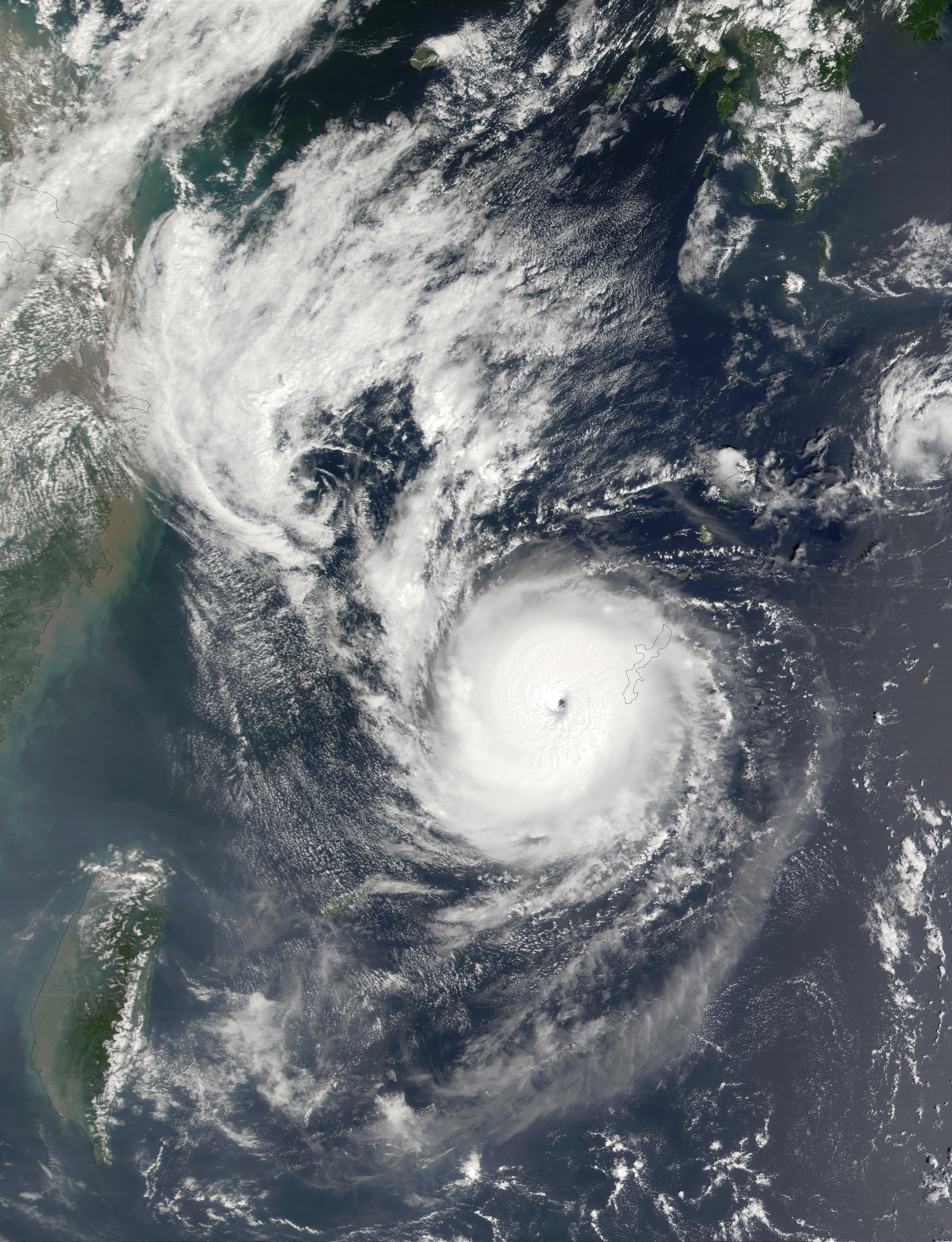
| 描述 | Typhoon Nari on September 11, 2001 at 0210 UTC. Maximum sustained winds (10-minute average) were currently 65 knots. This true-color image of Nari was acquired by the Moderate-resolution Imaging Spectroradiometer (MODIS), flying aboard NASA's Terra satellite, on September 11. | |||||
| 日期 | ||||||
| 來源 | http://rapidfire.sci.gsfc.nasa.gov/gallery/?2001254-0911/Nari.A2001254.0210.2km.jpg | |||||
| 作者 | Image courtesy of MODIS Rapid Response Project at NASA/GSFC | |||||
| 授權許可 (重用此檔案) |
|
|||||
| 其他版本 | Image:Nari 11 sept 2001 0210Z.jpg |

檔案歷史
點選日期/時間以檢視該時間的檔案版本。
| 日期/時間 | 縮圖 | 尺寸 | 使用者 | 備註 | |
|---|---|---|---|---|---|
| 目前 | 2006年9月3日 (日) 14:40 | | 4,600 × 6,000(4.59 MB) | Good kitty(留言 | 貢獻) | {{Information |Description=On September 14, 2001, Typhoon Nari was located about 418 km (260 miles) northeast of Taipei, Taiwan, and was moving slowly southwestward at a rate of about 4 km per hour (2.5 mph). The storm was packing winds of up to 150 km pe |
無法覆蓋此檔案。
檔案用途
下列頁面有用到此檔案:
全域檔案使用狀況
以下其他 wiki 使用了這個檔案:
- en.wikipedia.org 的使用狀況
- ja.wikipedia.org 的使用狀況
- zh.wikipedia.org 的使用狀況