File:USACE Coffeeville Lock and Dam Tombigbee.jpg
Aller à la navigation
Aller à la recherche
Taille de cet aperçu : 800 × 534 pixels. Autres résolutions : 320 × 214 pixels | 640 × 428 pixels | 1 024 × 684 pixels | 1 500 × 1 002 pixels.
Fichier d’origine (1 500 × 1 002 pixels, taille du fichier : 769 kio, type MIME : image/jpeg)
Légendes
Légendes
Ajoutez en une ligne la description de ce que représente ce fichier
| Description |
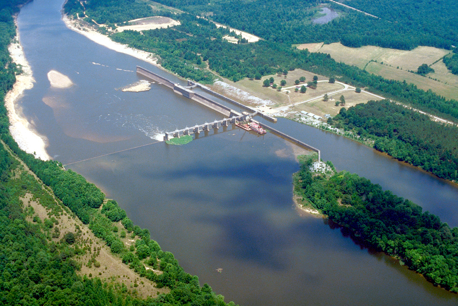
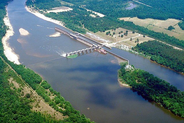
English: Aerial view of Coffeeville Lock and Dam on the Tombigbee River, spanning the border between Choctaw and Clarke Counties near Coffeeville, Alabama, USA. View is downriver to the east. The U.S. Army Corps of Engineers constructed the dam and lock on the river to provide a nine-foot navigation channel. Coffeeville Lock and Dam is the last lock and dam down the Tombigbee River (or the first, if travelling up the Tombigbee or Black Warrior River). There are no locks and dams between Coffeeville and the Gulf of Mexico. |
|||
| Lieu | Coffeeville, Alabama, USA 31°45′25.72″N 88°7′44.47″W / 31.7571444°N 88.1290194°W |
|||
| Date | ||||
| Source |
U.S. Army Corps of Engineers Digital Visual Library Image page Image description page Digital Visual Library home page |
|||
| Auteur | U.S. Army Corps of Engineers, photographer not specified or unknown | |||
| Autorisation (Réutilisation de ce fichier) |
|
Historique du fichier
Cliquer sur une date et heure pour voir le fichier tel qu'il était à ce moment-là.
| Date et heure | Vignette | Dimensions | Utilisateur | Commentaire | |
|---|---|---|---|---|---|
| actuel | 19 avril 2007 à 03:14 | | 1 500 × 1 002 (769 kio) | DanMS (d | contributions) | {{Information2 | Description = {{en|Aerial view of Coffeeville Lock and Dam on the Tombigbee River, spanning the border between Choctaw and Clarke Counties near Coffeefille, Alabama, USA. View is downriver to the east. The U.S. Army Corps of Engineers |
Vous ne pouvez pas remplacer ce fichier.
Utilisations locales du fichier
La page suivante utilise ce fichier :
Utilisations du fichier sur d’autres wikis
Les autres wikis suivants utilisent ce fichier :
- Utilisation sur arz.wikipedia.org
- Utilisation sur bg.wikipedia.org
- Utilisation sur ceb.wikipedia.org
- Utilisation sur de.wikipedia.org
- Utilisation sur en.wikipedia.org
- Utilisation sur es.wikipedia.org
- Utilisation sur frr.wikipedia.org
- Utilisation sur fr.wikipedia.org
- Utilisation sur gl.wikipedia.org
- Utilisation sur it.wikipedia.org
- Utilisation sur pl.wikipedia.org
- Utilisation sur ro.wikipedia.org
- Utilisation sur uk.wikipedia.org
- Utilisation sur www.wikidata.org