File:USACE John H Kerr Dam and Lake.jpg
Zur Navigation springen
Zur Suche springen
Größe dieser Vorschau: 800 × 533 Pixel. Weitere Auflösungen: 320 × 213 Pixel | 640 × 427 Pixel | 1.024 × 683 Pixel | 1.500 × 1.000 Pixel.
Originaldatei (1.500 × 1.000 Pixel, Dateigröße: 651 KB, MIME-Typ: image/jpeg)
Bildtexte
Kurzbeschreibungen
Ergänze eine einzeilige Erklärung, was diese Datei darstellt.
| Beschreibung |
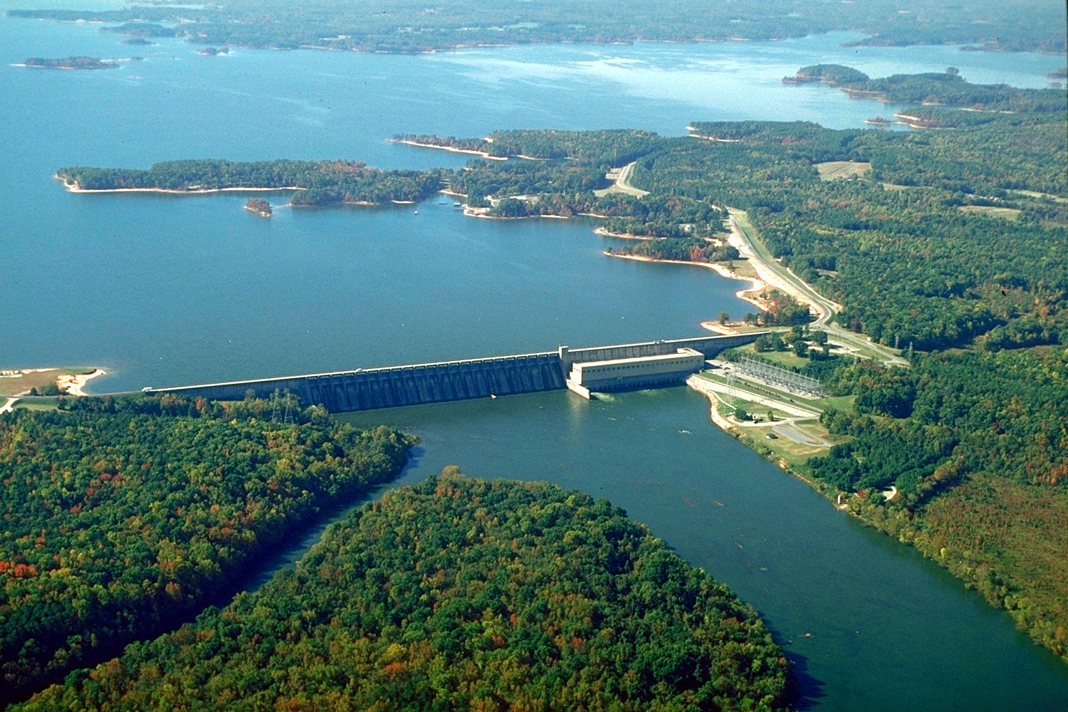
English: The John H. Kerr Dam and Lake on the Roanoke River in Mecklenburg County, Virginia, USA. The U.S. Army Corps of Engineers constructed the dam for flood control on the Roanoke River. View is to the south-southwest.
Coordinates: 36°35′53.76″N 78°17′53.63″W / 36.5982667°N 78.2982306°W |
|||
| Ort | Mecklenburg County, Virginia, USA | |||
| Datum | (Caveat: Dates provided by U.S. Army Corps of Engineers Digital Visual Library are not reliable and are often wrong.) | |||
| Quelle |
U.S. Army Corps of Engineers Digital Visual Library Image page Image description page Digital Visual Library home page |
|||
| Urheber | Bud Davis, U.S. Army Corps of Engineers | |||
| Genehmigung (Weiternutzung dieser Datei) |
|
Dateiversionen
Klicke auf einen Zeitpunkt, um diese Version zu laden.
| Version vom | Vorschaubild | Maße | Benutzer | Kommentar | |
|---|---|---|---|---|---|
| aktuell | 04:40, 26. Apr. 2007 | | 1.500 × 1.000 (651 KB) | DanMS (Diskussion | Beiträge) | {{Information | Description = {{en|The John H. Kerr Dam and Lake on the Roanoke River in Mecklenburg County, Virginia, USA. The U.S. Army Corps of Engineers constructed the dam for flood control on the Roanoke River. View is to the south-southwest.}} C |
Du kannst diese Datei nicht überschreiben.
Dateiverwendung
Die folgenden 2 Seiten verwenden diese Datei:
Globale Dateiverwendung
Die nachfolgenden anderen Wikis verwenden diese Datei:
- Verwendung auf ceb.wikipedia.org
- Verwendung auf de.wikipedia.org
- Verwendung auf en.wikipedia.org
- Verwendung auf es.wikipedia.org
- Verwendung auf fr.wikipedia.org
- Verwendung auf ja.wikipedia.org
- Verwendung auf no.wikipedia.org
- Verwendung auf sr.wikipedia.org
- Verwendung auf uk.wikipedia.org
- Verwendung auf www.wikidata.org