File:USACE New Orleans skyline.jpg
跳至導覽
跳至搜尋

預覽大小:800 × 534 像素。 其他解析度:320 × 214 像素 | 640 × 428 像素 | 1,024 × 684 像素 | 1,500 × 1,002 像素。
原始檔案 (1,500 × 1,002 像素,檔案大小:314 KB,MIME 類型:image/jpeg)
說明
說明
添加單行說明來描述出檔案所代表的內容
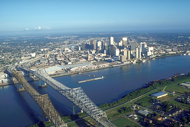
| 描述 | Skyline of New Orleans, Louisiana, USA. The twin spans of the Crescent City Connection bridges are in the foreground. | |||
| 日期 | ||||
| 來源 |
U.S. Army Corp of Engineers Digital Visual Library Digital Visual Library home page Image page Image description page |
|||
| 作者 | Michael Maples, U.S. Army Corps of Engineers | |||
| 授權許可 (重用此檔案) |
|
|||
| 其他版本 |
|

| 拍攝地點 | | 位於此地的本圖片與其他圖片: OpenStreetMap |
|---|
檔案歷史
點選日期/時間以檢視該時間的檔案版本。
| 日期/時間 | 縮圖 | 尺寸 | 使用者 | 備註 | |
|---|---|---|---|---|---|
| 目前 | 2007年3月14日 (三) 03:55 | | 1,500 × 1,002(314 KB) | DanMS(留言 | 貢獻) | {{Information | Description = Skyline of New Orleans, Louisiana, USA. | Source = U.S. Army Corp of Engineers Digital Visual Library<br />[http://images.usace.army.mil/Main.html Digital Visual Library home page]<br />[http://images.usace.army.mil/imag |
無法覆蓋此檔案。
檔案用途
下列3個頁面有用到此檔案:
全域檔案使用狀況
以下其他 wiki 使用了這個檔案:
- bg.wikipedia.org 的使用狀況
- bn.wikipedia.org 的使用狀況
- de.wikipedia.org 的使用狀況
- en.wikipedia.org 的使用狀況
- es.wikipedia.org 的使用狀況
- es.wikinews.org 的使用狀況
- ext.wikipedia.org 的使用狀況
- fa.wikipedia.org 的使用狀況
- fr.wikipedia.org 的使用狀況
- it.wikiquote.org 的使用狀況
- it.wikivoyage.org 的使用狀況
- nl.wikipedia.org 的使用狀況
- zh.wikipedia.org 的使用狀況