File:UTC hue4map USA-IN.svg
跳转到导航
跳转到搜索

此SVG文件的PNG预览的大小:391 × 599像素。 其他分辨率:156 × 240像素 | 313 × 480像素 | 501 × 768像素 | 668 × 1,024像素 | 1,337 × 2,048像素 | 2,887 × 4,423像素。
原始文件 (SVG文件,尺寸为2,887 × 4,423像素,文件大小:61 KB)
说明
说明
添加一行文字以描述该文件所表现的内容
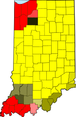
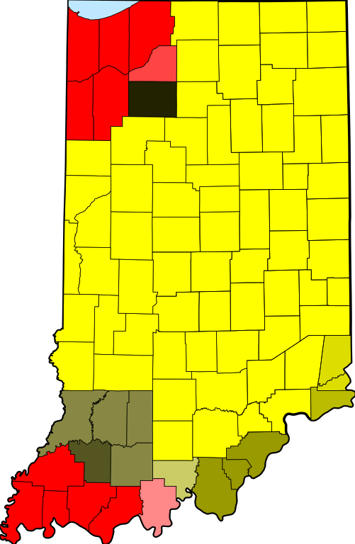
| 描述 | tz database zones for the US state of Indiana |
| 日期 | (UTC) |
| 来源 | |
| 作者 |
|
| 这是一张修改过的图片,这意味着它已在原版本的基础上通过软件进行了编辑。其原始版本为:Map of Indiana highlighting Adams County.svg。修改者:TZ master。
|
我,本作品著作权人,特此采用以下许可协议发表本作品:
| 我,本作品著作权人,释出本作品至公有领域。这适用于全世界。 在一些国家这可能不合法;如果是这样的话,那么: 我无条件地授予任何人以任何目的使用本作品的权利,除非这些条件是法律规定所必需的。 |
原始上传日志[编辑]
This image is a derivative work of the following images:
- File:Map_of_Indiana_highlighting_Adams_County.svg licensed with PD-self
- 2006-02-12T12:34:48Z David Benbennick 2887x4423 (56998 Bytes) {{subst:User:Dbenbenn/clm|county=Adams County|state=Indiana|type=county}}
Uploaded with derivativeFX
文件历史
点击某个日期/时间查看对应时刻的文件。
| 日期/时间 | 缩略图 | 大小 | 用户 | 备注 | |
|---|---|---|---|---|---|
| 当前 | 2013年12月14日 (六) 18:22 | | 2,887 × 4,423(61 KB) | Rcsprinter123(留言 | 贡献) | Lake Michigan blue |
| 2013年4月23日 (二) 13:41 |  | 2,887 × 4,423(57 KB) | Nyttend(留言 | 贡献) | From the beginning, this map has shown the tz database's zones, making any division erroneous | |
| 2013年4月21日 (日) 01:40 |  | 2,887 × 4,423(57 KB) | TimeZoneEditor(留言 | 贡献) | Reverted to version as of 03:49, 31 May 2012 | |
| 2012年8月16日 (四) 16:05 |  | 2,887 × 4,423(57 KB) | Nyttend backup(留言 | 贡献) | From the beginning, this map has shown the tz database's zones, and the database doesn't make a distinction for the two sides of the 1961 line. | |
| 2012年5月31日 (四) 03:49 |  | 2,887 × 4,423(57 KB) | TimeZoneEditor(留言 | 贡献) | Reverted to version as of 02:16, 31 May 2012, The IANA version is named "IANA" and located at File:UTC hue4map USA-IN IANA.svg | |
| 2012年5月31日 (四) 03:14 |  | 2,887 × 4,423(57 KB) | Nyttend(留言 | 贡献) | No reason to upload a map of a different subject at this name; maps showing different things should be uploaded with different filenames | |
| 2012年5月31日 (四) 02:16 |  | 2,887 × 4,423(57 KB) | TimeZoneEditor(留言 | 贡献) | This is not an IANA specific map. | |
| 2012年1月24日 (二) 06:11 |  | 2,887 × 4,423(57 KB) | Nyttend(留言 | 贡献) | This map shows the tz database's zones, and the database doesn't make a distinction for the two sides of the 1961 line. | |
| 2012年1月24日 (二) 06:09 |  | 2,887 × 4,423(58 KB) | MarcusBritish(留言 | 贡献) | Match yellows per request at Wiki Graphic Lab. | |
| 2011年10月9日 (日) 10:39 |  | 2,887 × 4,423(57 KB) | TZ master(留言 | 贡献) | change colors to better show 1961 divide |
您不可以覆盖此文件。
文件用途
以下4个页面使用本文件:
全域文件用途
以下其他wiki使用此文件:
- bn.wikipedia.org上的用途
- ceb.wikipedia.org上的用途
- el.wikipedia.org上的用途
- en.wikipedia.org上的用途
- es.wikipedia.org上的用途
- fa.wikipedia.org上的用途
- fr.wikipedia.org上的用途
- id.wikipedia.org上的用途
- ilo.wikipedia.org上的用途
- ja.wikipedia.org上的用途
- sco.wikipedia.org上的用途
- ur.wikipedia.org上的用途
- zh.wikipedia.org上的用途