File:Un-cameroon.png
Alkuperäinen tiedosto (2 367 × 3 092 kuvapistettä, 2,36 MiB, MIME-tyyppi: image/png)
Kuvatekstit
Kuvatekstit
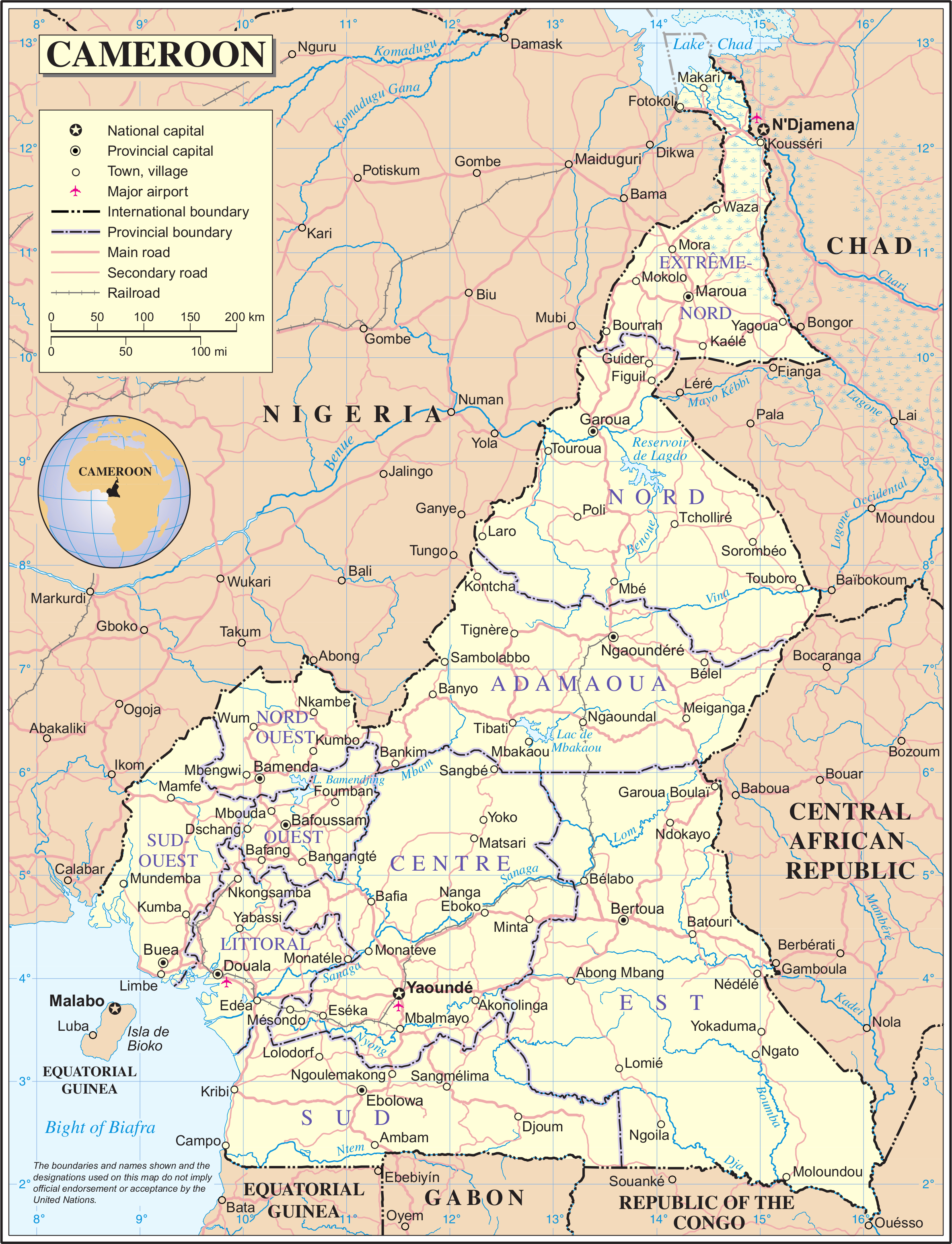
| This image is a map derived from a United Nations map.
Unless stated otherwise, UN maps are to be considered in the public domain. This applies worldwide. UN maps are, in principle, open source material and you can use them in your work or for making your own map. UN requests however that you delete the UN name, logo and reference number upon any modification to the map. Content of your map will be your responsibility. You can state in your publication, if you wish, something like: based on UN map … (map name, map number, revision number and date). See: Geospatial Information Section. And: Geospatial, location data for a better world. |
 |
Tiedoston historia
Päiväystä napsauttamalla näet, millainen tiedosto oli kyseisellä hetkellä.
| Päiväys | Pienoiskuva | Koko | Käyttäjä | Kommentti | |
|---|---|---|---|---|---|
| nykyinen | 23. lokakuuta 2007 kello 02.54 | | 2 367 × 3 092 (2,36 MiB) | Jeroen (keskustelu | muokkaukset) | {{UN map}} Category:Maps of Cameroon |
Et voi tallentaa uutta tiedostoa tämän tilalle.
Tiedoston käyttö
Tätä tiedostoa ei käytetä millään sivulla.
Tiedoston järjestelmänlaajuinen käyttö
Seuraavat muut wikit käyttävät tätä tiedostoa:
- Käyttö kohteessa ca.wikipedia.org
- Käyttö kohteessa en.wikipedia.org
- Käyttö kohteessa eo.wikipedia.org
- Käyttö kohteessa fi.wikipedia.org
- Käyttö kohteessa fr.wikipedia.org
- Käyttö kohteessa incubator.wikimedia.org
- Käyttö kohteessa nl.wikipedia.org
- Käyttö kohteessa pl.wiktionary.org
- Käyttö kohteessa tr.wikipedia.org
- Käyttö kohteessa uk.wikipedia.org